Terrain
Every game map is rectangular and is composed of a number of
terrain squares. Although there is no limit to the size of a map
(i.e. the number of squares), maps will typically range between
100 and 400 squares in width and height.
Terrain squares do not have many properties but do greatly
impact the type of infrastructure they may contain and the way
units move across these squares.
Terrain Properties
|
|
|
Address: Each square has an address consisting of an X
and Y value with the square in the top left of the map having
the address (1,1). Although most maps will also contain latitude
and longitude values for orientation, all orders and settings
use these simple grid numbers.
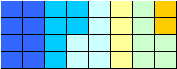
Type: The type of terrain square is depicted by the
color. Which type of squares are used in a specific scenario
will change but a number of square types will almost always be
present. Squares such as "Water" (blue) or
"Grassland" (light green) will be used in most
scenarios but others might be used only for very specific
terrain types. The "Mexican Adventure" for example
contains a terrain type named "Volcano" and the "Finland"
scenario includes a terrain type "Tundra".
|
Elevation: Each terrain type has an elevation value
attached. This can also change from one scenario to the next but
will usually be somewhere between -3 (deep water) and +5
(mountain peak. Elevation impacts the game in a number of ways,
including the speed units are able to travel across this terrain
and the fire and sight ranges which will be increased on higher
ground.
Movement cost (speed cost): Each terrain type also has
an associated movement cost value, defining how fast a unit will
be able to move through this type of terrain. Grassland and
Prairie squares will have low values of 2 or 3 while swamps,
marshes of jungle squares will have a very high cost thus
slowing down units moving across these squares.
|