September, 1999
|
|
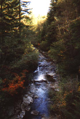
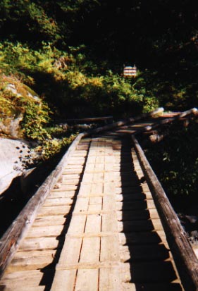
In Southwest Washington, just North of the Columbia River, is Silver Star Mountain. An 8-9 mile hike with 2,000 feet of elevation gain. Driving up to the trailhead includes driving over 8 miles on a dirt mining road. It is a one lane road with a mountain on one side, and a drop off on the other. This picture was taken off of a wooden bridge that crossed this river from 30 feet above. |
|
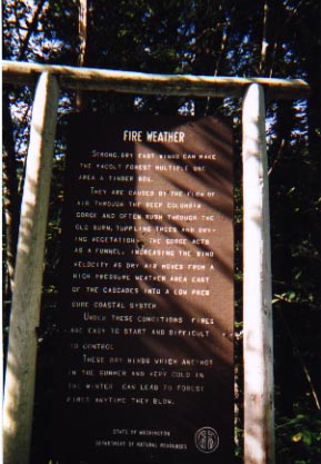
Hard to read in a picture, but the sign points out that due to way the weather reacts to the Columbia River Gorge, a funnel effect is created with the winds. As a result there is a year round threat of fires that spread quickly. Once Ally and got to the top of the mountain, we were really able to feel the winds this sign was talking about. |
|
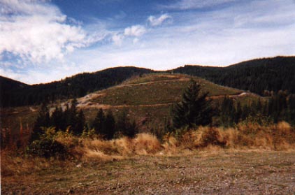 |
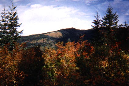
Another view on the way up to the trailhead. This picture clearly shows you why so many people in this state are opposed to the logging industry. This other mountain has been stripped bare of trees...only a minefield of stumps and dead branches litter the mountainside. This is a truly depressing view. |
|
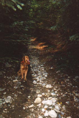
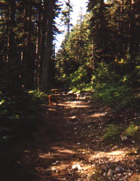
The early part of this trail starts off like so many of the other trails Ally and I have found. Dense woods with a narrow path leading up a mountain. While there were a lot of cars at the trailhead, there were no people to be seen. |
|
|
|
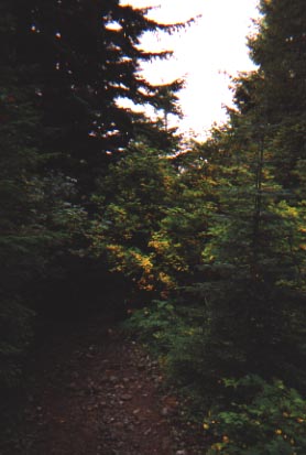
A little further up the trail, a photo looking back the trail from where we had come from. Still submerged in the trees, but this would change soon. |
|
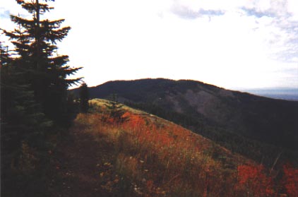
Just up the hill, we broke out of the trees and the views really opened up. This was just the beginning of what would be some amazing views. |
|
|
|
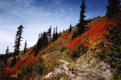
October in the Pacific Northwest means a flood of colors. In a sea of green trees, there were plenty of red and orange plants and leaves. |
|
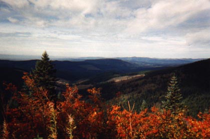
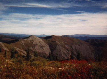
Following along one of the ridgelines, a look back offered up this type of view. Pictures just do not do justice for what you take in from on top of a mountain. |
|
|
|
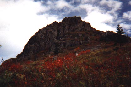
As we made our way up the mountain, rock outcroppings began to punch out of the trees. This is Sturgeon Rock, and proved to be a key landmark. |
|
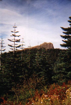
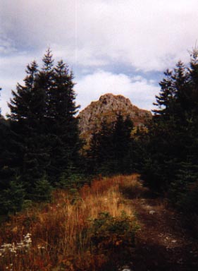
Pyramid Rock. This was the most critical of all landmarks on this hike. Still on the way up, but little did I know that on my way down, the trail would fork. A sign said right, my book said left. A roll of the dice and a quick prayer took us left. This rock helped us find our way back. Had we guessed wrong or not had this mountain, we would not have been able to backtrack and get off the mountain before sundown. |
|
|
|
Another view of Pyramid Rock through the trees. |
|
Getting closer to the top, we were greeted by a vast array of colors. The only downside is if you read your book, and realize that some of the plants are called "Bear Grass"...and that one of the roads you turned on to get to this trail was "Bear Meadows". |
|
|
|
Along the top of the mountain, we started to make our way to the Indian Vision Quest site. On the sides of some of these mountains, there were no trees, only slides of rock and dirt. This is not due to logging because there are no roads up there, so I am not sure why this occurs. My only guesses are Mt. St. Helens remnants, or the result of forest fires. |
|
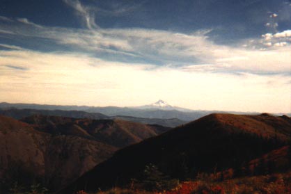
An awesome view from the top...if you look at the middle of the picture, you can see Mt. Hood across the river in Oregon. Unfortunately the picture makes the mountain look hundreds of miles away when in fact it was very close and beautiful. Something about this mountain always brings me a sense of peace and happiness. |
|
|
|
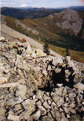
The first Indian Pit at the Vision Quest site. These pits, about 15 in total, ranged from 2-5 feet deep and several feet across. Legend has it Indians used to climb inside these pits and await a sign from their spiritual leaders. These pits were scattered across a fairly narrow mountain ledge. Only one way to the pits, and one way back. On the other three sides was a sheer drop off. Look carefully in this picture, the upper left corner. Mt Adams on the horizon. Unfortunately, my pictures of Mt. St. Helens did not come out. At these pits, there were clear views of Mt St Helens, Mt Adams, Mt Ranier, Mt Hood, and Mt Jefferson. 5 amazing snow capped peaks on the horizon. |
|
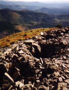
Two of the pits that are really close together. From the way most of the pits were positioned, the Indians were fond of views of Mt. Hood (not pictured here). |
|
|
|
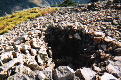
A final look at the pits. It is starting to get late and cold now. Time to get off the top of the mountain. The winds up here were blowing extremely hard, so any layer of sweat you built up on the way up now worked against you in the cold wind. |
|
The infamous fork in the trail was not much further past this. From the top we had a choice of going down the way we had come up, or taking a wooded loop back to the trailhead. We hiked 2 miles downhill to where the trail forked. At this point, knees were getting tired, and it was getting into the late afternoon. If we were forced to turn around and go back up the mountain to retrace our steps, it would have been 2 miles, back uphill (probably a 1,750 elevation gain from there). Thank goodness for a compass, a sense of direction, and the awesome books of William L. Sullivan. |
|
|
|
10 minutes before we came across this trail we had a view of Pyramid Rock...and at this point, we were confident we were going the right way. This bridge was further proof of that. A long day on an unbelievable mountain. |