June, 1999
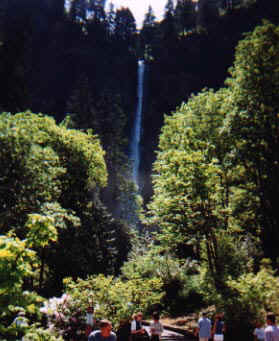
The falls are always the crowd favorite. The downside to it is that it is usually packed with people. Most people hike up to a bridge that crosses a small gorge area at the base of the falls (you have probably seen pictures of this bridge...I just don't have one to show you) and then hike back down. Little do they know that the best scenery is yet to be seen. But what you quickly learn, is that a switchback trail is not always the easiest kind of hike. And because of this, most people who make it to the top do not want to go any further out of fear of the entire hike being like that. And while there are difficult parts further up the trail, the next 30 minutes of the hiking is very easy, and the scenery is fantastic.
|
|
Not too far East of downtown Portland in the Columbia River Gorge, is Multnomah Falls. Ironically, it is a stones throw from the main highway you take to get there. The height of the falls varies depending on who you ask, but it is safe to say that it is at least 650 feet from top to bottom. I have seen pictures of the falls in different seasons. In the winter, the falls will actually freeze solid, top to bottom. Check back in a few months to see if I am able to add some pictures when the leaves are turning. |
|
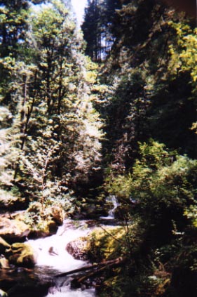
If you tough it out and hike to the top of the falls, then you are rewarded with some breathtaking scenery, including about 3-4 other waterfalls. While they are not as tall, they are at least 100 feet and pour into isolated pools. Ironically, most people, if they even go up top, will only go to the scenic lookout and go back down. All it takes is about another 30 minutes of pretty easy hiking to see the other falls. |
|
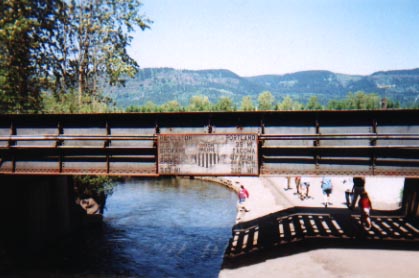 |
Looking away from the falls, the railroad runs nearby. You can not read the sign in this picture, but it lists out mileage distances to various cities in Oregon. That part of the stream that runs by there is a great place for a dog to swim after a long hike. Unfortunately, this partially explains the wet dog scent in my truck! |