Zillertal
Route 169, Tirol
Considered by many to be among the most beautiful valleys in all of
Tirol, this valley offers breathtaking views of the Zillertal Alps.
Interestingly, the people of the Zillertal are considered by many to be
the finest singers in Austria.
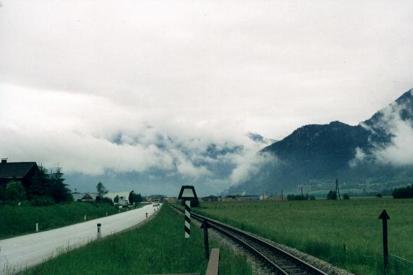
Copyright © 1999 Richard Jaklitsch
Gerlostal
Route 165, Tirol
The Gerlostal (Gerlos Valley) in Tirol is an eastern lateral
valley of the Zillertal. The Gerlosbach stream rises close
to the Reichenspitze peak (10,845 ft), reaches Tirol after the Gerlos
Pass (4,955 ft), and flows into the Ziller stream at Zell am Ziller.
The upper section of the valley is called Wildgerlostal. The
Gerlos Pass, which connects Tirol and the Salzach valley in the upper Pinzgau
valley, is located on the border of the provinces of Tirol and Salzburg.
This mountain pass at Krimml in the upper Pinzgau valley links the valleys
Zillertal in Tirol and Salzachtal at Pinzgau in Salzburg via the Gerlos
valley, and serves as a connection between Zell am Ziller and Krimml.
It also separates the Zillertal Alps from the Kitzbühel Alps.
The first road was built here in 1630. The Gerlosstraße
road via the Filzsteinalm Pasture and the Gerlos Plain was
completed in 1962. The main village of Gerlos lies at 4,088 feet
above sea level.
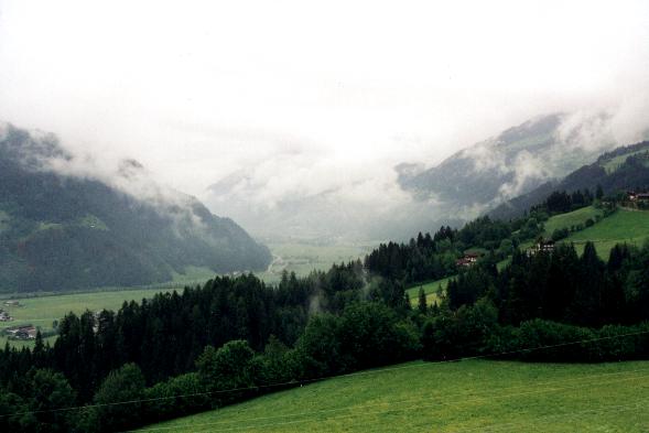
Copyright © 1999 Richard Jaklitsch
Krimml Falls
Hohe Tauern National Park, Salzburg
The falls are the highest in Europe, descending 1,248 feet in a series
of giant falls and cascades. The falls are in the Upper Pinzgau valley.
Just south of the falls lies the Hohe Tauern range, containing the highest
peaks in Austria. Hohe Tauern National Park is a nature preserve
in the Austrian Alps the conception of which was formed as early as 1918.
On October 21, 1971, Carinthia, Salzburg and Tirol agreed upon the foundation
of the Hohe Tauern National Park in the Three Provinces´ Agreement
of Heiligenblut. In 1983 Carinthia and Salzburg passed respective
laws, Tirol followed in 1991. Arrangements were made with about 1,100
landowners, as well as representatives of the power-producing, mining,
and tourist industries. The Hohe Tauern National Park comprises 1,107 square
miles (Carinthia: 231, Salzburg: 498, Tirol: 378), and is the largest park
in the Alpine region, encompassing 304 mountains higher than 9,850 feet
and 246 glaciers.
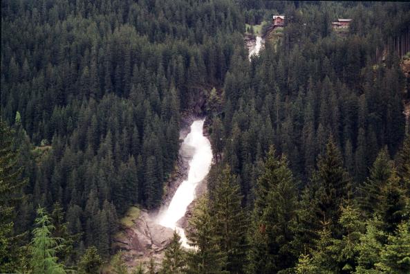
Copyright © 1999 Richard Jaklitsch
Grossglockner Alpine Highway
Hohe Tauern National Park, Salzburg
Heading south from Bruck through the Fuschertal on the Grossglocknerstrasse,
it is easy to see why this road has the reputation it has of being the
most beautiful road in the world. This spot is near the small town
of Fusch.
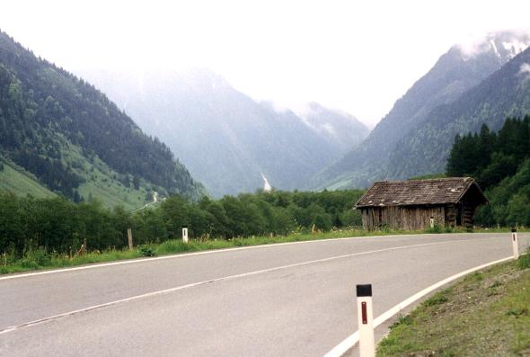
Copyright © 1999 Richard Jaklitsch
Grossglockner Alpine Highway
Hohe Tauern National Park, Salzburg
The road ascends through the clouds, creating a stunning, mystical
effect that only hints at the beauty to come.
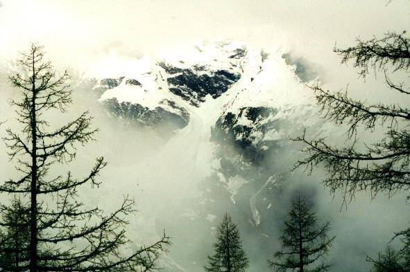
Copyright © 1999 Richard Jaklitsch
.
![]()
..