|
|
G.I.S.
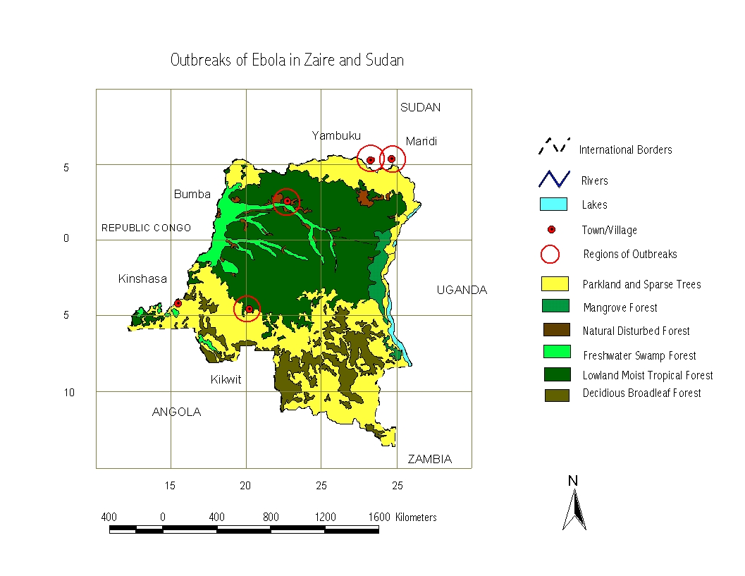
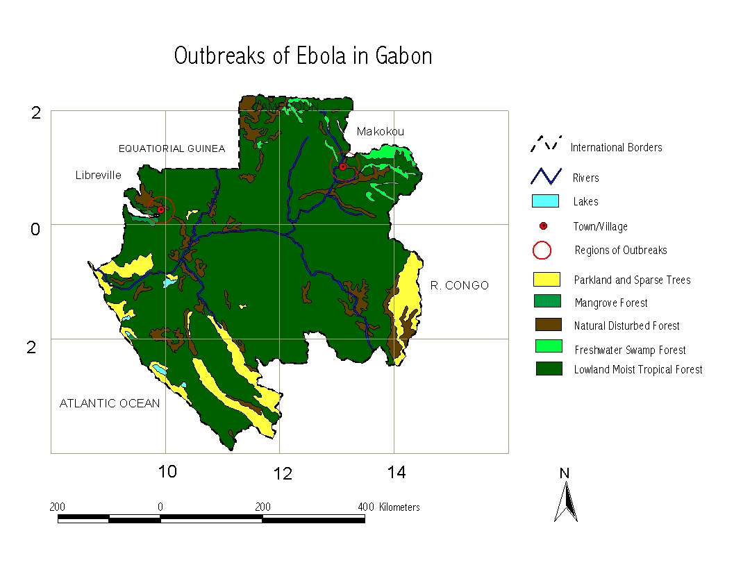
ANALYSIS Methodology for GIS Analysis · Assumption The main assumption is that the reservoir
species could come into contact with humans because of the destruction of
rainforest. If the forest had not been disturbed, it is very possible that
the virus would have continued its life cycle within the deeper regions of
the rainforest, as a part of normal ecosystem cycles. · Digitising and
conversion to ArcView files In this section, the maps of forest covers
for Zaire and Gabon have been downloaded from the World Conservation
Monitoring Centre (WCMC) and have been digitised using AutoCad, using the
World Co-ordinate System (WCS). The locations of outbreaks were identified
from published material and from the internet and the locations of these
places were fixed using AutoCad. The Maps of forest cover were then converted
to ArcView files using a Mercator Projection and the locations of outbreaks
were overlaid as new themes, over the existing forest themes. The locations of outbreaks selected were the
major outbreaks in · Results of the Analysis The actual work in GIS took a relatively long time, but the
results of the analysis can be summed up in one sentence ‘From
the results of the overlay, there seems to be a very strong and
definite relationship between the areas of Ebola outbreaks and areas of
destruction of tropical rainforest’. The G.I.S analysis is just a tool to add emphasis and physical
evidence to the claims and conjectures of this case study. It seems very unlikely
that there is just a mere coincidence between the locations of
Ebola outbreaks and vast tracts of destroyed forest.
The outbreaks in
The first outbreaks occurred in |
Map 1 Areas of outbreak of
Ebola in Gabon>
Map 2 Areas of
outbreak of Ebola in Zaire
|
|
Feedback? Bouquets? Brickbats? |
||
|
Copyrights and all
that stuff |
||
|
LINKS Need more information? |
||
|
Why this page was
published |
||
|
The violent world
of Biosafety level 4 viruses |
||
|
The shepherd’s crook |
||
|
The nature of the beast - Pathology- |
||
|
Comparison of Ebola with the deadly AIDS virus |
||
|
Where does the virus hide? |
||
|
Comprehensive list of outbreaks till date |
||
|
Current stage of
research |
||
|
Overlay of
deforestation and Ebola outbreak areas |
||
|
Is the human race
headed for destruction? |
||
|
|

