

-
Your Gateway To Oman
|
|
|
- |
|
Your Gateway To Oman |
||
|
|
The Regions Of The Sultanate of Oman The Muscat Region The Governorate of Muscat now extends from the town of Seeb in the north to the fishing port of Quriyat in the South. With its commercial centre, industrial areas, government offices, foreign embassies and hotels, the Governorate of Muscat is the most densely populated and developed part of Oman. The Dhofar Region
The Musandam Region
The Batinah Region The
Batinah is the name of the coastal strip between the Hajar mountains and the
Gulf of Oman. It was traditionally a fishing and farming region but is now
becoming urbanised and industrialised . It is now the most heavily populated
part of Oman. The Sohar is being developed once again as a major industrial
port and commercial center. The area on the other side of the mountainsis
known as the Dhahriah. This
region is in the north-west of Oman. Dhahriah means 'the back' : the region
sits at the back of the western Hajar mountain range which separates it from
the Batinah region. An enormous semi-sandy plain covers much of this area
which stretches from the foothills of the Western Hajar and rolls into the
bleak , arid , desert area of the Empty Quarter (Rub al Khali) . The Empty
Quarter runs for some 11,000kms westward crossing the regions boarder with
Saudi Arabia , Buraimi in the north west boarders United Arab Emirates and
in the east Jebel al-Kawr separates the Dhahriah from the Dakhiliya region. The
Dhakhiliya region links Muscat and the coast with the rest of the country ,
through the Sumail gap. Geographically, the area is distinguished by the
Hajar mountain range, from which the Jebel Al Akhadar (the green mountain)
soars upto 3,000 meters. this region stretches from Fanja, at the foot of
the mountain some 33kms from Muscat , south through Izki and Manah, to
beyond the town of Adam on the fringes of the desert. The old town of Nizwa
and Bahla lie at the western foothills of the Hajar. The
central region is a gravel desert with escarpments running down to the coast
where the main occupation is fishing. Inland lie Oman's oil , gas and
mineral depoaits. The Jiddat al Harasis , where the Arabian Oryx has been
re-introduced, was listed in 1994 by UNESCO on its World Natural and
Cultural Heritage Register.
|
HIS MAJESTY |
|
INTRODUCTION |
|
|
|
|
|
|
|
|
|
|
|
|
FEATURES |
|
|
|
|
|
|
|
|
|
|
|
|
|
|
WILDLIFE |
|
|
|
|
|
|
|
|
|
|
|
|
TRADITIONS |
|
|
|
|
|
|
|
|
|
|
|
|
|
|
MAPS |
|
|
|
|
|
|
|
|
|
|
Make Crazy $$$ With Your Website | /// |
|
Copyright© Hareesh Networks® |
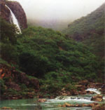 The
monsoon rains water an 8km wide plain which runs along the 130 km of the
country 560km coastline that overlooks the Arabian Sea. Salalah, the capital
governorate of Dhofar lies on this plain.
The
monsoon rains water an 8km wide plain which runs along the 130 km of the
country 560km coastline that overlooks the Arabian Sea. Salalah, the capital
governorate of Dhofar lies on this plain.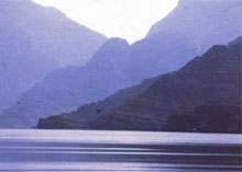 In
the far north, in the governorate of Musandam, the mountains rise to 1,800
meters in an area often called the Norway of the Tropics because of its
Rocky Inlets.
In
the far north, in the governorate of Musandam, the mountains rise to 1,800
meters in an area often called the Norway of the Tropics because of its
Rocky Inlets. 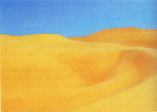 The
eatern Hajar , with its gravel plains and valleys lying on the inland side
of the mountains is the northern boarder of the Sharqiyah region. To the
southeast lies Jaalan , a vast sandy plain that stretches to meet the
Arabian coast at Sur and Al Ashkarah. To the south are isolated Eastern (Wahiba)
Sands and to the southwest lie the towns of Mudaibi and Sinaw. The road from
Muscat to Sur cuts through the Sharqiyah region , passing the main towns of
Ibra,Mudirrib, Al Qabil & Mintrib.
The
eatern Hajar , with its gravel plains and valleys lying on the inland side
of the mountains is the northern boarder of the Sharqiyah region. To the
southeast lies Jaalan , a vast sandy plain that stretches to meet the
Arabian coast at Sur and Al Ashkarah. To the south are isolated Eastern (Wahiba)
Sands and to the southwest lie the towns of Mudaibi and Sinaw. The road from
Muscat to Sur cuts through the Sharqiyah region , passing the main towns of
Ibra,Mudirrib, Al Qabil & Mintrib.