While the Philmont Scout Ranch in New Mexico is an outstanding adventure, there are rewarding and challenging opportunities here in New England worthy of consideration. Or if you have Philmont in mind, you might find participation on these alternative hikes and backpacking trips a great preparatory exercise.
|
|
|
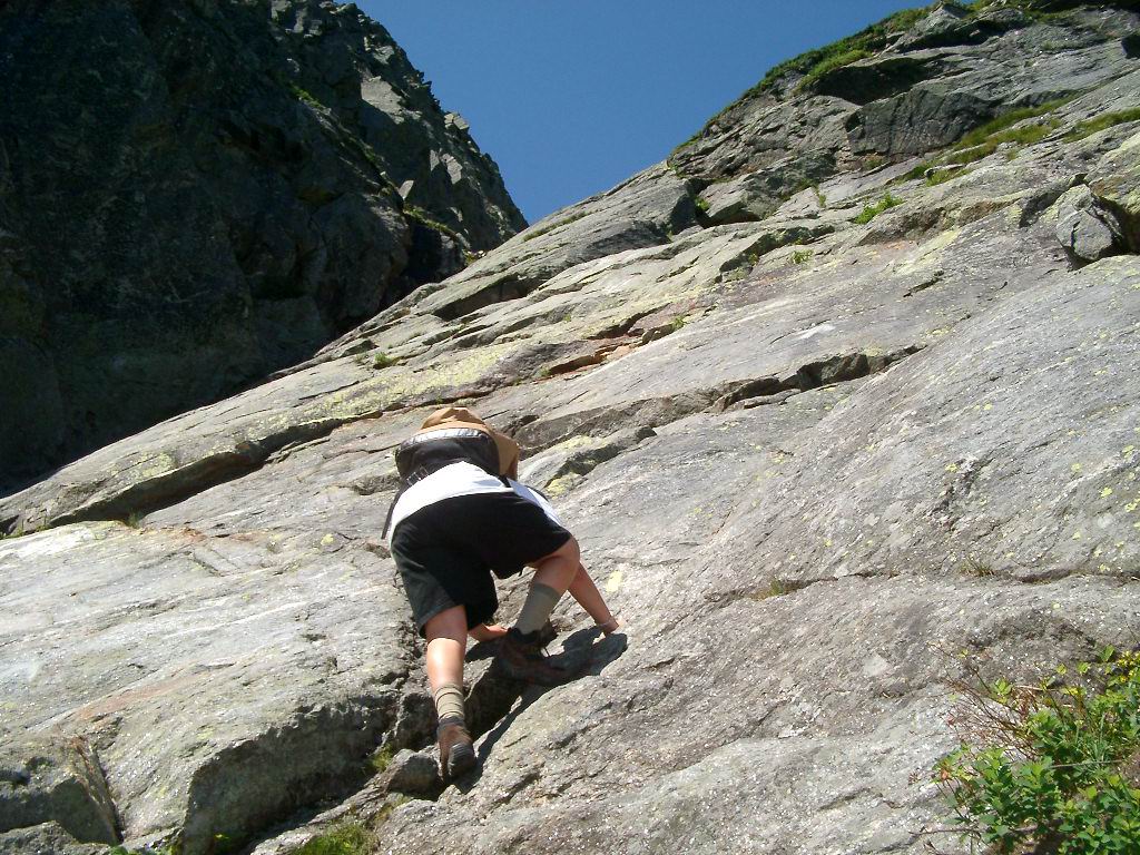
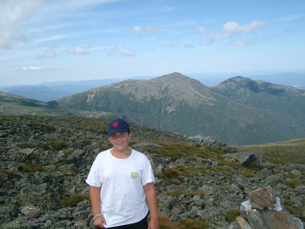
| Mt Washington via the Huntington Ravine Trail - the steepest trail in the White Mountains. Somewhere above 4500 ft elevation the distinction between hiking and rock climbing became blurred - great hike - but "Be Prepared" | Rest stop near summit of Nelson Craig. Mt Jefferson (center) and Mt Madison (right) in background |
None of the activities below are currently sponsored troop activities; they reflect individual efforts towards obtaining certain merit badges and achievements (such as the 50 miler). If any scout is interested in joining, contact scout Harry and he will work the necessary paperwork with the troop leadership (i.e., Senior Patrol Leader and/or Scoutmaster) to investigate the possibility of making it a sponsored troop event. These events are based upon increasing levels of experience with the bottom line being fun but, safety first and foremost.
This page is broken into four categories; click on any area of interest
| Hiking Merit Badge | ||
| Backbacking Merit Badge | ||
| 50 Miler Award | ||
| 48, 4000 ft Club |
---------------------------------------------------------------------------------------------
This badge contains requirements for safety, first aid, and six hikes. Five of those hikes need to be 10 miles in duration and the sixth for a distance of 20 miles. All hikes must be completed in a single day. If you are interested in joining one of these hikes, click on the desired hike for more information. Dates for hikes not yet completed are flexible and subject to change
| Hike | Date | Event (Click for info) | Miles | Brief Overview |
| - | 23 Jun 2002 | Peaked Mountain | 4.2 | Preparatory mountain hike suggested by merit badge requirements as part of conditioning program prior to beginning 10 mile hikes. |
| I | 24 Jul 2002 | Black Cap | 10.2 | Fairly easy hike with gradual elevation changes. Part of the Green Hills Preserve with good views of the Mt Washington Valley. |
| II | 26 Jul 2002 | Mt Kearsarge | 10.6 | Less known but challenging Mountain. Old fire tower on summit provides good shelter for overnight "camping" right on the summit. First class views. |
|
III |
21 Aug 2002 | Mt Washington | 10.0 | Strenuous hike via Huntington Ravine Trail - Steepest Trail in the White Mountains. Return via more gradual Tuckerman Ravine Trail. |
| IV | 14 Jun 2003 | Moat Mountains | 10.0 | Lower elevations (3,000 ft) but nice views from exposed summits due to past fires. Route traverses South Moat and North Moat before exiting at Diana's Bath. |
| V | July 2004 | Franconia Notch | 13.4 | Trip begins climbing Mt Flume (4328') via Flume Slide Trail and then follow the Franconia Ridge Trail to Mt Liberty (4459'), Little Haystack (4780'), Mt Lincoln (5089'), and Mt Lafayette(5260'). Descend from Franconia Notch via the Greenleaf Trail. |
| VI | Summer 2004 |
Pemigewasset Wilderness |
20.5 | Circular route which takes us to 13 Falls before turning west along the base of Franconia Notch. Trail distance is only 18.3 miles so we will take the optional side trip up Owls Head (2.2 miles round trip) at about the 14 mile mark. - But might break this up into a three day backpacking trip (with day 2 as side trip up to Franconia Ridge) - would then need another 20 miles route for a one day hike. |
These trips are scheduled after completion of the hiking merit badge requirements. There are numerous preparatory and safety requirements which scouts should complete prior to the actual trips. The trips are designed to reinforce the concepts. There are four required backpacking trips - three of at least three days duration each, and a fourth of at least five days covering a distance of at least thirty miles. Dates below are tentative and subject to change. They are also flexible so if you would like to join a trip, but cannot make a listed date, we can probably accommodate. No trip can be over a Saturday night due to work schedules. Also, weather will play a key role in dates - for those trips which will primarily be above the timber line, the trips will be delayed for inclement weather due to exposure and safety.
| Phase | Dates | Event (Click for more info) | Miles | Brief Overview |
|
I |
24-27 August 2003 |
Presidential Traverse | 26 | Tough, three day excursion over the presidential range. Will spend both nights in mountain huts. But some of the most beautiful scenery in New England and a trip scouts will always remember. |
| II | 27 - 29 Jun 2004 |
13 Falls | 22 | Three day hike. Gradual terrain into Pemmigewasset Wilderness. From Base camp, make second day side trip to Mt Garfield |
|
III |
18 -22 July 2004 |
Monadnock - Sunapee Greenway Trail | 55 | Moderate terrain with 6 peaks. Depart from Mt Sunapee and hike towards Mt Monadnock (which will be visible for the the last three days - nice goal to work towards. Trip could be done in three days but we will take five to drive home backpacking skills in preparation for the upcoming presidential range trip. |
| IV | TBD 2005 |
TBD | TBD | Three day hike |
Trip Dates: 24-27 August, 2003
Description:
Backpacking trip along the Presidential Range in the White Mountain National Forest in New Hampshire. It is one of the roughest and most beautiful in New England. It was be a three day (two night) trip of approximately eight miles each day. The first day we dropped the car at Crawford Notch (Exit point) and traveled to the Appalachia trail head to begin the Northern Presidentials at Mt Madison. Each night we stayed at huts (like dormitories) of the Appalachian Mountain Club. This cut down on weight (no tents and less food).
Click here for trip highlights
Trip Itinerary:
| Day | Date | Event | Hiking Distance | Hike Time |
| 1 | Sunday 24 Aug, 2003 | Leave Lynnfield at 1:00 PM. Arrive Pinkham Notch Appalachian Mountain Club "Hotel" and spend night. | ||
| 2 | Monday 25 Aug 2003 | Drop car at Crawford notch. Take AMC transportation to Appalachia trail head. Hike to AMC Madison Hut (4825' elevation) via the Valley Way trail. Leave gear at Hut and take side trip up Mt Madison (5366'). Return to hut and spent night. | 4.2 miles | 4 hr 10 min |
| 3 | Tues 26 Aug 2003 | Depart AMC Madison Hut and traverse Mt Jefferson, Mt (John Quincy) Adams, possible side trip to Mt (Sam) Adams, Mt Clay, Nelson Craig, and Mt Washington. Depart Mt Washington and spend night in AMC Lake of Clouds Hut. | 6.8 miles | 4 hr, 20 min |
| 4 | Weds 27 Aug 2003 | Depart AMC Lake of Clouds Hut and traverse Mt Monroe, Mt Franklin, Mt Eisenhower, Mt Pierce, Mt Jackson, and Mt Webster. Exit trail at Crawford Notch. Remainder of day dependent on trip participants - if need to return to Lynnfield, we will do so that evening. If not, we could spend the night at Crawford Notch or Pinkham Notch and return the following day. | Approx 9 miles (depends on route) | 8 hrs |
back to backpacking merit badge
Trip Dates: Sunday 27 - 29 Jun 2004
Current Participants: Expressing interest - 1Adult, 1 Scout
Trip Description:
This is a fun trip within the White Mountain National Forest. We enter along the Kancamagus Highway and head east along the Pemigewasset River before heading north to the backside of Franconia Notch. The trip will cover much of the same terrain as the 20 miler for hiking merit badge (difference being we will not climb Owl's Head and will traverse the northern section of Franconia Notch or day 2)
This will be a 23 mile hike over various terrain. The trip into the 13 Falls tent site is a fairly moderate hike of 8 miles. Much of it is along old abandoned railroad track. From there, we will climb the south side of Mt Garfield up fairly steep terrain (2.5 miles). The option will be then to return the same way (To 13 Falls) or travel east 2 miles to the Galehead hut and then descend to 13 Falls via the Twin Brook Trail. The hike out will again be fairly moderate taking a different route to the west of Owl's Head (Mountain)
Trip Itinerary:
| Day | Date | Event |
| 1 | Sunday 27 June, 2004 | Leave Lynnfield at 0700. Arrive at trailhead at 1000. Depart at 1030 and hike to 13 Falls Tent Site via the Franconia Brook Trail. Arrive 13 Falls at 1600. Total miles for day = 8.0 |
| 2 | Monday 28 June, 2003 | Leave 13 Falls as base camp and hike up backside of Mt Garfield. From there, spend day on ridge of Franconia Notch. Numerous options such as heading east to Galehead Hut and then descend retracing route and spending a relaxing afternoon swimming/relaxing on rocks at 13 Falls. Total miles for day = 5 to 8 |
| 3 | Tuesday 29 Jun, 2003 | Break camp and head out to west of Owl's Head (Mountain) via the Lincoln Brook Trail. Depart 13 Falls at 0830. Arrive Kancanmagus Highway trailhead at 1230. Depart Trailhead at 1315. Lunch in Lincoln or North Woodstock. Depart area at 1430. Arrive Lynnfield 1715/ Total miles for day = 8.0 |
Fifty - Miler Backpacking Badge
| July 2004 | Monadnock - Sunapee Greenway Trail | 55 | Five day hike. Meets logistic reqts for a Troop 50 miler. Moderate terrain with 6 peaks. (Trip dependent upon two drivers) |
|
Trip Dates: 18-22 July, 2004
Dates flexible to accommodate other hikers but trip can not be over a Saturday.
Current Participants: Expressing interest - 3 Adults, 1 Scout
Trip Description:
This will be a 54.7 mile hike from Mt Sunapee to Mt Monadnock in Southern Central New Hampshire. The terrain is moderate and perhaps because of this, the trail is much less crowded than most found during the summer season. The highest of six peaks encountered on the trail is Mt. Monadnock at 3,165 feet. Mt Monadnock will be visible the last three days of the trip making a nice goal.
The trail was established in 1974 by the Society for the Protection of New Hampshire Forests. It follows the same general area as an earlier trail that was laid out in 1921 but fell into disrepair during the depression and world War II. The trail is hosted primarily on privately owed land who's owners have graciously agreed to the trail use. Because of this there are several limitations such as no wood fires and limited camp locations.
The Boy Scout 50 Miler Badge can only be earned as a troop event. So should there not be enough scouts interested, the trip will just be a 50 miler with no badge awarded. The fifty miler also requires 10 hours of trail service work. We can perhaps do this along the way or the Greenbelt association has numerous Saturday trail maintenance days scheduled which we can partake to fulfill this requirement
Trip Itinerary: Note: Itinerary needs to be redone - this reflects a south to north trip - but after exploring the terrain, we will switch to go north to south. The simple reason is that Mt Monadock is the highest peak in the area and will be visible for the last three days of the trip - nice goal to work towards.
| Day | Date | Event |
| 1 | Monday 5 August | Leave Lynnfield at 0700. Arrive at Mt Sunapee at 0900. Leave one car (for transportation at completion of trip) and depart and drive to Ranger Station of Mt Monadnock. Park car at Ranger Station, register trip itinerary, and depart station at 1130. Hike 2.3 miles to Monadnock Summit via White Dot trail. This will be the most strenuous part of the day. Depart Summit at 1400 and begin the official start of the Monadnock-Sunapee Greenway Trail. Hike six miles to the Leighton State Forest Campsite. Total miles for day: 8.3 |
| 2 | Tues 6 August | Hike 14 miles from Leighton State Forest to the Parker Hill Campsite |
| 3 | Weds 7 August | Hike 12.4 miles to the General Washington Campsite |
| 4 | Thurs 8 August | Hike 11.2 miles to the Loose Lookout Campsite |
| 5 | Friday 9 August | Hike 5.5 miles to the summit of Mt Sunapee which is the official end of the trail. Then 3.5 miles to reach the cars (Total of 9.0 miles for day). Depart at 1400 to retrieve vehicle left at Monadnock. Depart Monadnock at 1600. Stop for dinner in route and eat pizza or greasy cheeseburgers. Arrive Lynnfield approximately 1830. |
Additional Information via Web Sites:
The Monadnock Sunapee Greenway Trail Club (MSGTC). The home organization for this trail
Dates for trail work. Should this be a troop sponsored activity, we would need 10 hours of service projects to complete.
Independent assessment by G. Scott Durham, Apparently an avid hiker who will be traversing the trail this summer
Forty - Eight, Four Thousand Ft Club
Section in work. There are 48 mountains in New Hampshire which are above 4000 ft. The goal is to keep track of those climbed in the previous activities and schedule some of all of the remainder for hikes in 2003 as side hikes or for activities in 2004 and on. Any scout who needs to complete hikes for hiking or backpacking merit badge, and was not around, or who could not partake, in the first round, can fulfill some of there requirements here.
Back to forty-eight, four thousand ft club
Home Calendar & Trips Troop Organization