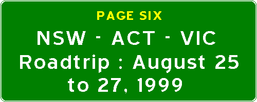
There is a system of roads which form a rough circuit around the downtown area of Melbourne which are signed as the City Bypass. Signs for the City Bypass are bordered in a highly flourescent and refelctive yellow. These signs are extremely helpful in avoiding the heavy congestion of Central Melbourne. The bottom sign says "Victoria Parade - Footscray - Hawthorn".
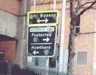
After I passed the General Post Office, I found myself stuck on traffic on Collins Street. The streets of central Melbourne are set out on a neat grid, and many of these streets have a tram line in the centre, Collins Street being one of the busiest tram routes. Tram stops in downtown Melbourne are marked as "Safety Zones", where pedestrians wait for trams in an island in the middle of the road, separated from the traffic stream by a series of barriers. To turn right at busy junctions in the city centre requires what is known as a 'hook turn', which is indicated by the "right turn from left only" sign. This is how to do a hook turn - stay in the left lane, then when the light is green, proceed into the middle of the intersection and stop. Indicate that you are turning right. When the lights on the street go red, and the lights on the street you are turning into turn green, you have the right of way and may then proceed into the left lane of the street you are turning into. The cars waiting to go straight on the street you are turning into then follows you. Confusing? Well, yes, it confuses me (and a lot of non-Victorians) too. :-) The reason this is necessary is because, in the city centre, cars are not allowed to travel on the tramlines, and before hook turns were introduced, cars would turn right and a tram would slam straight into the car, with disastrous consequences for all concerned.
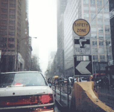
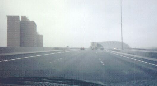
At the west end of Collins Street, I turned left onto Spencer Street, then right onto Flinders Street, then left onto the Charles Grimes Bridge, then right onto the M1 (Westgate Freeway). It was at this onramp that I noticed that Victoria uses Californian-style "Freeway Entrance" signs on its onramps. I then went onto the loop at the trumpet interchange between CityLink and the M1, and headed north along the CityLink over the Bolte Bridge. This photograph is of a typical gantry on CityLink, and clearly shows again the difference between a CityLink sign and a standard road sign.
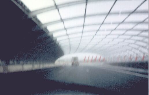
Further north on CityLink, you will pass through a structure called The Sound Tube. It is an open mesh of tubular steel with completely surrounds the freeway. Despite the fact that the mesh is open, it blocks out most of the noise of the passing traffic and provides relief for the residents of the public housing towers visible on the left. It is so unusual that several companies have incorporated the Sound Tube into its television commercials.
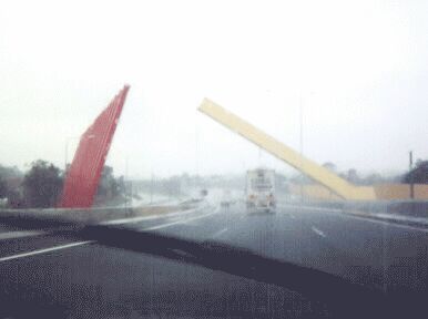
Several hundred metres to the north, you will pass the Gateway sculpture. This is a typical example of civic art in Melbourne. It's meant to welcome motorists heading south to the Melbourne city centre, but I don't know much about art, so I don't get it. Perhaps someone a little more artistic can explain this sculpture to me. :-)
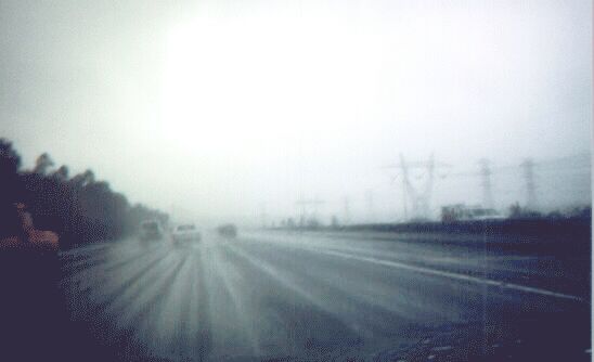
I continued onto the Tullamarine Freeway, and then headed east onto the M80 (Western Ring Road). This is a great road, and a much needed bypass of the Melbourne metropolitan area, but damn it is so ugly! For much of its length, it parallels huge power transmission lines. The day I took this picture was very rainy and misty, so you can't see the lines in all their glory, but I hope that the reader will take my word for it and accept that the M80 ia s true specimen of urban industrial ugliness.
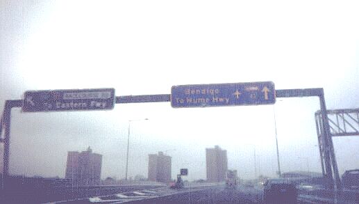
I headed north onto the Hume Highway (National 31) shortly after that photograph was taken. Through the outer northern suburbs of Melbourne, the Hume is a wide suburban arterial. Most notable is the fact that it passes the Pacific Rim headquarters and assembly plant of the Ford Motor Company. After the northernmost suburb of Craigieburn, National 31 becomes an expressway (M31), which lasts all the way to the NSW/VIC border at Albury-Wodonga. Much of it is now full freeway standard, but otherwise, there are many grade crossings at low-volume intersections with local rural roads. In the many times I have travelled this route, I think I might have seen only about three cars using these intersections, so building a grade-separated interchange for each of these roads would be a rather futile and expensive exercise.
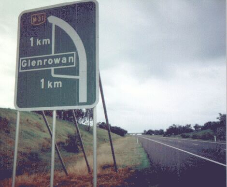
Many of the towns the Hume Highway used to pass through have now been bypassed, and this is how VicRoads signs the routes through the towns. A typical National Highway shield in Victoria can be seen up the top. Sometimes, services available in the town are indicated at the bottom of the sign in the form of symbols, e.g. knife and fork for food, petrol bowser for fuel, a bed for a motel, etc.

This is how multiplexes are signed in Victoria. A diagonal stroke is placed between the two route numbers. This is also how at-grade intersections are signed on rural expressways in Victoria.
This was the last picture taken on my roadtrip. Soon after that intersection, I arrived in the city of Wodonga, and crossed the border into Albury, which is a large bottleneck and a classic example of NIMBYism at its most illogical. An essay about this can be found on the next page, which deals with the last leg of my journey - the Hume Highway in New South Wales.
© Bradley Torr. Last updated 22-Jan-2003.