Starting on August 25th 1999, I decided to take a little break and explore the roads of south-eastern Australia. I covered 1,922km (1,194 miles) over three days, and covered two states and a territory. I took along a couple of disposable cameras and had a happy time snapping away for your vieweing pleasure. :-)
This roadtrip report is divided up into 7 pages, with about 8 photos on each (except for the last page, which has no photos). You are currently on the first page, and to get to any other page, simply click on one of the links below:
Anyway, on with my roadtrip, enjoy. :-)
I started out from my house in Port Kembla (a suburb of Wollongong, NSW) at 12:07pm on Wednesday, August 25, 1999. I then popped down to the local shopping mall where I picked up a few essentials, then I was on my way.
I headed west along NSW-155 (Northcliffe Drive), which provides an access route between the Port Kembla steelworks and the F6 / National 1 (Southern Freeway). There was nothing too interesting about this suburban road. Then I turned south onto the F6 to head off to Canberra, the nation's capital.
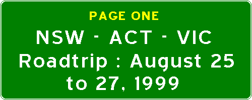
This is what much of the F6 through the Wollongong metropolitan area looks like. In fact, this is what most suburban freeways in New South Wales look like - typically two lanes in each direction; a wide median; many pedestrian and bicycle overpasses and concrete noise barriers on either side. I believe that this section which bypasses the suburb of Dapto was built sometime in the 1980's.
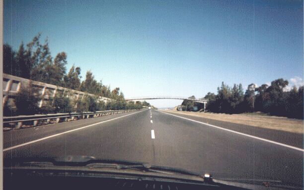
The freeway ends at Albion Park Rail, where it merges back with the old Princes Highway (which the F6 replaced). The traffic on the F6 is dumped unceremoniously onto the Princes Highway through Albion Park Rail, which is not a very attractive road lined with petrol stations, fast food restaurants, light industrial warehouses, and hardware shops. It becomes a pleasant rural highway after Albion Park Rail. Thankfully, I turned right at a roundabout onto National 48 (Illawarra Highway) before this strip, and passed through the rather sedate town of Albion Park.
After Albion Park, the Illawarra Highway goes through tranquil dairying country. It's generally a two-lane rural highway with an overtaking lane or two. Roadworks were frequent along this leg, with the Roads and Traffic Authority (RTA) widening some bridges over streams.
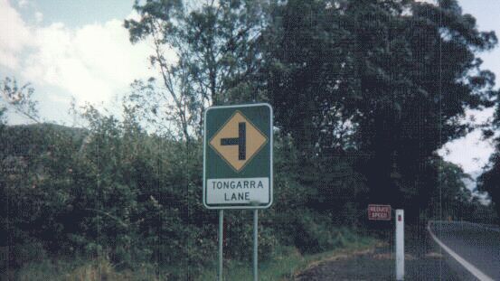
These signs are quite common in New South Wales, and I like them. Not only do they warn traffic that there is a side road ahead, they also give the name of the road - useful for emergency services, visitors and commercial vehicles. It saves having to look out for tiny locally maintained signs at the actual intersection.
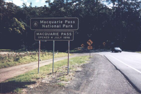
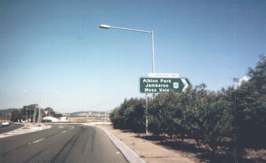
The City of Wollongong is located on a narrow coastal plain, with the Pacific Ocean to the east and a steep and formidable mountain range to the west rising to 2,000 feet in some places. This range is known locally as "The Escarpment", and has presented major difficulties for ease of transportation ever since the earliest days of European settlement. Numerous passes have been cut through the Escarpment, and I'm about to go up the biggest and baddest one of them all; the enemy of many clutchplates and brakepads which have travelled this route - the Macquarie Pass. 8km (5 miles) of steep, unforgiving, twisty road which takes about 30 minutes or so to travel safely. Now that the area has been proclaimed a National Park, improvements are unlikely to be forthcoming.
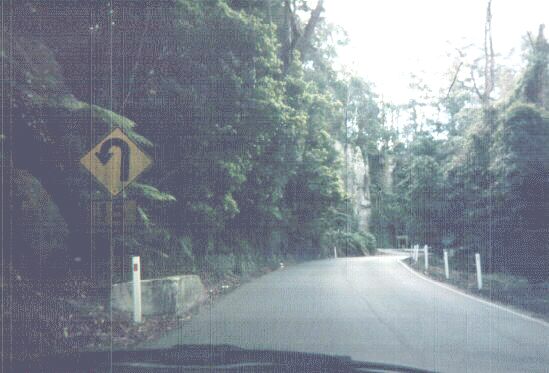
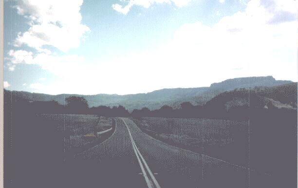
And this is what a typical stretch of Macquarie Pass looks like. After about five kilometres or so, the road flattens out, line markings reappear, and an overtaking lane materialises. The motorist is lulled into a false sense of security... then you come to a 15km/h curve, and you still have a fair bit to go......
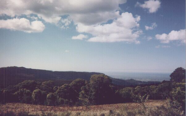
...but, as this picture shows, it was all worth it. This photo doesn't do justice to the scene from up here. You can see the Pacific, as well as the southern half of the Wollongong metropolitan area (including my suburb), the Steelworks, Lake Illawarra...... these didn't turn out on the photograph though.
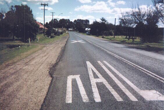
Soon after you climb Macquarie Pass, you encounter the village of Robertson. Robertson is most famous for being the town where the movie 'Babe' was filmed. However, I took this photograph to ilustrate what a typical Australian railway crossing looks like. First, you have this warning painted on the roadway (though part of the 'R' is covered with a pothole patch). You also have adjacent warning signs too, which aren't visible in this picture.
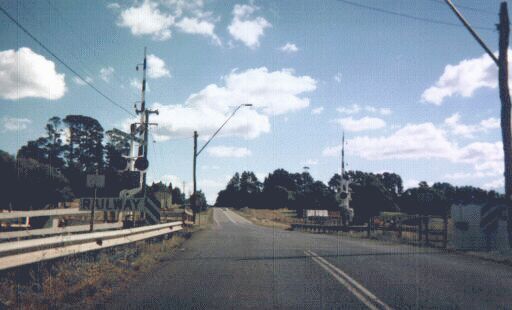
This is a little closer to the crossing itself. It shows the lights, the boomgates and the signs in a little more detail. Most railway crossings on major highways now have lights and boomgates. Minor crossings tend to have just a "STOP" or "GIVE WAY" sign.
© Bradley Torr. Last updated 22-Jan-2003.