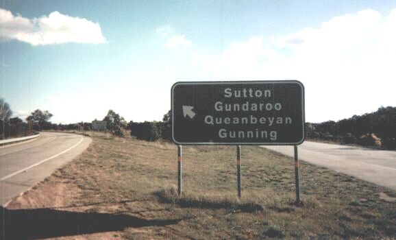
Whoever hates this font, put your hands up..... well, I know I do. I don't know what this Arial-like font is called, but its infection of the NSW road network is becoming insidious and widespread. First, I noticed this font first on distance signs, then roadwork and warning signs; then it appeared on directional signs.... now it's on this exit sign. I hate it. I don't know why the RTA is doing this, but I wish they'd stop. I like the existing font based on that used by the United States Federal Highway Administration; it's clear, crisp and is clearly identifiable as being official and used only on roads, which I think is important as it helps to distinguish it from advertising and privately owned signs. Please, stop it, RTA. This new typeface tortures my eyes.
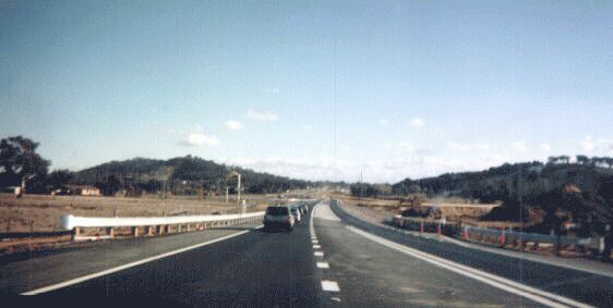
Most of the section from Lake George into the Australian Capital Territory (ACT) is still single carriageway, but this is being remedied. This photograph shows a queue at a roadworks site, and the earthworks on the new second carriageway on the right. This section is expected to be opened some time next year.
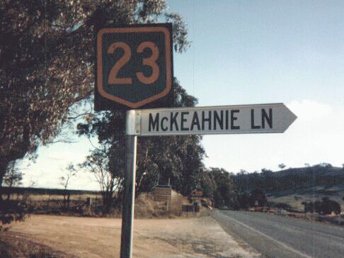
I don't believe it... a reassurance marker on a New South Wales highway! Gasp! Shock! Horror! Of course, my cynical nature tends to make me believe that this is actually an Australian Capital Territory marker.... ACT National Highway markers don't have "National" written along the top, and this sign is only 200 metres or so inside New South Wales. To be fair, I actually saw a National 23 marker soon after the National 31 - National 23 split near Goulburn; I was going too fast to grab a picture of it though. The only other place I've seen a reassurance marker of this type in my home state is in the far south-western corner of the state near Euston, on National 20 (Sturt Highway).
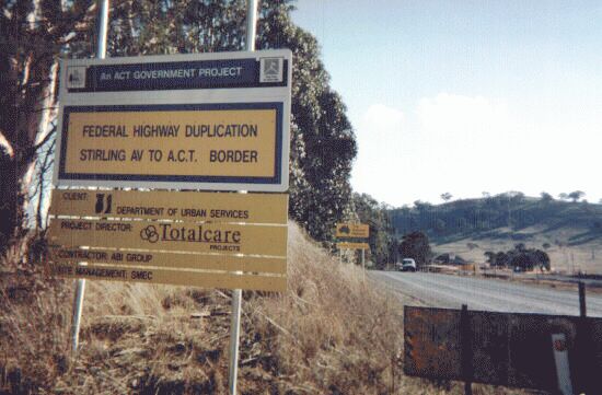
A little bit closer to the border itself, you find this sign. I don't mind these types of signs, even if they sometimes are a little conceited; after all, taxpayers should have the right to know how their money is being spent and why they're being held up at all these roadworks. However, what really annoys me about this sign is, it's not even in the Australian Capital Territory! Message to ACT Department of Urban Services - stay off our turf. Put these signs up in your own tinpot territory!
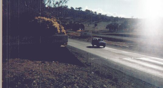
And this is the NSW/ACT border itself. Because I was facing the setting sun, the border sign didn't turn out - it's a painted concrete block with "AUSTRALIAN CAPITAL TERRITORY" written on it, surrounded by a small garden of native shrubs and flowers. However, what is most interesting from the observer's point of view is the change in pavement surface at the actual border - right on the border to the nearest centimetre. The smooth bituminous blacktop of the ACT breaks suddenly into a more worn, lighter surface on the NSW side. The way the light is hitting the road surface accentuates this difference. There is currently no sign for traffic heading north indicating a state border due to the roadworks.
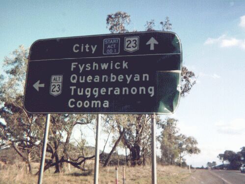
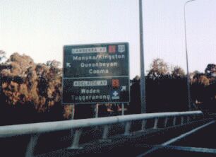
This is one of the first signs you will see heading into Canberra. National 23 heads through the centre of Canberra right up to Parliament House then continues on its merry way through the southern suburbs and down to the skifields near Cooma. Alt-23 bypasses the city altogether and rejoins National 23 south-east of Canberra. I've never been on Alt-23, but I'm told that it's a two-lane rural highway. There's an error as well - the shields should be green and gold! Aaargh! "Start ACT OD1" signifies the beginning of ACT Overdimensional Route Numer One, which is a madatory route for trucks and earthmoving equipment over a certain length, height or weight. I also notice that it bypasses the Parliament House area and the diplomatic missions as well. Perhaps they don't want a Timothy McVeigh type with a truck bomb to do some damage to the High Court building, or am I just being too cynical? :-)
I continue along National 23 into Canberra. On the northern outskirts, it becomes Northbourne Avenue. Northbourne Avenue is an incredibly wide six-lane boulevarde with a huge wooded median. The reason why the median is so wide is because the original plan of Canberra called for a system of tramlines running from the Parliament precinct to the suburbs. In the city centre (known as Civic) I stopped off to grab a late lunch at McDonald's. Walking out of the restaurant, I noticed that just across the street was the headquarters of the Federal Department of Transport and Regional Services! Even though I was pressed for time, I ambled across the street and took a look at their library. I'd like to go back down there one day and explore a little more as I was a little rushed and couldn't find what I was looking for (an inventory of all the Federally funded highways of Australia; and the original reports into the national route numbering scheme).
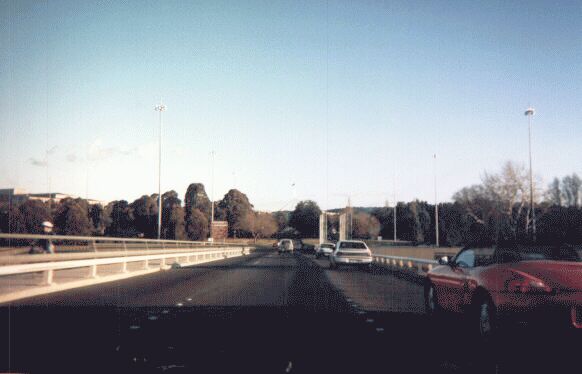
I headed back out onto Northbourne Avenue, which passes through a giant roundabout called London Circuit, then over the Commonwealth Bridge which crosses Lake Burley Griffin, from which I took this picture. I hoped that this picture would illustrate just how wide and spacious many Canberra roads are. Just visible off in the distance is the flagpole of Parliament House, which sits in the middle of a giant roundabout called State Circle. Canberra is famous for giant roundabouts, many of which intrepid travellers have driven onto, never to be heard from again..... I don't know why they didn't just build one huge roundabout and then build Canberra inside it, and build thousands of little roundabouts within the city and put each house in the middle of its own roundabout. Driving through the ACT is quite a dizzying experience much of the time. Even a person like me with a superior sense of direction has gotten himself lost in Canberra, even with an aid of a map!
I then drove onto Capital Circle, which is a roundabout so big, you don't even realise you're on a roundabout. It's only when you pass the same sign half a dozen times that you realise you're going around in circles. In any case, this is a typical Canberra directional sign taken on State Circle. The orange symbols are Tourist Drives. There are about seven or eight tourist drives in the ACT, and each of them are colour-coded for ease of navigation. This is Tourist Drive 5, which is colour-coded blaze orange. Other colours include purple, black, white, bone, and mauve (that I can recall).
After this, the light became too poor for me to take any more pictures. I continued south through the Canberra metropolitan area, and Highway 23 for the most part was of freeway standard, interrupted by two roundabouts (I think, they were too big to tell if they were roundabouts or full interchanges) and a traffic light, which was the sole cause of quite a lengthy backup. In the northern part of the metropolitan area, National 23 loses its National Highway status and becomes a National Route. After passing through Canberra, the Monaro Highway becomes a decent-quality two lane road with many overtaking lanes. I stopped at the New South Wales border heading out of the ACT, and I saw a similar break in the pavement to the one I saw heading into the Territory. It was blacktop on the ACT side, and a kind of sealed gravel, a rough kind of bitumen on the NSW side. There was also a concrete pylon, about one metre high, painted yellow with "ACT" stencilled on one side and "NSW" stencilled on the other.
© Bradley Torr. Last updated 22-Jan-2003.