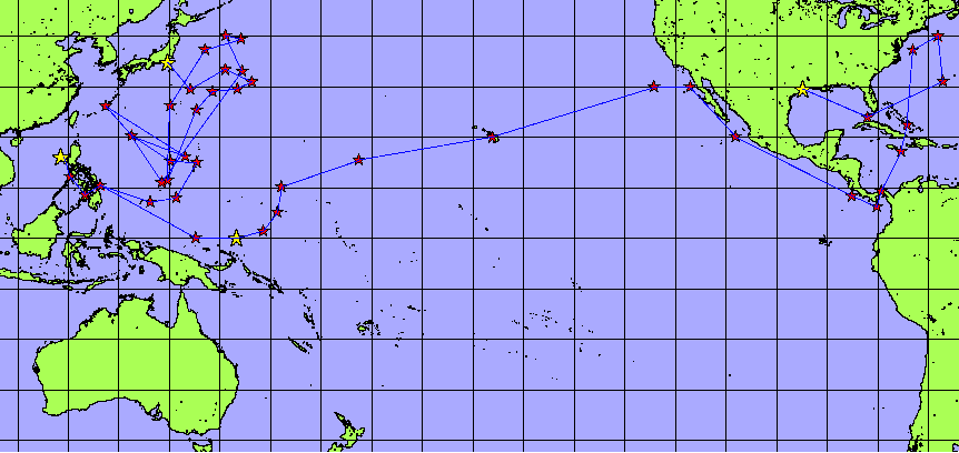
This map shows the approximate track of the WILSON from May 1944 in Houston, Texas to September 1945 in Tokyo, Japan. It is not a complete track. Using Design Map, which was developed by Tony Steinke, Charles Sturt University, I began entering the day's end coordinates (2000) from the War Diary. I had entered approximately three months worth of coordinates when the program would no longer show the picture. So I began weeding out the chaff. If a coordinate overlapped one I'd already entered (and MANY of them did), it was removed. Believe me when I say that this ship covered THOUSANDS of miles of water between Texas and Japan. Click on one of the yellow stars to take you to the corresponding page. Or just follow the Blue Angels -- you'll get there eventually.
![]()
![]()
© 1999-2003![]() CigarSquid
CigarSquid
This page hosted
by ![]() Get your
own Free Home
Page
Get your
own Free Home
Page
Background courtesy of Oscars
Background & Texture Archive
 Sign Guestbook