|
|
|
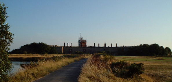
Fort Gilkicker is a coastal fortification
located at a low lying headland to the west of Portsmouth Harbour entrance.
Its large earthen bank rises above the low lying coast, topped by a row
of distinctive chimneys and a radar scanner.
Around the structure lies ponds shingle
banks .These are the remnants of the Moats used as a part of the defensive
system based on the nearby Fort Monkton. The area now forms an area used
for recreation, a haven for wildlife and a golf course.
Because of the relative low relief of
its surroundings the Fort Gilkicker is used as a trig point by the Ordinance
survey. The short climb up to its dizzy heights of 12mtrs does offers
an interesting view. |
|