The Prescott Gallery - 1900s |
|
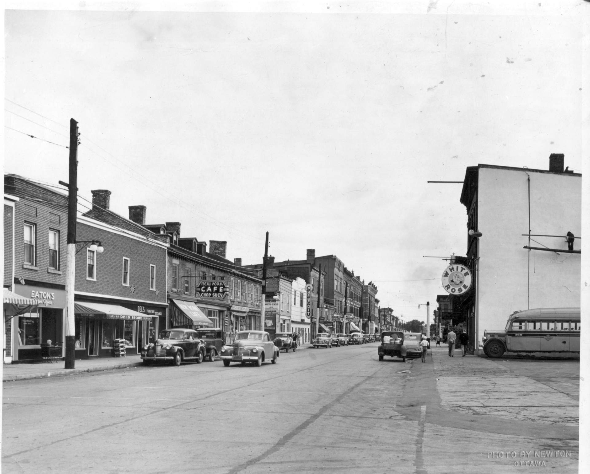 |
This is a fascinating picture (for me) of downtown looking east from the
southeast corner of King and George Streets, where the
Mac's is now. We guess the date
(from the vintage of the cars) to be early 1940s. Many of the buildings are still there
now. In the detailed version, you can read the license plate numbers. The photograph was
from the Ottawa "Evening Citizen", taken by Newton
(Lee McKnight Collection). Is it significant that the name of the theatre (white building in the middle) is the PRESCOTT. We knew if in the 1960s as the PRINCESS. Did somebody actually change the name to minimize the number of letters that had to be changed? The theatre was built in the mid 1930s and changed owners in 1943 and 1948. Could anyone give me a precise year on the picture? |
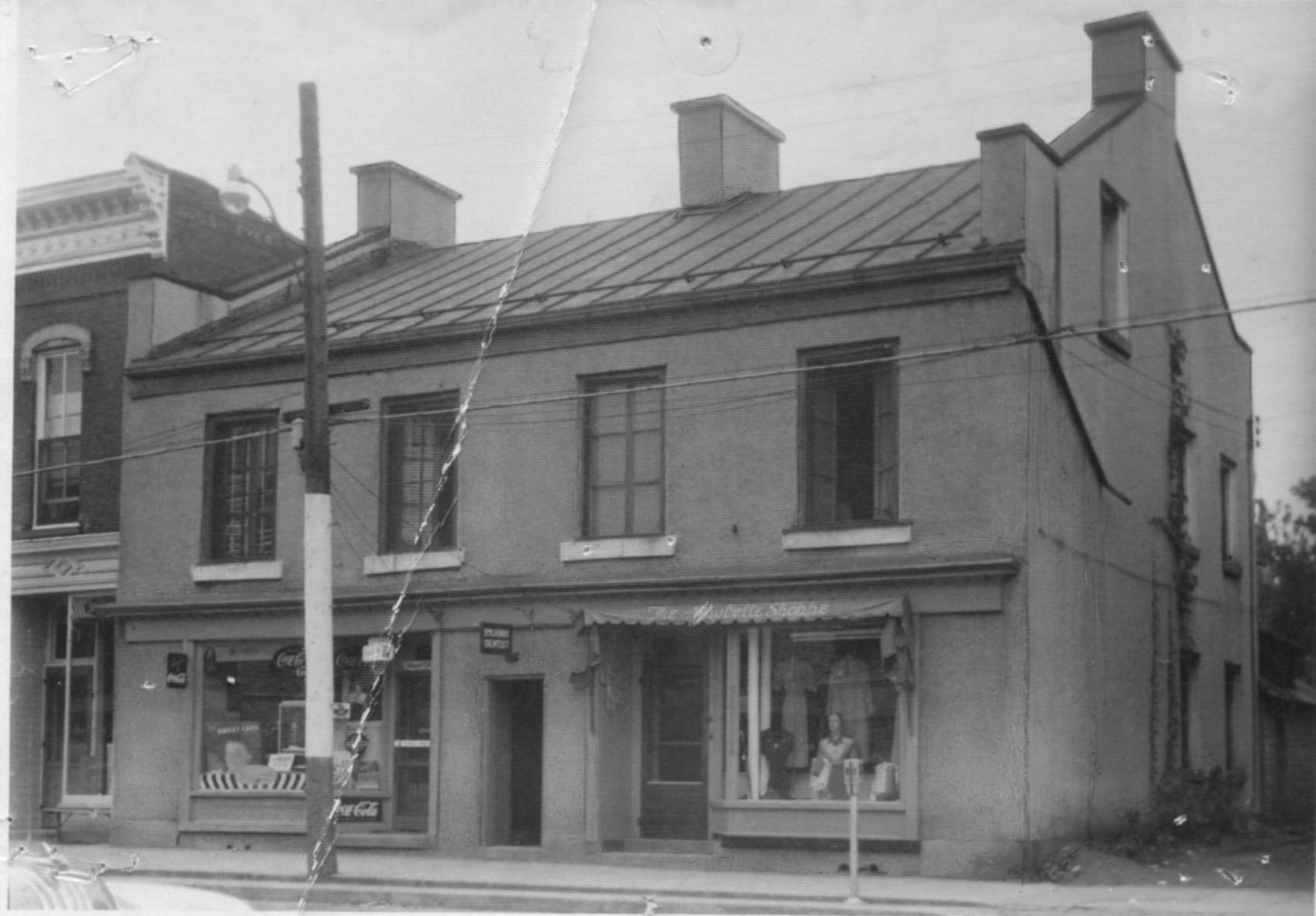 |
The Maybelle Shoppe, late 1940s or early 1950s. This is the same location as it is now (i.e., north side of King Street between Centre and Edward). (Lee McKnight Collection) |
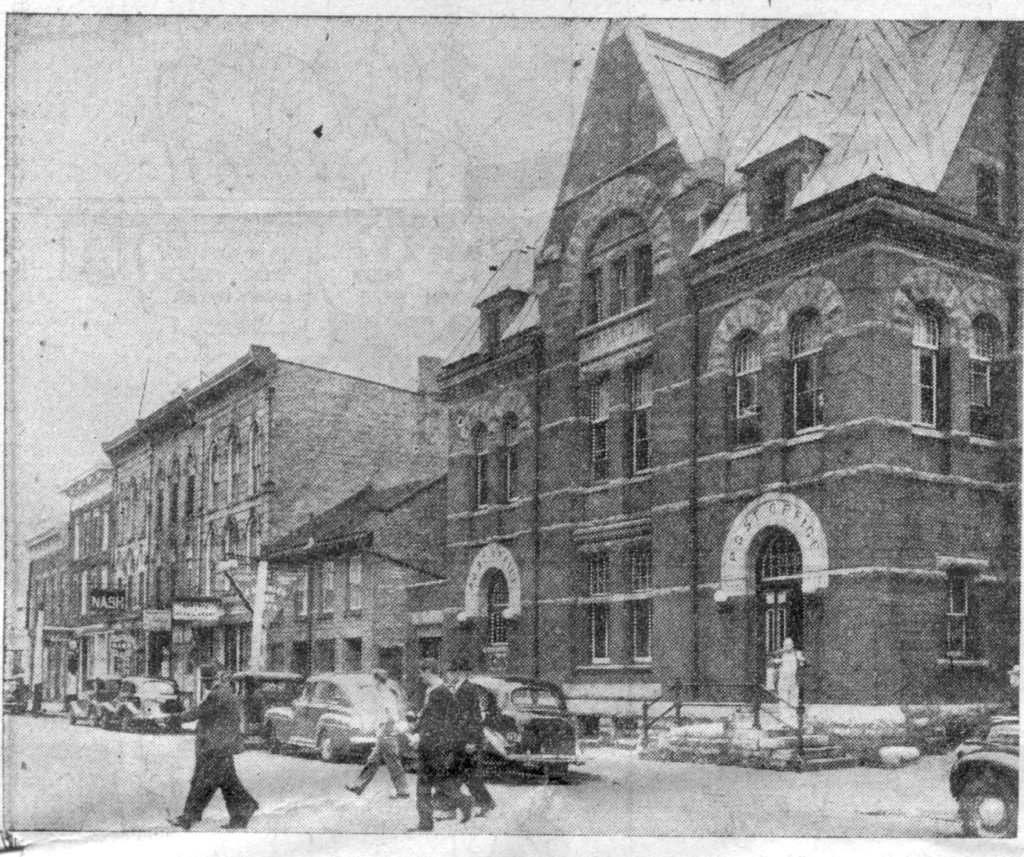 |
Prescott's "19th century" post office on the south side of King
Street between Centre and Edward Streets was built in
1889. It lasted until 1966, when a
Metropolitan Store was built on the site. Isn't progress wonderful? If you take a close look at the
air photos, you will see a
building of a similar style behind the post office facing water street.
This was likely the customs
house? The photo was taken from the Ottawa Citizen, October 5, 1946. The full-page article was entitled "Prescott First Glimpse of Canada for Many Americans". |
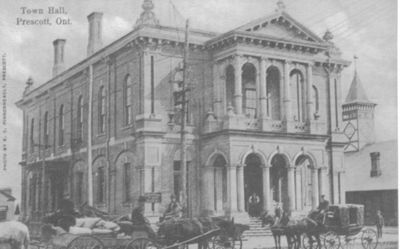 |
An early postcard of
Victoria Hall, Prescott's town hall built in 1874. There's no
date on this picture but it's late 1800s or early 1900s. Thanks to Bruce Whitehead
of Campbellville, Ontario for contributing this. Another, similar postcard
identifies this as the Opera House! If anyone has any more details on the
interior of the building, please let me know.
The photo credit on the postcard is E. C. Pinsonneault, Prescott. The Prescott Journal ran a nice story on E. C. in it's June 18, 2003 edition. See Digital imagery could create a major bleep in historical records, by John A.H. Morris. We hope you appreciate the reference, John. |
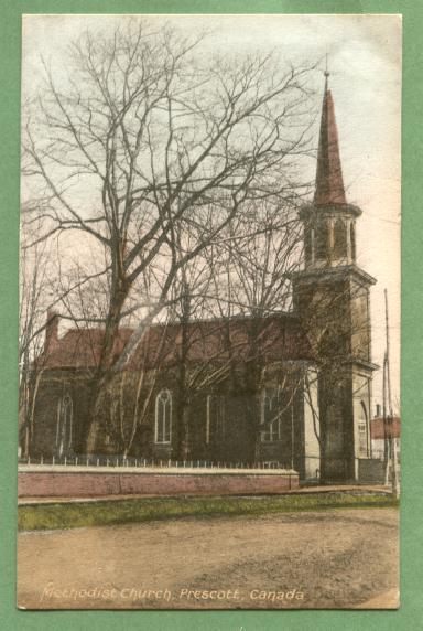 |
Another E. C.
Pinsonneault photo of prehistoric Prescott. This is the Methodist Church but
it's not certain whether it's the same one seen in the
Dibble Street photo in about 1890. (I borrowed the image from Simone's Postcards, Saint-Lazare, Quebec. You can buy the original for $4 plus tax and shipping.) |
 |
 |
| Also from the October 5, 1946 Ottawa Citizen, this photo shows Prescott's Town Hall on the Southwest corner of King and Centre Streets. It was dedicated in 1876 while James Irwin was mayor. The clock tower was a later addition. | Another view of the Town Hall taken from the mid--1940s economic development brochure. This was likely taken a few years after the Citizen photos. The Town Hall was demolished in the early 1960s--the building had fallen into poor repair and the town couldn't afford to maintain it. The site is now the site of the town clock and parking lot. |
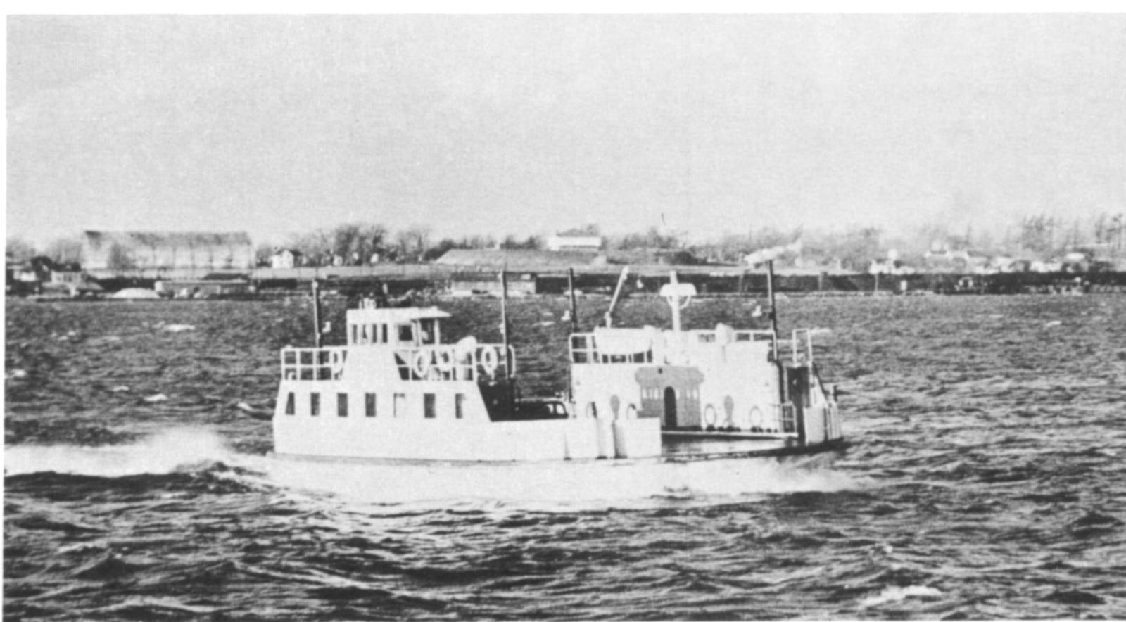 |
The "Maple City" was one of three diesel ferries operating the
Prescott-Ogdensburg service between 1951 and 1960. The others were called The "Fort
Town" and the "Windmill Point". The photo was taken by Captain L. A. Gilbert and was reproduced in the Pictorial History of the Thousand Islands. The "skyline" in the background is Prescott in the early 1950s. Fort Wellington can be seen in the middle. What is the large building on the left? |
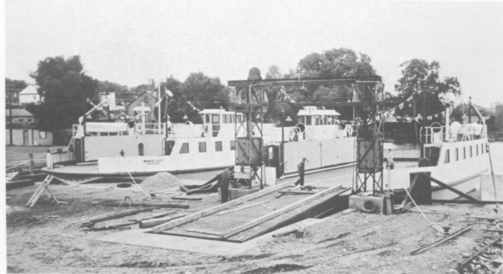 |
Another view of the "Maple City" in dock at the foot of West Street. (same source as the above). |
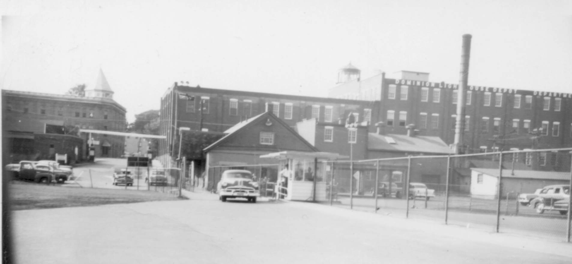 |
While we're at the ferry docks, we may as well take a look around. This photo comes from my own family archives and was taken in 1956. Looking north from the base of West Street, the DLD (Dominion Lighthouse Depot) dominates the view. The Alexandra Hotel on the left side burned to the ground in 1959. The photo was taken by F. R. Bordt. |
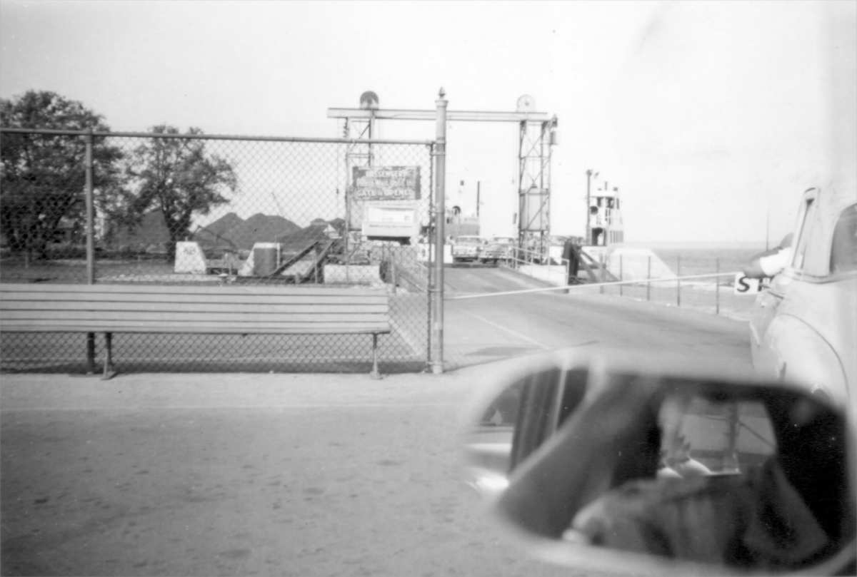 |
Another Bordt Archive image shows the ferry being unloaded. The view is looking east from the foot of West Street. (photo by F. R. Bordt) |
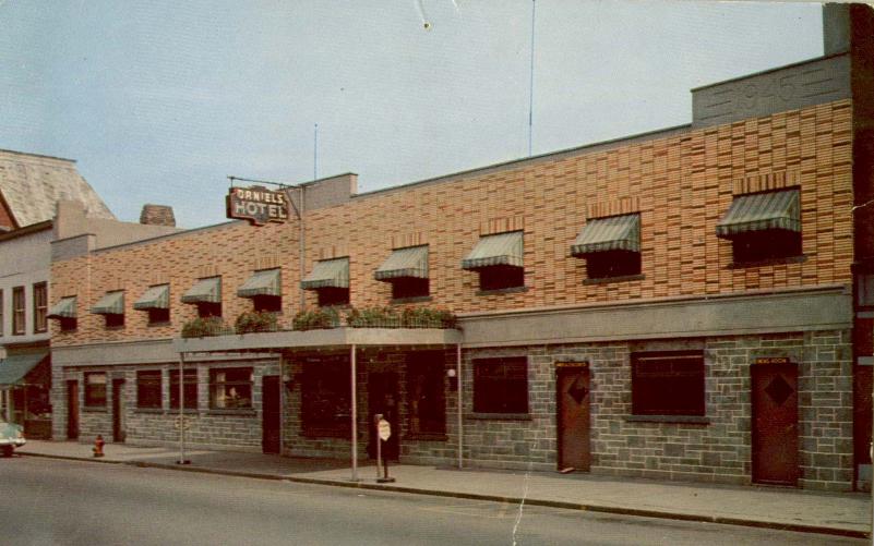 |
Ahh, the venerable Daniels Hotel again. This is probably the same location as the one on the 1800s page but somehow this one looks a little more pedestrian. This post card (who would ever send one?) must have been from the late 1950s or early 1960s. Don't look for it now, it was torn down in the 1980s. The space serves a much higher purpose now--a vacant lot. |