The Prescott Gallery - 1800s |
|
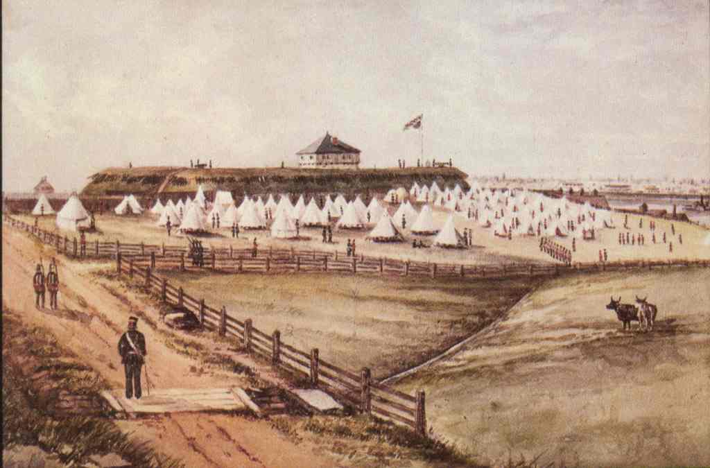 |
This is a drawing of Fort Wellington in the 1860s, called "Encampment of Fort Wellington during the Fenian Threat". The perspective is from the north west of the Fort near the St. Lawrence, looking south with the river in the distant background. (Public Archives of Canada) |
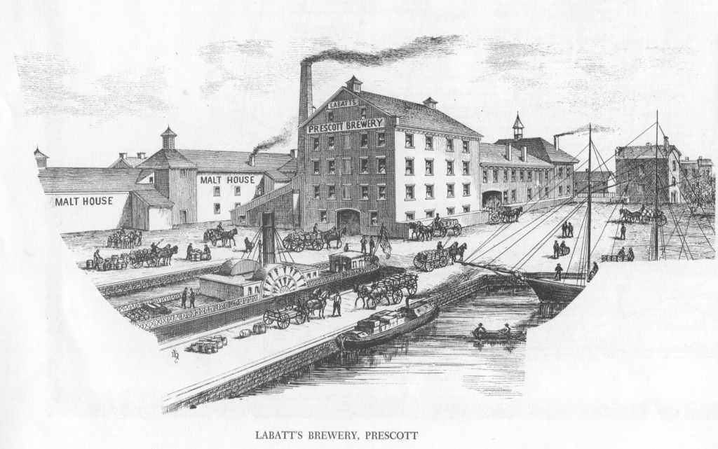 |
The many breweries and distilleries closed down in the early 1900s. This one was on the waterfront between St. Lawrence St. and West St., the current location of the Coast Guard docks. The illustration was taken from the Illustrated Historical Atlas of the Counties of Leeds and Grenville Canada West. |
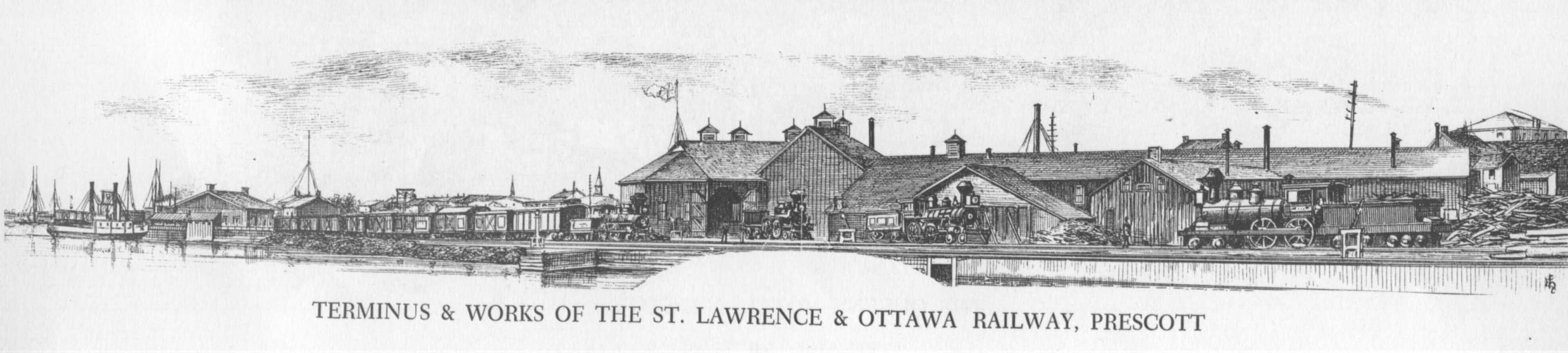 |
The railroad terminus between Fort Wellington and the river appears to have been a major enterprise in the mid-19th century. Note that on the map above, this area is shown as land whereas in more recent times it appears as water. Most of this area was built up on wooden pilings, many of which still remain underwater. The illustration was taken from the Illustrated Historical Atlas of the Counties of Leeds and Grenville Canada West. |
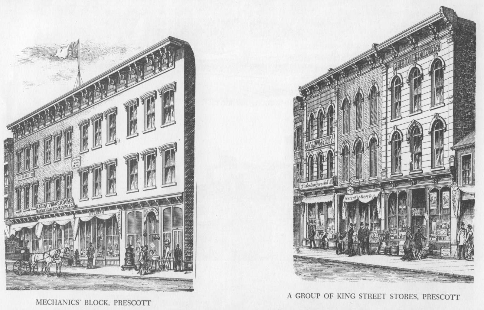 |
The Mechanics Block on the north side of King Street
between Centre and Edward Streets is still standing. It was built in 1874. The other block is on the south side of King Street between Centre and Edward Streets. It is known as the Bains Boyd Keilty Block. The illustration was taken from the Illustrated Historical Atlas of the Counties of Leeds and Grenville Canada West. |
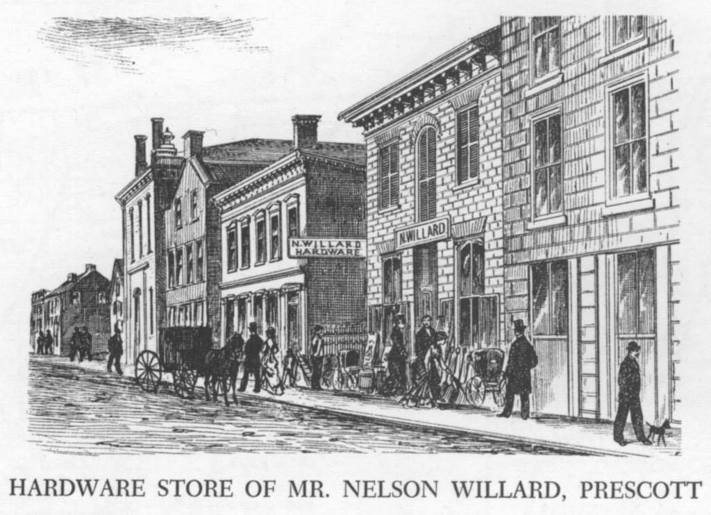 |
Mr. Willard sure had a fine hardware store in the mid-1800s. It was
located on the north side of Water Street, close to Centre. The Prescott Messenger
later was housed in this building. When referencing the illustrations with the detailed town map, it was almost impossible to find any of the places referenced. From a couple of examples, it appears that the illustrations were done ten to twenty years before the map. The illustration was taken from the Illustrated Historical Atlas of the Counties of Leeds and Grenville Canada West. |
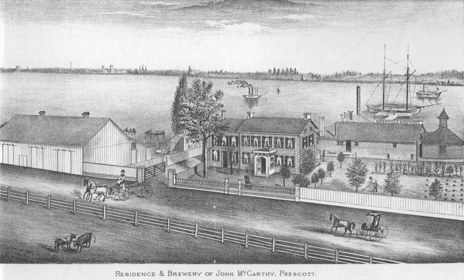 |
John McCarthy's residence and Grenville Brewery in the early 1800s.
According to J. A. Morris' Prescott 1810-1967, the residence and brewery were
about a mile west of Prescott, near the current location of the "Isle of Rest"
Motel. Drawing taken from The History of Leeds and Grenville Ontario from 1749 to 1879 by Thad W. H. Leavitt, published by the Recorder Press, Brockville. The book was reprinted in 1979. |
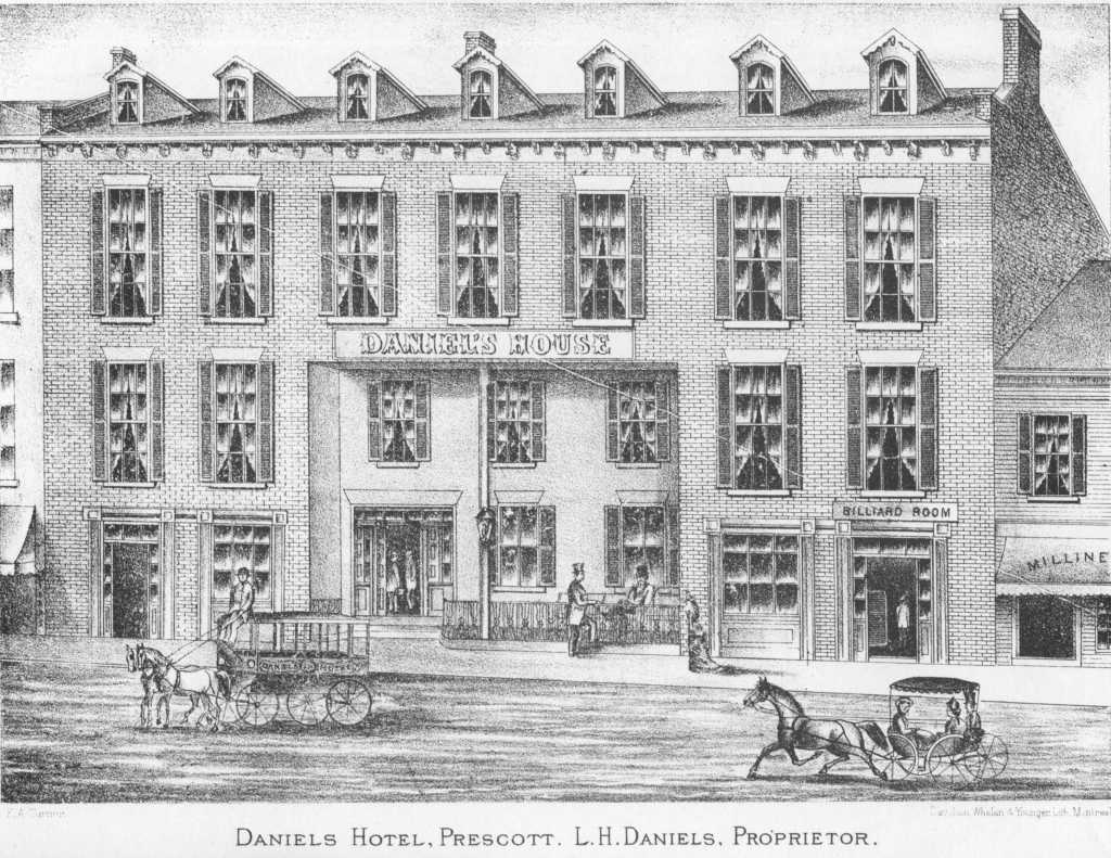 |
The Daniels Hotel of the 1840s stood on the south side of King Street, I presume in the same location as the one that was rebuilt in the 1940s (?) and was demolished in the 1980s. Also taken from The History of Leeds and Grenville Ontario from 1749 to 1879. |
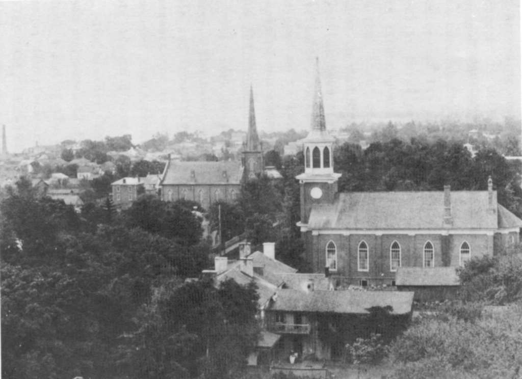 |
A view of St. Paul's United Church in about 1890. At the time, it was the Methodist Church. A couple of thing are notable about this photo. The first to strike me was the presence of another large church on the south side of Dibble Street, between George and West Streets. This is identified as the Methodist Episcopal Church. The next is the tall spire on St. Paul's. It was removed in 1925 after pieces of it started falling on to the streets below. Also interesting is the view of the west end riverfront industrial area. The photo was taken from A Firm Foundation: History of St. Paul's United Church, Prescott Ontario, 1830-1980 by Elva Richards McGaughey. |