|
Navigation |
|||||||||||
|
DESTINATIONS Big Bear City |
|
|
Navigation |
|||||||||||
|
DESTINATIONS Big Bear City |
|
© all photos (2000-2002), all rights reserved (Bob and Esmeralda Grove)
On May 7, 2000, I approached Big Bear City from the North West. From Rosamond, I flew an almost direct route to Big Bear passing the cities of Lancaster and Palmdale. My route takes me just South of Apple Valley and just North of the Cajon Pass. I flew directly over Lake Silverwood and Lake Arrowhead (see the thumbnails below).
Most pilots in Southern California flying from the Los Angeles or San Diego areas would travel North West or North, crossing over the San Bernardino Mountains. Big Bear City is located in the rugged San Bernardino Mountains of Southern California.
One look at the Los Angeles Sectional Map will let you know that you have obstructions in all four quadrants. If you are coming from the South you have mountains ranging in elevation from 9,000 to over 10,000 feet. If you are coming from the North you have peaks ranging from 6,500 to over 8,000 feet. My approach brings me from the West and I have the whole length of Big Bear Lake to get down to pattern altitude of 8,000 feet. It is recommended that you fly in at a minimum altitude of 9,500 feet as outbound planes will fly out at a maximum altitude at 8,000 feet.
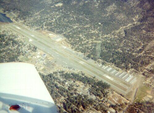
The prevailing winds are from the west and you will make left traffic, runway 26. If you have to land runway 8 you will make right traffic. As I entered the area I moved as far south of the lake as I could so that I could make a 45 degree entry starting at about Snow Summit, the local ski resort in the area. This ski resort is also a landmark for reporting to unicom or CTAF. This is a very noise sensitive area so make sure you read carefully the procedures as outlined in your AFD. (Thanks to Scott Smith of Big Bear for correcting my miscalling Snow Summit "Ski Summit" in an earlier version of this page.)
Big Bear City can be a challenging flight for a first time visitor. I recommend low time pilots take a flight instructor along with them the first time, as I did (I have 250 hours). Having a flight instructor or someone else that knows the ins and outs of a particular area can help you with the various landmarks and general hazards of mountain flying. Since I fly in the Antelope Valley, I'm used to windy and rough conditions in general. The mountains will have wind and turbulence as well as extreme density altitude situations at all times of the year. When I landed in the spring, it was only 62 degrees on site and already the density altitude was 8,200 feet! I was flying a 200 HP retract Arrow and didn't have any problems but I would be careful in a loaded Cherokee 140 or Sky hawk - check your density altitude charts in your handbook! Check out the accident report in the link below.
Once you get there, try out the Barnstormer Cafe for the "$100 lunch." They even have a Chinese restaurant on the 2nd floor. I've eaten at the Barnstormer for both breakfast and lunch and can give them a positive recommendation. A walk into town is also pretty easy and you can try an eatery there. My wife, daughter and myself enjoyed the walk to the lake and relaxing in a picnic area they have on the South side of the lake.
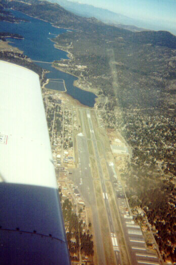
When you depart runway 26, the unicom will usually advise you to turn left 10 degrees immediately after rotation to avoid over flying a park and houses. This will take you straight out over the lake. Look for the solar observatory that was built out on a promontory of the North shore of the lake. It will be on your right as you depart. The observatory was built out into the lake so that the cool waters would not cause as much viewing problems as convection from a dry surface.
Below are thumbnails of some other pictures taken around the area. Click on them to view the full size picture. Use your back button to return to this page.
Big Bear City Airport looking West
![]()
Palmdale from the East
 Cajon
Pass from the North
Cajon
Pass from the North
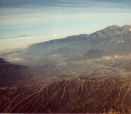
![]() Cloud
cover South of Cajon Pass
Cloud
cover South of Cajon Pass
![]() Silverwood
Lake from the North West
Silverwood
Lake from the North West
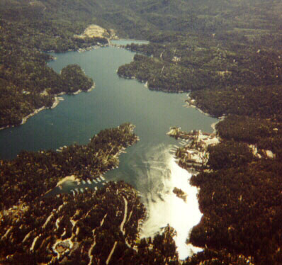 Arrowhead
Lake from the West
Arrowhead
Lake from the West
![]() Big
Bear Lake from the West
Big
Bear Lake from the West
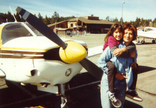 My
wife and daughter, Esmeralda & Maya with the
My
wife and daughter, Esmeralda & Maya with the
Barnstormer Cafe in the background
Big Bear Links
An excellent Big Bear Airport Site
Provides good general info on Big Bear
Density altitude a problem? Check this accident report
Contact me at: [email protected]