|
Navigation |
|||||||||||
|
DESTINATIONS Kern Valley |
|
|
Navigation |
|||||||||||
|
DESTINATIONS Kern Valley |
|
© all photos (2000-2002), all rights reserved (Bob and Esmeralda Grove)
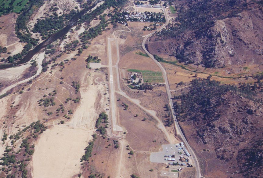
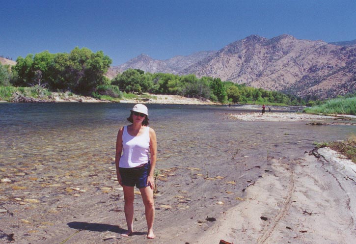
On June 20, 2000 my wife and I approached Kern Valley airport from the the South. For my family, Kern Valley is a good morning get away. But as "The Gateway to the High Sierra" it can be a multifaceted destination all in itself. It is a perfect base camp for hiking, climbing, rafting, swimming and fishing adventures. In fact, I plan on setting up a rafting trip in a couple of weeks. The companies that provide guided rafting trips can be found in the links below. They will even come out to the airport and pick you up. Speaking of the airport and rafting, the airport has a small campground just to the West of the runway. There are about 16 tie downs and a nice grassy campsite to welcome any tent. Look at the picture of the airport (either above or below), the campground is the small green square just above the tie down area (the small white square) on the left side of the middle of the runway. Another big plus; you can land your airplane and after about a 5 minute walk, be cooling your feet in the Kern River (see picture below). I take perverse pleasure in calling my buddies in the Antelope Valley with my cell phone and saying "hey, I'm in the Southern Sierras, I'll meet you for lunch in say, about an hour."
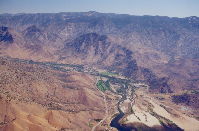
Getting in to Kern Valley is pretty straight forward. You are in the Southern Sierras though, with 8,000 foot peaks all around the airport, especially on the East side. From my Rosamond home base I have several ways I can approach Kern Valley. I prefer to fly direct to Tehachapi and then follow the Tehachapi Valley West until I'm almost into the Central Valley and Bakersfield area. The navigation is a no brainer. Stay over highway 158 that leads to Bakersfield. Right about the town of Caliente (see LA sectional), I make my turn for the North. There is a natural North trending canyon here with a large 7,775 foot mountain to my immediate left. I stay in this canyon and it is only a few minutes before I see Lake Isabella shining at 1200. Another popular way to approach Kern Valley from the south is to fly North to the left of peak 7775 and intersect the Kern River as it flows out of Lake Isabella. Follow that and you can't go wrong. Both routes give you plenty of time to let down to pattern altitude and both give wonderful views of Lake Isabella (see picture below).
Most of the time you will make right traffic runway 17. Cool air flows South down the Sierras usually only in the early morning. If this happens you will use runway 35. In my many trips to Kern Valley I've only had this happen once, but I arrived at 0730. The other times I've found the prevailing winds to always be blowing out of the South, straight up runway 17. I always call unicom on my approach and they are quick to give any advisories. Right traffic is always the rule for runway 17 due to the high mountains just East of the airport. The area is quite a bit cooler than the Antelope Valley and I've never found density altitude to be a problem. Of course, use common sense if the mercury climbs into the 90s or above.
There are supposed to be 26 restaurants in the area. I've never made it passed the Airport Cafe. Where else can you get a huge plate of French toast, with bacon or sausage for only $3.00? I hear the hamburgers and shakes are great too but I've always been there for breakfast. If you call ahead, the FBO on site, Nelson Aviation, will even provide you with an old car to drive into town.
Give Kern Valley a try. I can't beat the fact that it is only 40 minutes flight time from my home base - but no matter where you live in Southern California it is an easy hop to view the wonders of the Southern Sierras.
Below are thumbnails of some other pictures taken around the area. Click on them to view the full size picture. Use your back button to return to this page.
![]() Approaching
Kern Valley from the South. Coming up on Lake Isabella.
Approaching
Kern Valley from the South. Coming up on Lake Isabella.
![]() Kern
Valley from the South (looking North).
Kern
Valley from the South (looking North).
![]() Esmeralda
and "weather stone". Note the Bede 5 aircraft acting as a weather vane
in the background.
Esmeralda
and "weather stone". Note the Bede 5 aircraft acting as a weather vane
in the background.
 Kern
River (0.25 miles to the West of apt).
Kern
River (0.25 miles to the West of apt).
![]() Campground
adjacent to the runway (just to West).
Campground
adjacent to the runway (just to West).
![]() Lake
Isabella looking North. The airport is just above the upper left arm of the
lake.
Lake
Isabella looking North. The airport is just above the upper left arm of the
lake.
 Good
shot of airport and surrounding topography.
Good
shot of airport and surrounding topography.
Kern Valley Links
Calendar of events around Kernville
Rafting, hiking, climbing info around Kernville
Contact me at: [email protected]