- Use MapQuest to view the
geographic
position of today's city of Piła (the former city
of Schneidemühl) (Latitude 53°09,'
Longitude
16°45')
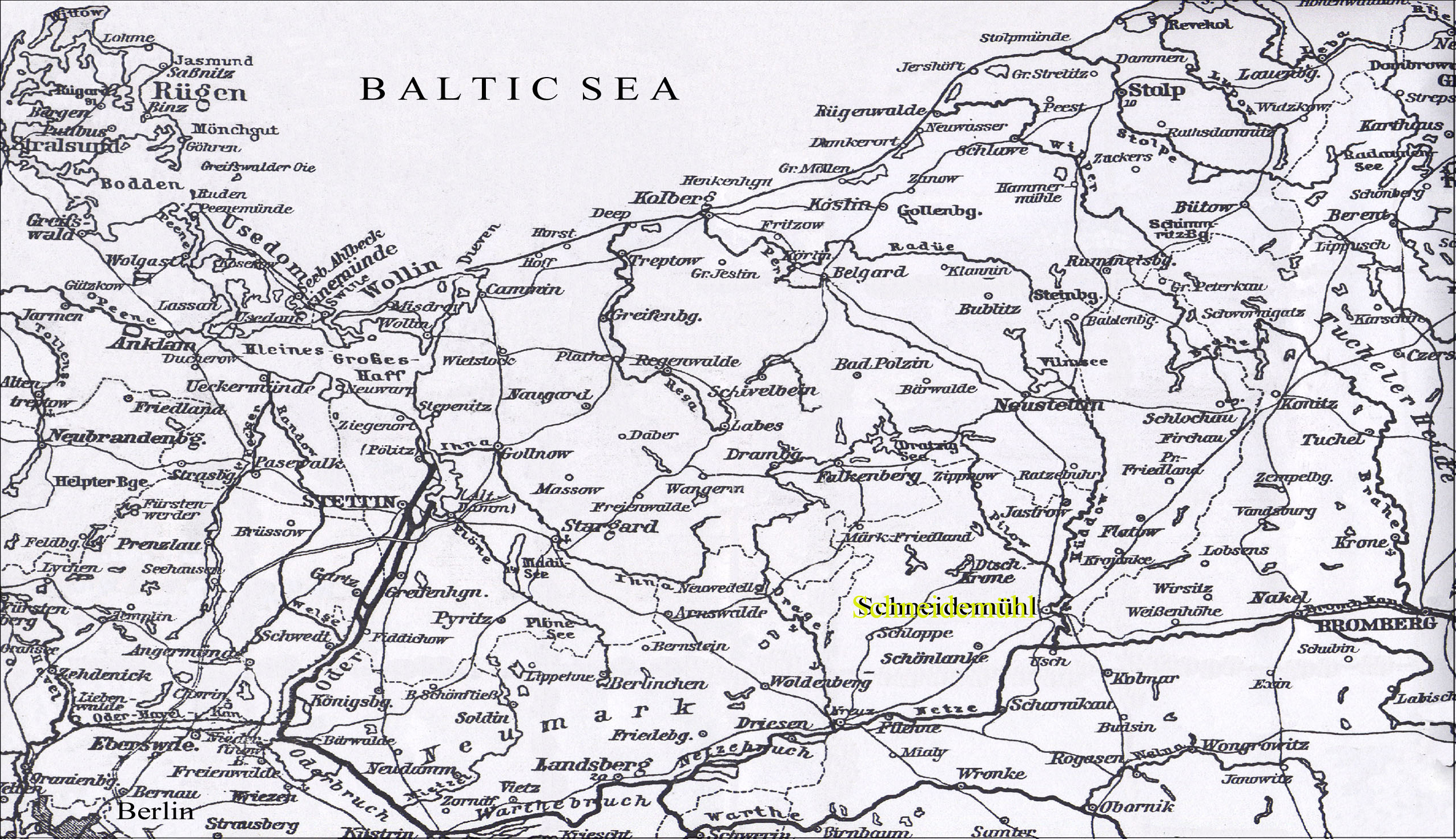
- Schneidemühl
and surrounding areas, 1906
- Index
sheets of the general map of Central Europe (1:200 000)
- By
clicking on a particular index map you can look at the sheets (3-3.5 MB
each)
- For Schneidemühl and an enlarged view of surrounding
areas, please click on the 4th square from the left at the top
(Szczecinek 34º), or scroll down
to
sheet 34-53
- Use Kartenmeister to view
geographic positions of former German communities near
Schneidemühl.
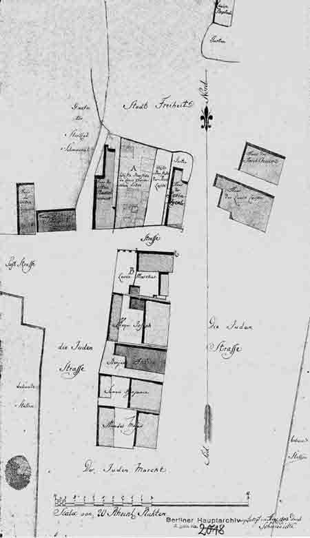
- Below, a map of the remnants of the old
ghetto of
Schneidemühl,
as recorded in 1803. The
ghetto had
first been
established by decree of
Queen Konstancja after the great fire of 1626.
The decree read:
“The side of the ghetto
measured from the rising sun, along the road to Ujscie should be 30
ruten, the side toward the setting sun, should
also be 30 ruten (where the town’s farmlands were). At the
midday side, the ghetto should measure 11 ruten—there,
where there is a garden that belongs to the Catholic Johannes
church.
Toward
the side of midnight, where the vicar’s place and fields are
bordering, the side should measure 16 rhuten and 4 ellen.”
|