Salem, Oregon Photo Gallery 5
|
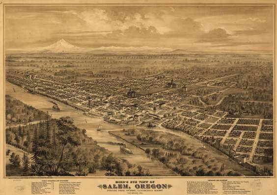
An 1870 aerial map/view of Salem. From the Salem Library historic photo collection. | , Salem, Oregon. Today's Salem has grown to a population of about 130,000. It had only about 90,000 in 1990.
|
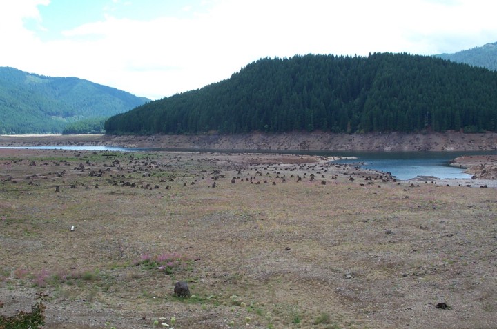
To the east of Salem is Detroit Lake, which during the drought of 2000-01 was kept at a dreadfully low level (controlled by Detroit Dam), and became utterly useless for recreational purposes. This of course about ruined the town of Detroit which gains a large part of its income from visitors to the lake. |
|
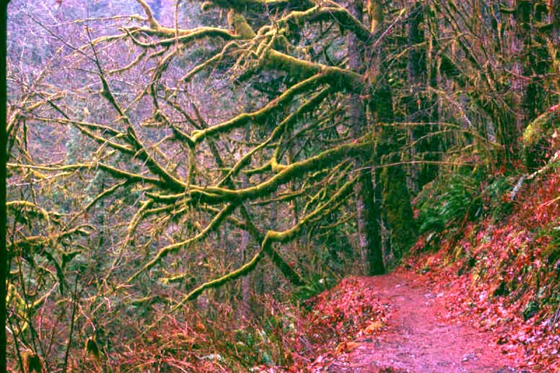
The drought described above is a rarity, while the constant rains that aid in the growth of all the moss in this typical winter scene from Silver Falls State Park is the norm. The 2001-02 winter has just about made up for any lack in the previous year. |
|
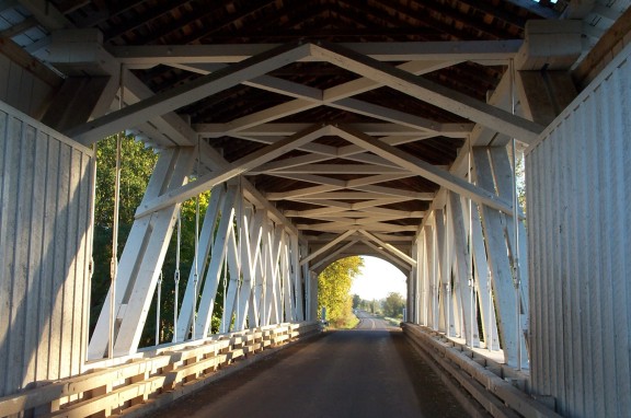
Another area attraction is the large number of covered bridges in the area. This is the interior of Gilkey Bridge in Linn County, just south of Salem. This bridge is a Howe truss type like several others that were built in the area in the late 1930s. I have a gallery planned for the future that covers just covered bridges, as there are many in the counties around Salem. |
|
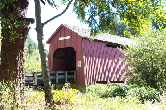
Chitwood bridge is located in Lincoln County taking off of Hwy. 20, just west of Eddyville, which is located between Corvallis and Newport. This bridge is the third generation from the first bridge on this same location to span the Yaquina River, the first of which was built in 1896. This Howe truss bridge was contracted in 1926 for $4000. |
|
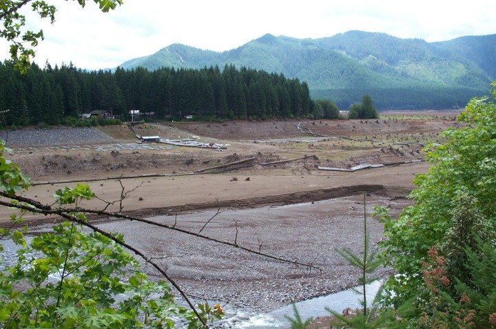
Another illustration of the effect of the 2001 drought on Detroit Lake. Note the docks high and dry far above the waters of Brightenbush River which feeds Detroit Lake. This was taken during the peak of the summer season, when the docks should be crowded with watercraft. |
|
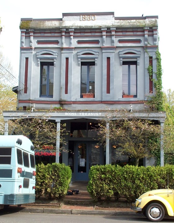
The Boone Treasury is where Salem began. One of several buildings, most of which have been moved to the Mission Mill grounds and can be seen on my page dedicated to that. This 1860 building is however still in commercial use, as a small restaurant. |
|
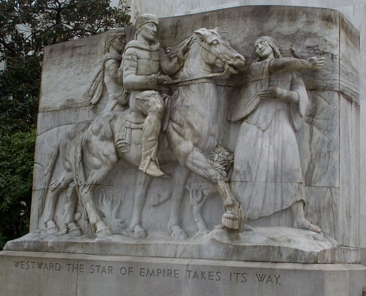
On the east side of the capitol steps is this image of the American explorers Lewis and Clark, being guided by Sacagawea. This art reminds me a lot of the images of President Jefferson Davis and Generals Robert E. Lee and Stonewall Jackson on Stone Mountain, Georgia. Stone Mountain is more refined, and much larger, but this Oregon image gives me such a big flashback. |
|
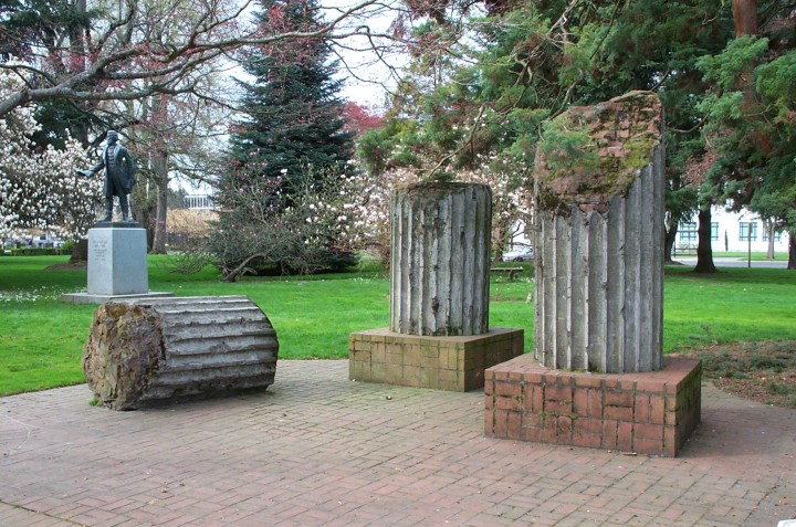
On the capitol grounds lie a few remnants of the ruins of the old capitol building which had been destroyed by fire in the 1930's. In the background is a statue of Rev. Jason Lee, who as an early missionary to the native peoples of Oregon was a key pioneer to the state. |
|
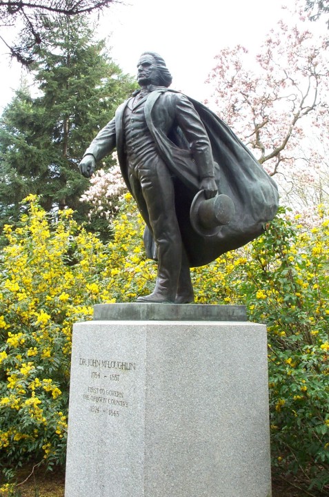
Dr. John McLoughlin, the Father of Oregon. His statue, and that of Jason Lee, here on Salem's capitol grounds, are both copies of those in the National Statuary Hall in the United States capitol in Washington, DC. McLoughlin's home is one of the major historical sites in Oregon City, Oregon's first capitol. |
Gallery 1 Oregon state capital building - Sculpture of Oregon pioneers - Asahel Bush house of 1877 - Deepwood Estate 1894 - 1952 Marion county courthouse - Teddy Roosevelt visits 1903 - Bush Pasture Park rose garden - Silver Falls State Park South Falls
Gallery 2 Bush Pasture Park Rose Garden Gazebo - High Street, Downtown Salem - kinetic sculpture "Galaxy" created by Andrew Carson - whimsical Salem artwork - sculpture on the Marion County Courthouse - Lower South Falls at Silver Falls State Park - banks of the Willamette
at Minto-Brown Park - President W. H. Taft visited Salem in 1911 Ladd & Bush Bank 1880/2001 - Salem Courthouse Square - kinetic scuulpture "Galaxy" created by Andrew Carson with video - Salem Riverfront Carousel - Yaquina Head Lighthouse 1893 Historic Mission Mill Museum - Jason Lee and John Boon houses - Thomas Kay Woolen Mill, carding machine, loom - mill race - forge room of the Mentzer machine shop Jason Lee statue - Larwood covered bridge - Salem Riverfront Carousel - Salem Pioneer Cemetery - Olallie Lake - capitol dome pioneer - old state capitol buildingThis page created April 8, 2002, updated September 5, 2002