| Full Cascades Tour | Virtual Climbs | Live Cameras | Climb the Web | Top Pics | Climb Smart |
 |
 |
 |
 |
 |
|
|
Virtual
Mt. Jefferson Climb
|
|
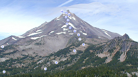
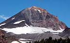
Experience a virtual Mt. Jefferson climb by navigating the south side route from the lowest point to near the summit pinnacle. Conditions shown are typical of late summer or early autumn. During this climb the winds at higher elevations blew steadily at 40 to 50 miles per hour. The distance covered on this route is about seven miles from base camp near Shale Lake with an elevation gain of 4000 feet. This climb depicts the traditional south side route up to Red Saddle. Navigate either by clicking on the thumbnail images at left, or by following the numbers on the image map above. You can browse the climb from the mid-size images at right, or if you select the Expanded View selection you will have the choice of moving through the full size images directly by choosing the Climb On icon. For
more route description information and general details, check out the |
Around
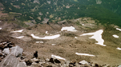
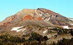
9000 feet the drop off is quite impressive as you look down at your
climbing partner. Base camp areas near the brown spot of Mud Hole Lake
can be seen in the top of the picture just right of center.
|