The Prescott Gallery - Air Photos - Other Air Photos |
|
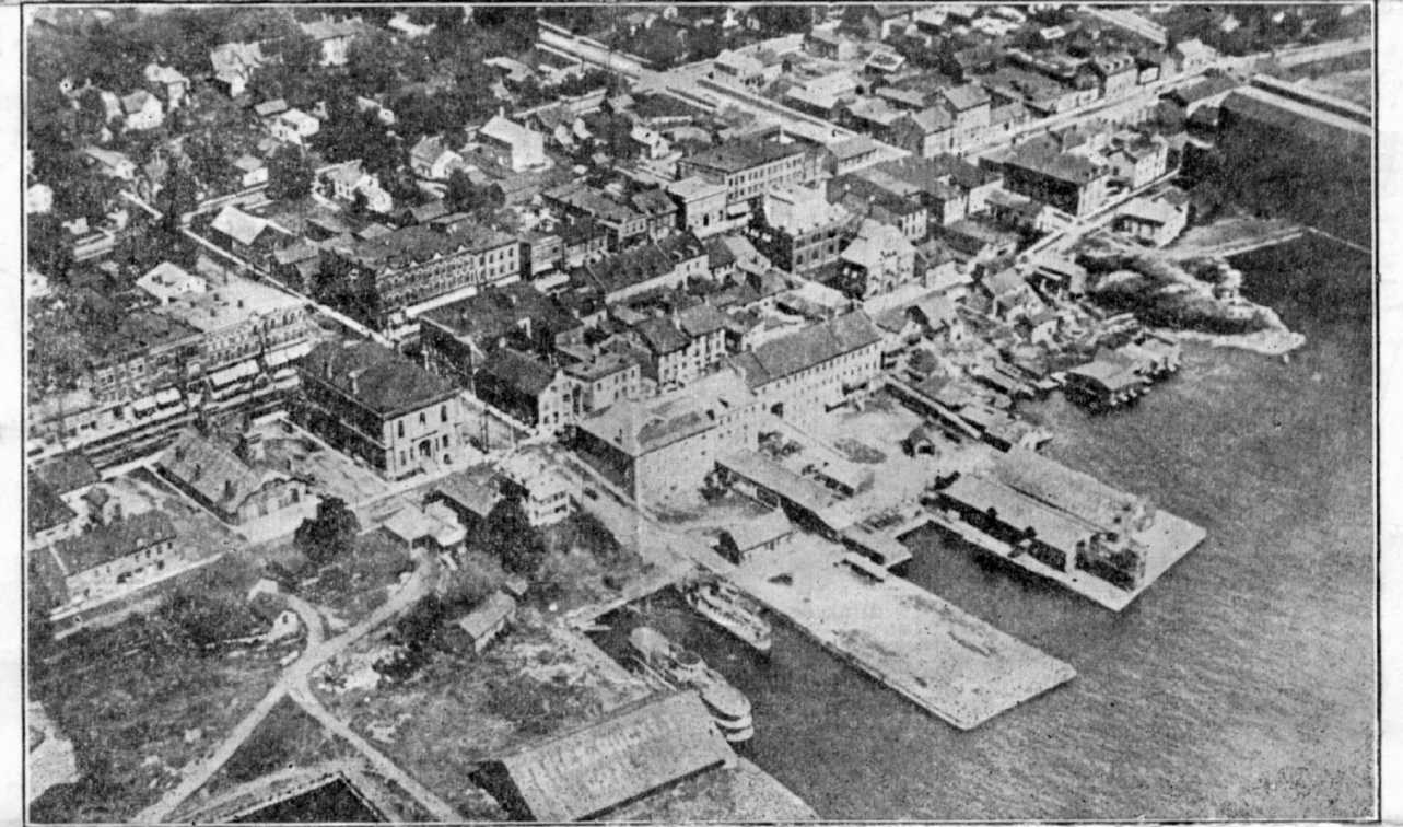 |
This one surprised me when I first saw it. There are more docks, ships
and warehouses along the waterfront than I ever remember. The picture appeared in a 1940's
brochure promoting Prescott as an ideal spot for industrial location. This
was during
the time when Lee McKnight was mayor. I suspect the photo dates from the early 1920s--there's no clock tower on the Town Hall! The large block in the upper right is the Prescott Elevator, built in 1895. There's nothing left of it in the 1929 Air Photos. |
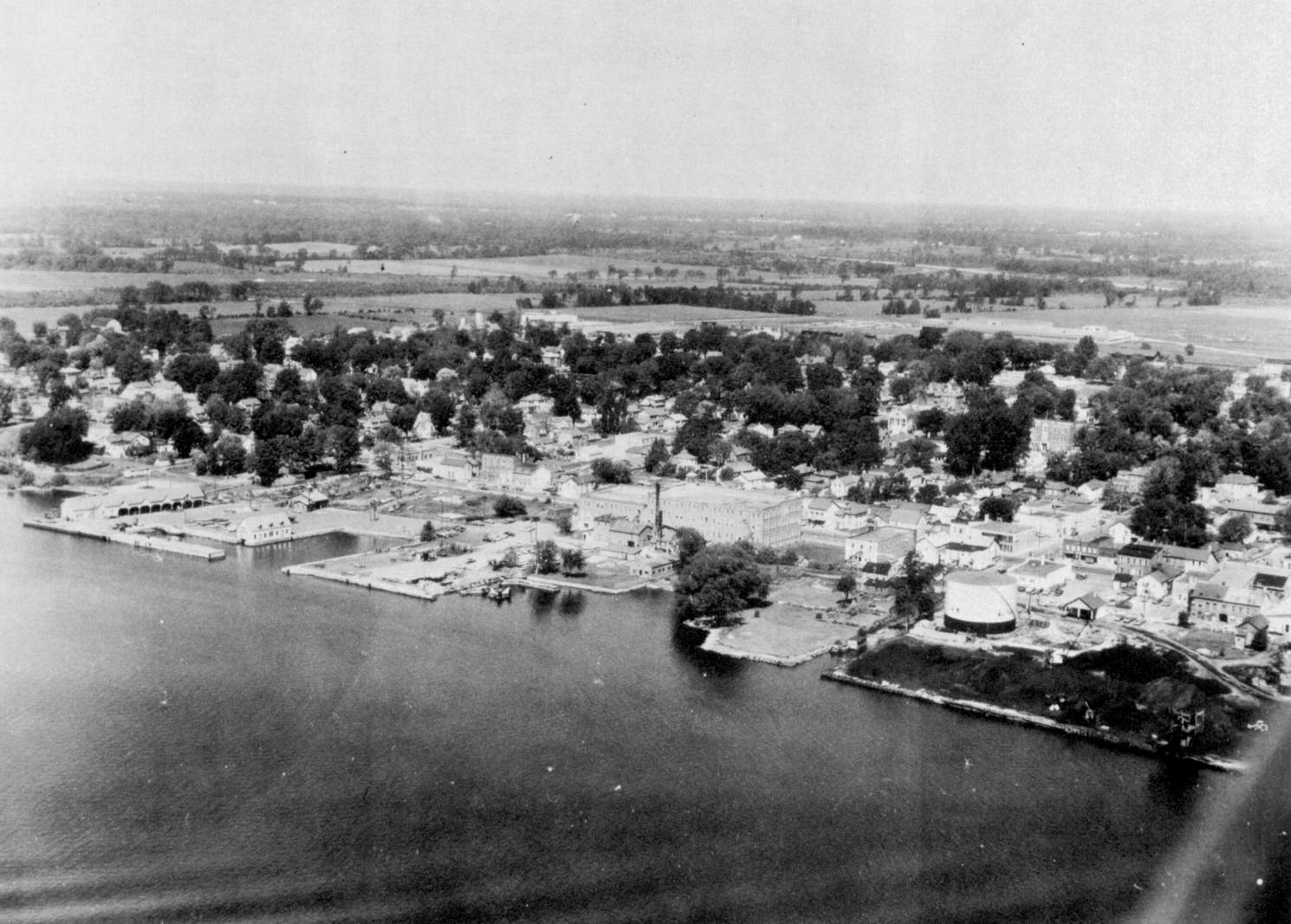 |
This photo is from the mid-1960s (probably 1964 or 1965). It shows the oil storage tank and the coal docks. In the detailed picture, you can see many of the homes and businesses. This was taken from "The Pictorial History of the Thousand Islands" by Adrian G. Ten Cate and Mary Beacock Fryer (published by Besancourt Publishers, Brockville, Ontario). |
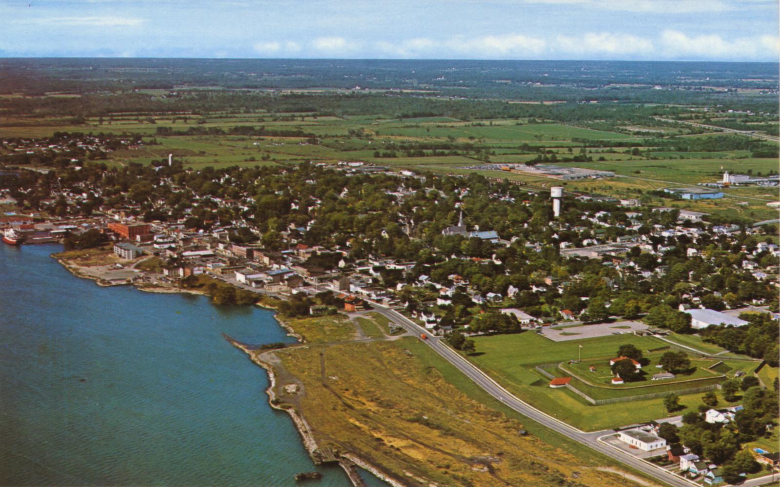 |
This is Prescott in the early 1970s. I don't know the exact year. The
water tower, Community Centre, Prescott Place, Stan Ward's silo and Rehau Plastics are
already there. It was taken from a post card published by the Peterborough Post Card Co. Ltd. in (where else?) Peterborough, Ontario. The photo was taken by H. R. Oakman.
|