The Prescott Gallery - Maps |
|
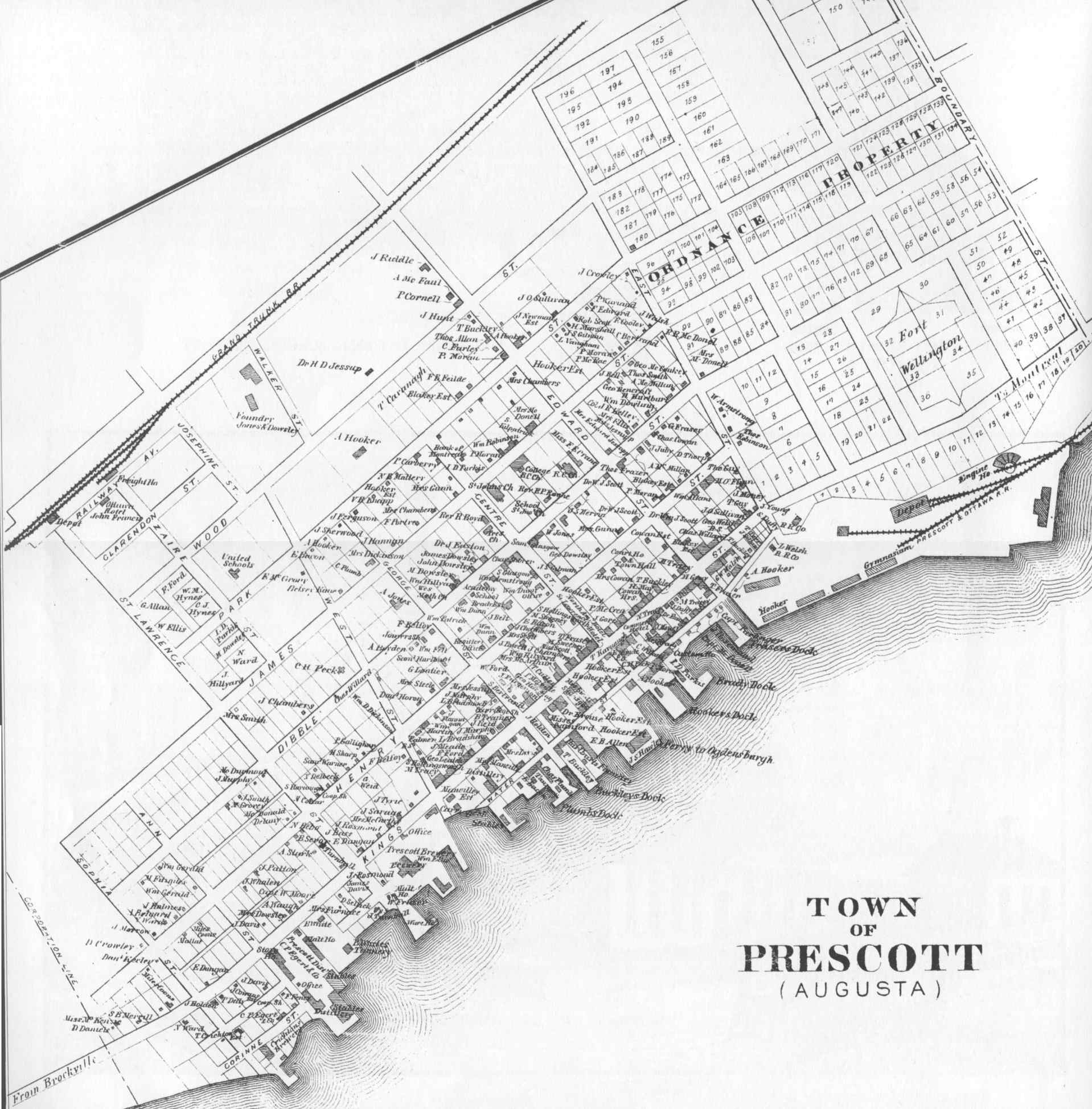 |
The ultimate map of "old" Prescott, likely from the 1850s. This
shows residences and their owners. Note the many breweries and distilleries on the
waterfront. Fort Wellington is surrounded by "ordnance property". This map was taken from the Illustrated Historical Atlas of the Counties of Leeds and Grenville Canada West, from actual surveys under the direction of H. F. Walling, Putnam & Walling Publishers, Kingston, C. W. 1861-1862. Edited and reprinted by Mika Publishing, Belleville in 1973. |
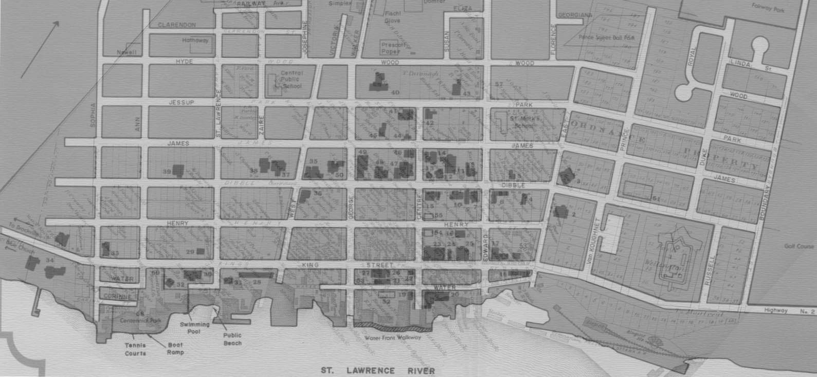 |
Shadows of history? What do you do when you have 2 maps separated by 130 years? Overlay them if you can. This is a crude comparison of the two above maps. The historical one appears as faint lines. |
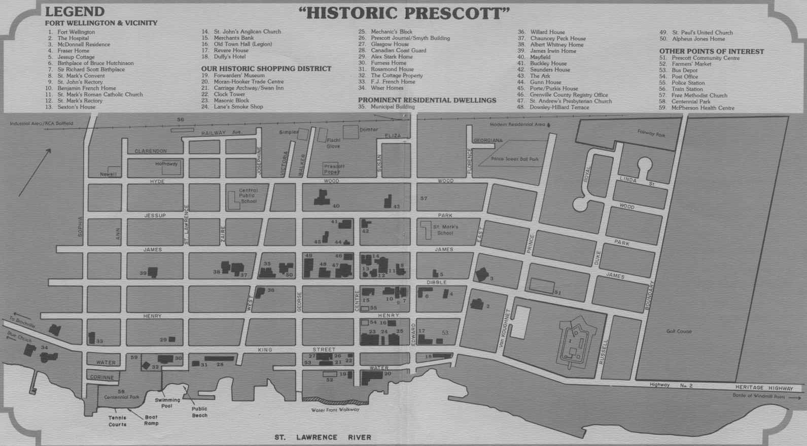 |
You can't tell the players without a map. This is from an historical brochure with no obvious copyright notice but it was put together by Suzanne J. Dodge under the Canada Community Development Program, 1982 with the assistance of the Local Architectural Preservation Advisory Committee (Where were they when the Town Hall and Post Office were torn down?). |
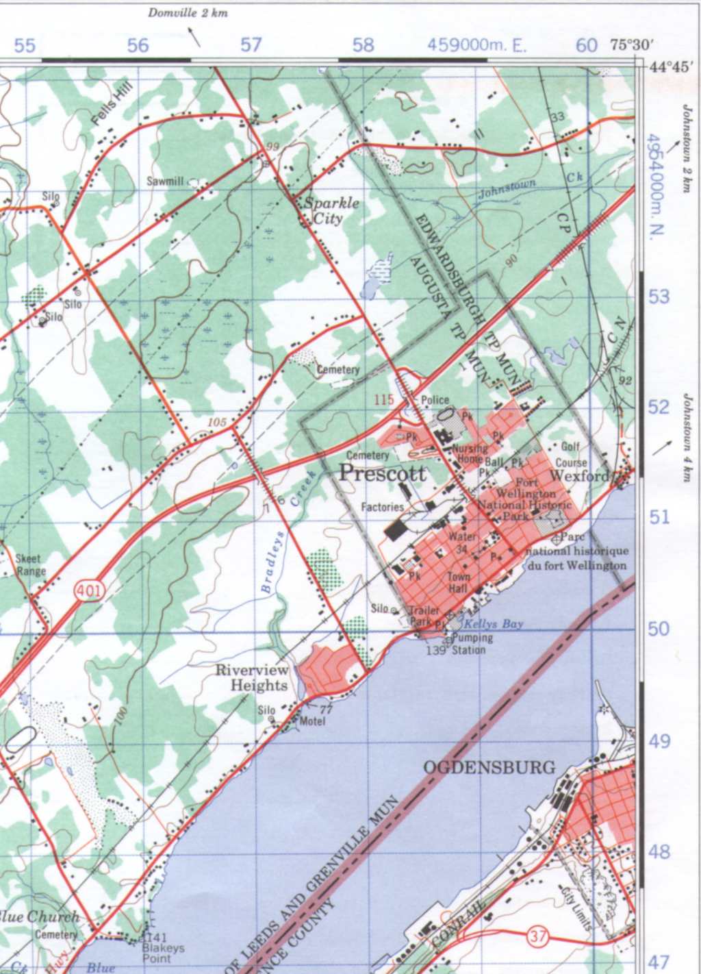 |
In case you were wondering exactly where Prescott was, this is the corner of the 1979 series of the National Topographic Survey sheet 031-B/12. Note that "Sparkle City" is mentioned (in italics as an unofficial name). Domville almost made it onto the same map. |