The Prescott Gallery - Air Photos - 1929 to 1994 high altitude photosAll these photos are from the National Air Photo Library, Natural Resources Canada. The earlier ones (1929 and 1935) were taken on 70mm film. I ordered laser prints of the existing enlargements. Enlargements would have shown much more detail (and cost a lot more). You are seeing the entire photo. The more recent air photos are taken with 25cm (that's 10 inches!) film. Contact prints from these don't show much detail but they cost a lot less than enlargements. I scanned only the part of each image. In the 1994 photo, Prescott appears as about one inch square in the 10" by 10" contact print. |
|
 |
 |
 |
 |
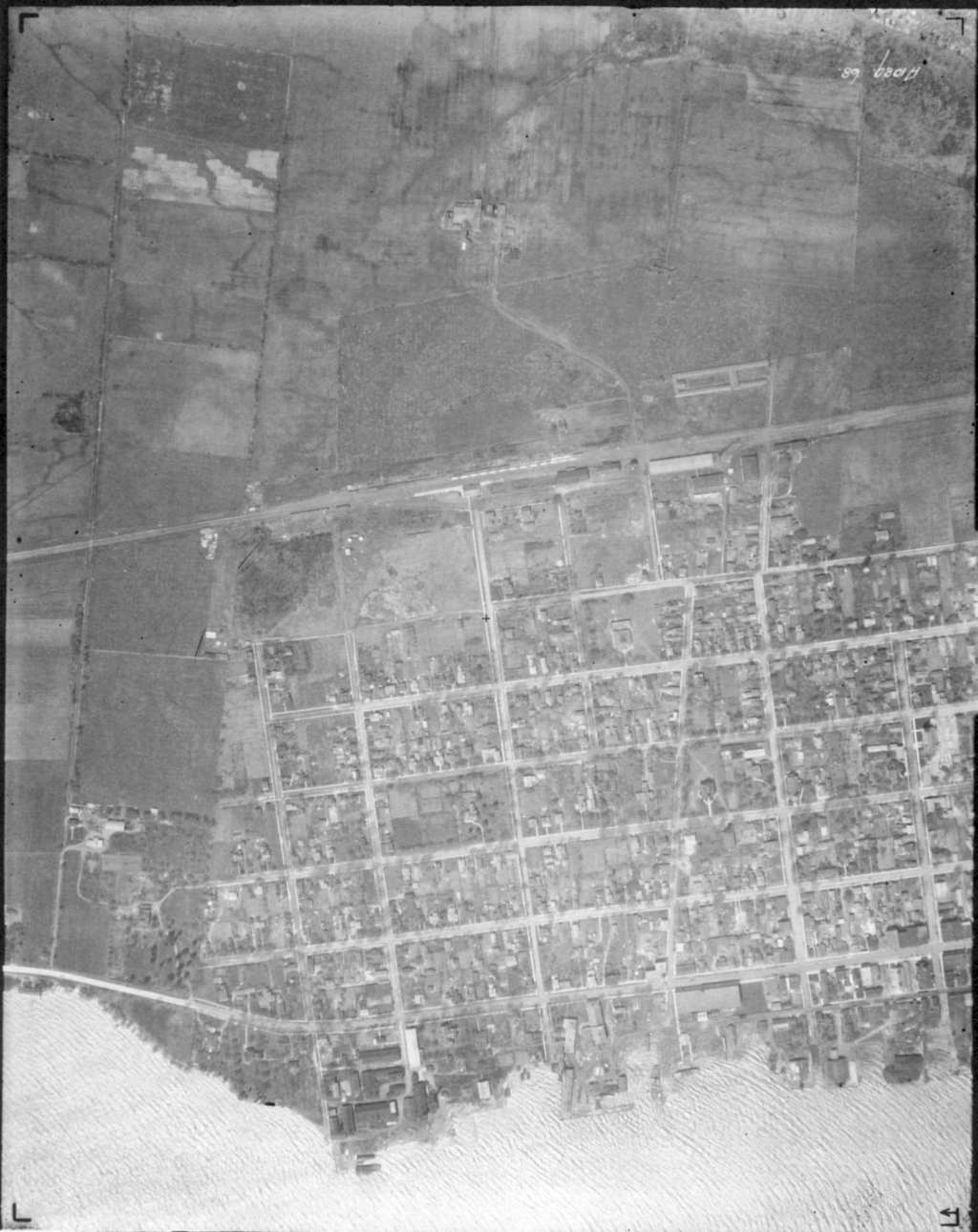
| The above four air photos were taken in 1929. The town hasn't yet developed north of the railroad tracks. Note the farms on Edward Street where the IGA now stands. | |
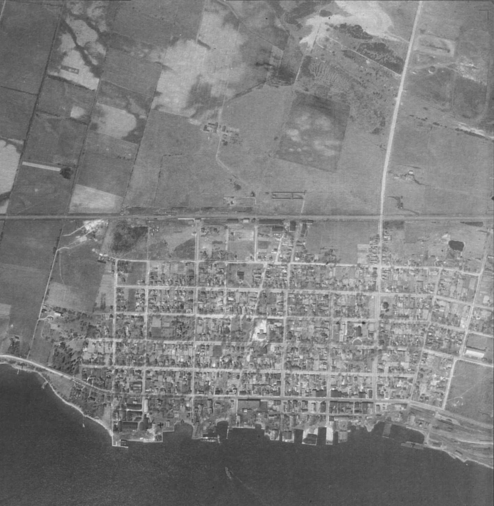 |
This is a higher-altitude image taken in about 1935. You can see the "old" Prescott High School (built in 1930, now the municipal building) on Dibble Street between West and George Streets. |
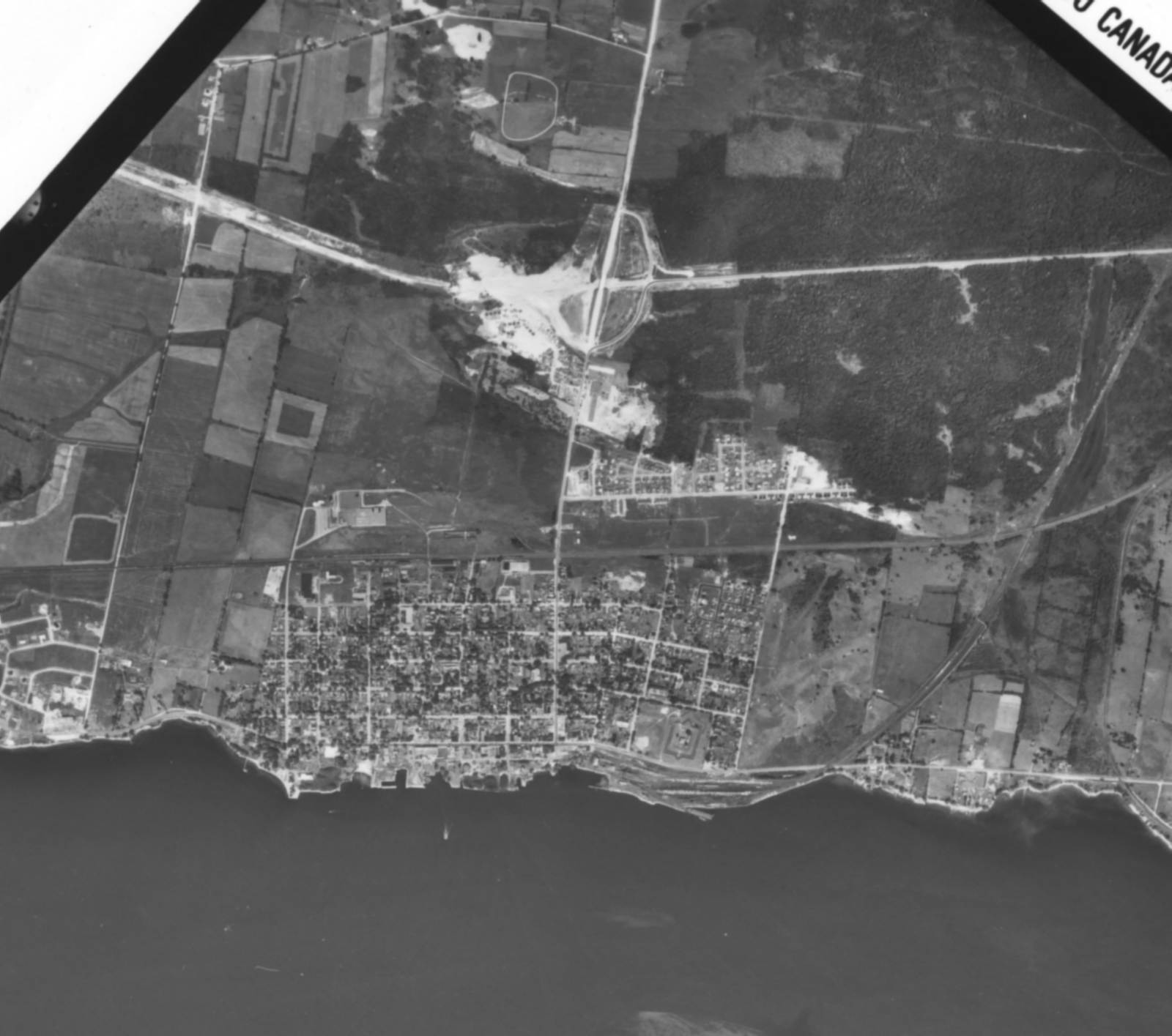 |
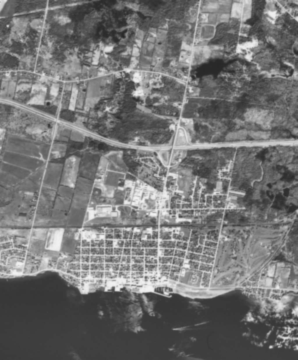
In 1958, the Highway 401 and new South Grenville District High School were under construction. There is significant development north of the railroad tracks (Fader's Subdivision and MacAuley Gardens) as well as to the west (Riverview Heights). The RCA plant has been in operation for several years. |
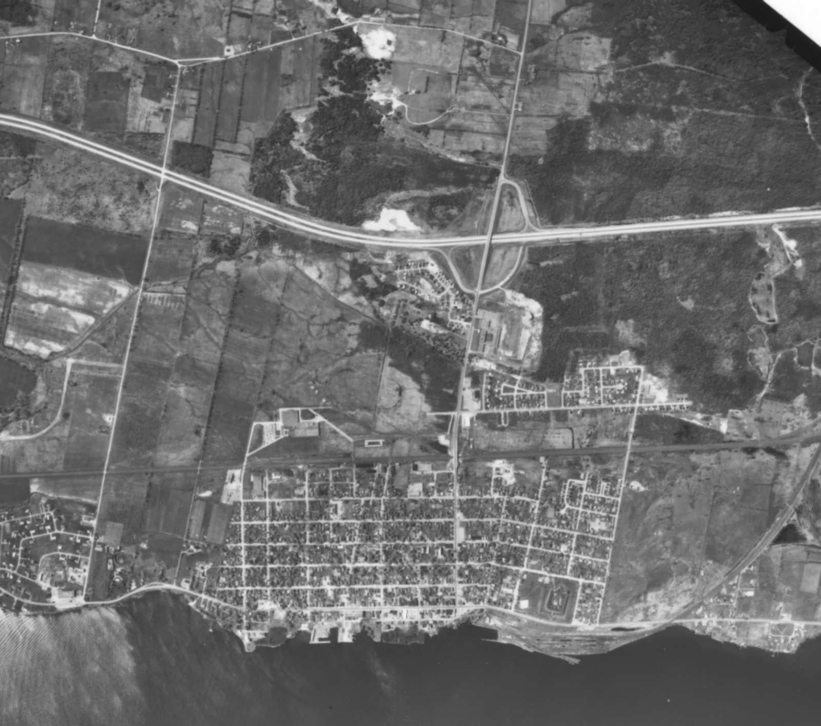 |
By 1963, the Highway 401 and high school have been completed. The more recent air photos were taken at very high altitude so the images from the contact prints are small. You could get much more detail from enlargements of the original negatives.
|
 |
By 1994, MacAuley Gardens has expanded as has the industrial area west of Edward Street. The Sandra Lawn Harbour is visible at the foot of Edward Street. |