More spring images
Another view of the cherry trees uphill from Lorane Highway at Madison. Madison, on the left, is the former Arcadia Trail, which started at Arcadia Station, the street railway station at West 28th Avenue and Madison, and followed today�s Madison all the way to Crest Drive � see the neighborhood history for more details about the trail and the railway. The section northwest of this intersection was formerly called Arcadia Park. |
|
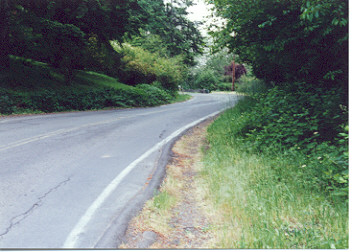
The view just past Lorane Highway at Friendly Street/Whitten Drive, looking uphill. According to the 1918 plat, this section bypassed the old portions of Storey Boulevard that continued just north of Lorane Highway and followed the road on the downhill side all the way to Whitbeck Boulevard, where it crossed Lorane Highway. The section of the road that crossed Lorane Highway later came to be called Van Buren, but initially it was still named Storey Boulevard. |
|
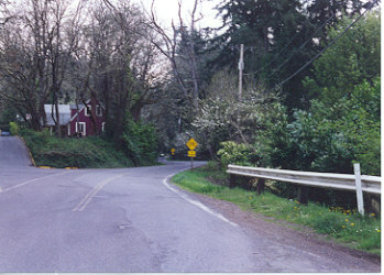
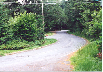
A bit further uphill, just around the curve, and looking back toward the city. Underneath the groundcover on the right bank is an old stone wall. |
|
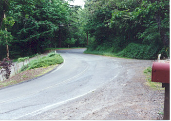
Looking downhill toward the curve one quarter of a mile below Whitbeck Boulevard. This was the location of the deep canyon where the 1919 road crew had to resort to blasting and pick-and-shovel construction because of the rugged terrain and hard shale � see the Lorane Highway history for a description of the building of the road. The gully was hand-filled by Mr. Ziniker and his two sons, who worked for most of the 1919-1920 winter to complete the work. |
|
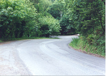
Looking downhill toward Fillmore from Kervon Court. According to the 1918 plat of the area, the property to the left was owned by �Louis Glick�, the property on the right by �William E. Frow�, although their names appear on the petition to establish Lorane Highway as �J.J. Glick� and �M.E. Furrow�. J.J. Glick was an immigrant from Germany who spoke English with difficulty. He and his son Roy, a deaf mute, lived in a small, neat white house with a small barn, an orchard, and a garden that were located right around this area. Every fall, father and son found weeks or months of work in Eugene, sawing stacks of cordwood piled on downtown parkings into 16-18� stove lengths. The Furrows were a large, industrious family who lived three miles southwest of the present junction of Lorane Highway and Blanton Road. Their main income came from wood felled on their own land, trimmed to 4� lengths, and hauled to Eugene on a very large wagon pulled by two or more horses. It would take a full day to drive the wagon, which held four or five cords of wood when fully loaded, to a Eugene residence, unload it on the parking, and return home. In 1920, the best wood or�body fir�, now called �old growth�, sold for a little less than $5.00, while inferior wood, now known as �second growth�, was about $3.75. Lorane Highway was built on a 5% grade so the large wagons used to haul lumber and valley crops could be held back by wooden handbrakes to avoid running up against the horses on the way downtown. Old Lorane Road (Crest Drive), aside from being almost impassable because of mud during the rainy season and large boulders and holes during the dry season, also had steeper grades that were much more difficult to negotiate, and the new Lorane Highway, slow and outdated as it appears to us now, was the ultimate luxury in 1918 commuter routes. |
Updated: 2003