Written by Roger Houglum, 1983
(Current street names added)
Please note:
Although almost all of the links in the text connect to relevant photographs, a few of the links connect to other pages.
In May 1918, thirty-eight citizens signed a petition to locate a new highway, the Lorane Highway, in south Eugene. Some of the petitioners have familiar names such as Whitten, Emery, Chambers and Blanton, and many lived in the area and were principally concerned with providing themselves with better transportation from their homes to Eugene.
In 1918, a comparatively small number of College Crest residents owned automobiles. There was a well-established street railway system in Eugene, and one of its largest routes was the College Crest Line that served much of southwest Eugene. The problem for neighborhood residents at that time was that of how to get to and from the street car line. A well-established system of trails, terminating at actual stations on the line, made this quite feasible in the immediate College Crest area. Many commuted daily from as far away as the present Crest Drive and upper Storey Boulevard. To give some perspective, it would be helpful to outline the College Crest loop of those days.
Starting from 11th and Willamette, the line swung west on 11th to Polk, where it turned south to 18th Avenue. Then it headed east on 18th Avenue to Jefferson then south to 24th. The line then went west to Friendly Avenue. Turning south on Friendly, it continued to 28th and Friendly, the location of the College Crest Station. The line proceeded east over what is now 28th Avenue and over the low divide between College Hill and the higher ground to the south. Arcadia Station was at the present intersection of 28th and Madison, Sunset Station was located at the intersection of 28th and Jefferson. From Sunset Station, the line veered southeastward toward its intersection with Wood Avenue, now 29th Avenue, and continued east to 29th and Willamette, the location of Orswell Station. At 29th and Willamette, the line turned north on Willamette, which it then followed to the intersection of 11th and Willamette, completing the loop.
There was half-hour service on the line between the hours of 6:00 A.M. and midnight, seven days a week; and the fare was five cents for those riders under twelve years of age, ten cents for all others. The electrically heated cars had straw-upholstered seats, and could accommodate up to thirty-five to forty passengers.
The stations mentioned were all electrically lighted, using the same direct current source that fed the overhead trolley on the cars. College Crest Station was by far the most impressive. It was at least 15 feet by 15 feet, had two or three windows with benches along three sides of the interior, and could easily seat 15 or more people. Arcadia and Sunset Stations were merely slant-roof shelters, about 10 feet by 10 feet, open to the elements on the north side.
Important roads and trails fanned out from College Crest Station (28th and Friendly) serving foot travelers and commuters over a wide area. Friendly Avenue extended up the hill as far as Inspiration Point, above the present Whitten Drive. A wooden sidewalk ran about a quarter of a mile west on 28th Avenue to the intersection with Ingalls Way. A primitive trail, bushy and muddy, took off up the steep hillside until Chambers Road was reached.
Arcadia Trail started at Arcadia Station (28th and Madison) and extended the present route covered by Madison Street to the intersection with today�s Crest Drive. It was sidewalk all the way too. Two parallel planks over the entire distance were made slip-free by transverse wooden cleats nailed every 12 to 15 inches apart on all the steep grades. There were lots of street-car riders that used Arcadia Trail in those days.
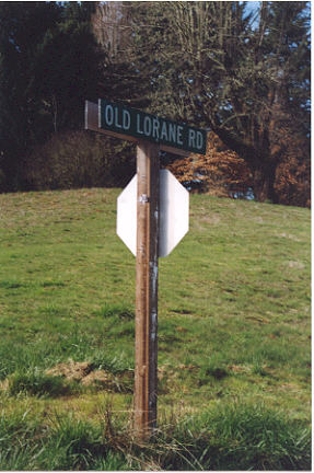
Sunset Trail started at Sunset Station (28th and Jefferson), and headed due south along what is presently the alignment of Washington Street, crossed the present Wayne Morse property, and terminated eventually on what is now known as Crest Drive. The first three blocks or so were easy to travel since a broad sidewalk was provided. This consisted of transverse lengths of rough boards of cheap lumber nailed to 2x4 sleepers laid in direct contact with the ground. (Members of the neighborhood made emergency repairs when portions of the sidewalk gave way, usually because of wood rot.) The sidewalk ended a little beyond what is now known as 29th Place. The trail then really started. It was well-cleared but very muddy in the wet season. First it crossed a three-stair stile over a barbed wire fence that marked the boundary of the Morse property, then continuing south half a mile to the south boundary of the same property. Once another stile was crossed, you were at the county road which is today called Crest Drive. But, in the period 1919 to 1925 or so, it was usually referred to as the Lorane Road or the Lorane Valley Road.
In 1918, the preponderance of wheeled traffic was horse-drawn. Large wagons moved great loads of fruit, vegetables, grain, and lumber from the fertile and productive Lorane Valley and surrounding areas. Most of this was en route to Eugene and its down-town merchants, the Eugene Fruit Growers Association, or the Southern Pacific Railway freight depot.
In downtown Eugene, the situation was completely reversed: the streets were crowded with automobiles of every type, all touring cars since sedans were practically unheard of at that time. Most of these cars were only used in town simply because the wagon roads beyond the city limits were so rough and filled with chuck holes that a blow-out of a fabric tire was always likely and a broken springor axle always a distinct possibility!
South Willamette was unpaved south of 11th Avenue in the early teens. It was eventually paved to 22nd or 24th Avenue by the early 1920s. South of that point there was a very rough and chuck holed county road that led to the intersection of what is now 29th and Willamette. At the intersection, a wooden post held two signs, one pointing west marked Wood Avenue (29th Avenue), the other south marked Lorane and Dunn School. From this point, one could go as far as Spencer Butte in the dry months, but it was completely impassable for autos in wet weather.
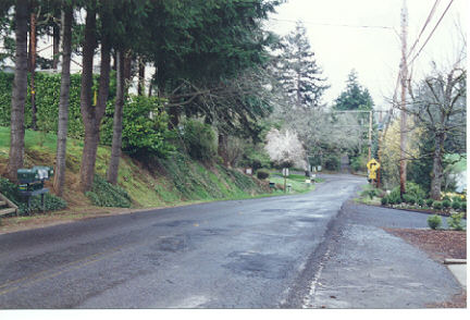
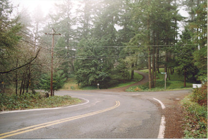
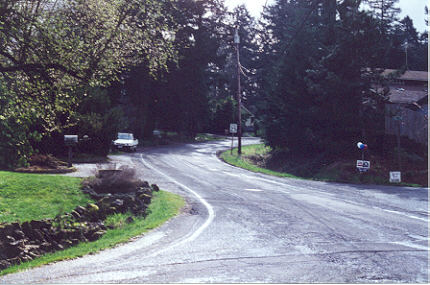
The Lorane Road, which started at the 29th and Willamette intersection, followed the present route of Crest Drive to the top of the first hill. The roadbed was studded with jagged rocks and near-buried boulders, a real hazard to the fabric tires of that early period. At the present intersection of Crest Drive and Storey Boulevard, the Lorane Road followed the course of Storey Boulevard, bearing southwest, then south until the top of the ridge was reached (and the intersection of Blanton Road). At that point, the old Lorane Road rambled west, then southwest. The roadbed was wretched (worse than today!).
In the decade or so after the year 1900, the upper Lorane Valley was intensely farmed. Access to Eugene via the old Lorane Road was difficult and time-consuming. The Spencer Creek Grange and other area residents brought pressure to bear on the Lane County Road Department to rebuild the road on a new route which would take it through the College Crest area. Work on this project got underway late in 1918.