The construction of Lorane Highway
The petitioners
THE CONSTRUCTION OF LORANE HIGHWAY
Written by Roger Houglum, 1983
(Current street names added)
Please note:
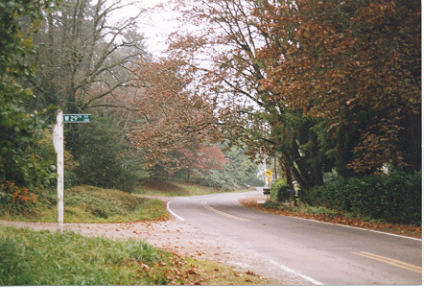
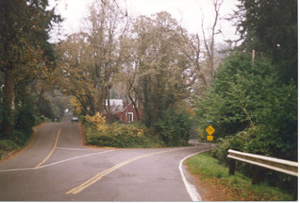
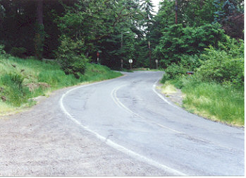
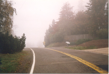
Although almost all of the links in the text connect with relevant photographs, a few of the links refer to other pages.
When we first moved to the old Millican place at the southeast corner of Jefferson and Wood Avenue in March of 1918, I was immediately conscious of a sense of isolation from both my school friends and the city of Eugene. My father, Oluf A. Houglum, had no car at the time, and the only access to town was by way of the streetcars on the College Crest line, caught at Sunset Station, a quarter of a mile away. Actually, Wood Avenue (West 29th Avenue) ended just past our front yard in a series of wagon ruts impassable by automobiles.
The house was quite primitive, even by the standards of the time for rural homes. There was no inside plumbing, and all water came from a somewhat reliable shallow well and hand pump located on the back porch. All cooking was done on a two-burner kerosene stove! After some remodeling, it was at least liveable. Three decades later, after a major remodeling, it became quite luxurious.
At the time of the move, I was also distinctly aware that some major project was getting under way just north of our front yard, and across Wood Avenue. There was a muddy trail that wandered along the contour of the hill to Arcadia Trail(Madison), then disappeared into the brush and trees between that point and Storey Boulevard (a real misnomer!). There was evidence that some large trees had been cut down, and then their stumps blasted from the ground, leaving some very large, water-filled "craters". One, just east of the intersection with Storey, must have been at least 8� across, and five or six feet in depth. (I never ventured much beyond this point at first because of the wet, slippery roadbed. Because it was mostly yellow clay, it tended to build up on the soles of one�s shoes, and this led to many a tumble.)
In March, 1919, there was no noticeable construction on the new road under way because of the wet soil of the roadbed, and the impossibility of doing any extensive earth-moving until there was a drying trend. It was early May before I saw the first organized work crew of the Lane County Road Department at work.
Although the crew of workers were under the direct supervision of the Lane County Court, and were in large part seasonal laborers, they were generally known as the County Road Department. Their activities were supervised by one of their number that had been appointed as the director because of superior previous experience. I can�t recall more than ten or twelve men in any work crew assigned to the Lorane project.
By today�s standards, the earth-moving and road-making equipment was really totally inadequate for the assignment ahead. The most impressive piece of machinery was a gasoline-powered version of the well-known "steam roller" with its steerable front roller, and its two very large, flat-treaded rollers at the rear. Also conspicuous was the large, vertical exhaust stack at the front of the machine, from which puffs of blue and black smoke rose with each stroke of the single-cylinder engine.
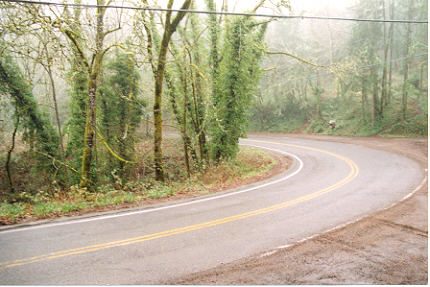
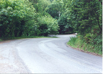
There were also at least two gasoline-powered graders with their angled blade that could be used for smoothing and leveling surfaces, or spreading gravel. They were too underpowered to cut into a freshly-exposed surface and bring it "down to grade". This explains in part why the present Lorane Highway has so many curves. The earth-moving equipment of the late teens was so inadequate that deep cuts and fills had to be avoided at all costs!
Last item of the earth-moving equipment was that of the "Fresnos", horse-drawn scrapers operated by a single man. They resembled half of a 50-gallon water tank, one edge which had been sharpened; the other equipped with a long steel handle to which a rope was attached. It could scrape up a load of previously loosened soil, and then drag it to the edge of the road. Then an upward push on the handle by the operator would dump the load; a pull on the rope would position it, ready for the next scrape-and-dump operation. Fresnos were most commonly used with a single horse, but, on occasion, two were used when the loads were heavy, or otherwise difficult to move. In addition to the Fresnos, there was a supply of such items as wheelbarrows, picks and shovels!
By early May of 1919, it was readily apparent to onlookers that a "plan of action" for the new construction had long before been decided upon: major construction would start at the end of the new section of road nearest Wood Avenue. This would provide a number of positive advantages. There was easy access for the construction equipment and the workers; gravel trucks from the Eugene Sand and Gravel Company could travel over city streets and a finished road gradient until the new highway was completed; and sprinkling trucks, necessary in the "macadam process", could be filled at the nearest Eugene fire hydrant; and the new highway, with its direct access to Wood Avenue and Eugene, could be immediately used by residents of the area.
The initial ground-breaking was near the present intersection of Lincoln Street, and at an elevation above sea level of about 450�. It should be noted that the rest of the route to its crossing of Spencer Creek had been previously cleared of trees and brush and this had been disposed of by burning or hauling. Holes caused by the blasting of stumps still remained, but could be handled later by one and two-man crews.
At that time, Lane County was using the traditional "macadam process" on all of its best market roads. Named after a Scottish road engineer of the early 1800s, it results in a hard, durable roadbed, built up of alternate layers of crushed rock and clay firmly rolled into place. A berm (a low, continuous ridge of topsoil along both edges of the road) prevents spillage of gravel during construction and lends additional strength to the roadbed. In the case of the Lorane Highway, a layer of coarse, broken rock was first spread over a smooth and rolled surface. A layer of clay was applied over this, sprinkled with water, and then rolled. This was followed by a layer of finer gravel topped with clay that was sprinkled and rolled. Finally, this was covered with an inch or so of very fine, crushed rock and rolled thoroughly. This completed the construction and it could be used immediately by motor vehicles, although it was a little dusty at first (the road was not initially treated with oil to keep down the dust until the 1930s).
The road over the low divide and to the crossing of Spencer Creek was not to be completed during the year 1919 because of difficult engineering problems that took months to overcome and by reason of a winter season that brought snow and sub-zero cold well before Christmas. The major construction difficulty lay in a deep canyon of a large, but seasonal, stream just about a quarter mile below the turnoff to Whitbeck Boulevard. First the road heads south, then turns abruptly to the right, and leaves the canyon heading northwest. Today, with our heavy earth-moving machinery, it would pose no problem. But back in the 'teens and 'twenties, the road-making equipment was greatly under-powered by modern standards. As a result, the road crew had to resort to blasting and much pick and shovel work as the road graders couldn�t be used. The Fresno scrapers were of little help because of the ruggedness of the terrain and the hardness of the shale encountered. I can�t verify it, but I was told that it took a work crew nearly an entire winter to complete this fill and cut, just slightly over 300 linear feet of highway! There were additional problems, such as slides caused by the slippage of water-soaked soil from the uphill side, and all of these had to be dealt with.
With the approach of summer in 1920, the roadbed was completed to just short of Mary Jane Rutherford�s peach and pear orchard (around the intersection with EmRay Drive) which marked the divide separating the Willamette from the Spencer Creek watersheds (it should be noted that much of the upper stretch of the highway above Friendly Avenue had only received two coats of gravel, and the finishing coat had not as yet been applied). The summit cut revealed a few inches of soil underlain by several feet of relatively hard yellow shale. Moreover, there were myriads of marine fossils embedded in the shale. I collected a dozen or so, and many Eugeneans did the same, including staff members of the Geology Department at the University of Oregon. Most of the fossils closely resembled the clams and scallops of today, but others were classified as "unique" by the Geology Department.
Once the divide was passed, it was comparatively easy for the road crew to complete the long downhill stretch of the road to the Spencer Creek bottoms where it made a left turn, crossed the creek on a wooden bridge, and just after that point, joined the old Lorane Road (Crest Drive). Before the summer was over, the entire stretch, from 29th and Willamette to the intersection just mentioned, was nearly completed and already open to traffic. Cars that had found the original road (over the present route of Crest Drive) nearly impassable because of its poor surfacing and steep grades that required the use of low gear and maximum power, could effortlessly cover the new route entirely in high gear over a nearly-flawless road.
I recently checked (twice) the elevations at the present Lorane summit and the former one, using an altimeter, and obtained the following data. Present Lorane divide: 820�; former divide at intersection of Crest Drive and Blanton Road: 900�; and the intersection of the old and new Lorane roads (just south of the Spencer Creek bridge): 720�. The same instrument showed the elevation at the crest of Chambers to be 840�. Admittedly, a topographic map would be slightly more accurate, yet the readings obtained are probably close.
In the year 1920, the traffic on the new highway was largely horse-drawn; two-horse teams drawing wagons filled with agricultural products, or four-horse teams pulling large loads of firewood destined for delivery at the parking strip of some Eugene home. Five years later, most of these same farmers were driving gasoline-powered trucks, and making their deliveries in an hour or so. Previously a whole day had been required for a single round trip!
Two decades later, a serious problem arose when a sudden demand on the lumber market for 60� lengths of piling, used in dock construction, stimulated loggers to negotiate with Spencer Creek land-owners for suitable timber for this purpose. Trees were topped, cut down, trimmed of branches and bark, and the 60� lengths loaded onto both a heavy truck (fore portion) and a steerable trailer (rear section). A man rode the trailer and piloted it with a conventional steering wheel.
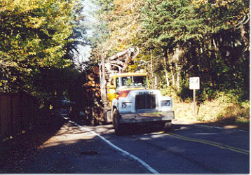
Meeting one of these monsters, some 80� in over-all length, could be a traumatic experience since the pilings frequently forced motorists into the ditch, and their mid-section tended to dig into the banks along the road, causing extensive damage. Alarmed, the County Court barred the hauling of piling beyond the intersection of Lorane Highway and Chambers, and directed all piling haulers to use the Chambers Street route into town thereafter. As most of the piling was destined for the Lichty piling processing plant on West 11th Avenue, it was comparatively easy to obtain compliance. At the close of World War II, the great number of logging trucks with very heavy loads posed a similar problem for the Lorane Highway and trucks were re-routed over to Chambers. (Judging from the photograph taken recently on Lorane Highway at Paige Avenue, the problem persists, despite "No Through Trucks" signs.)
Perhaps we have given the impression that the comparatively short section of the Lorane Highway we have described represented the only new construction on the Eugene to Lorane route. It was not. In the early 1920s, a large rock crusher was installed near Spencer Creek, and on the Simpson place (the water-filled pit is still there). Extensive work was done in the straightening of the so-called Spencer Creek Canyon and some resurfacing was done as well. The road was improved as far as the Spencer Creek Grange, about two miles further south.
By 1922, my father had purchased his first car, a Maxwell touring model, complete with folding top and attachable rain curtains that were fastened in place when bad weather threatened. One fine Sunday we made a courageous decision: the whole family would drive to the settlement of Lorane and back in one afternoon! (The distance from Eugene to that hamlet was shown to be 23 miles, a great adventure.) The going was fine from Eugene to the Spencer Creek Grange. Beyond that point, the road became rough and chuck-holed, yet readily passable. The most difficult point was reached just south of what is today known as the McNutt Ranch. There it was necessary to cross an abrupt grade between two creeks (with very steep grades) and low gear was necessary all of the way. Once over this watershed, it was smooth sailing to Gillespie Corners where motorists had the option of turning right (to Crow), or continuing straight ahead to Lorane. Lorane proved to be in an intensively cultivated area with forested hills well in the background. There was a schoolhouse, a church, a blacksmith shop, and the marvelous Addison general store. There one could buy groceries, yard goods, seed grain, harnesses, kerosene for your lanterns, and a great variety of hardware.
From Lorane, the adventurous could head south over a plank road that crossed a steep ridge; then dipped down to join the old Pacific Highway (now Freeway 5) at Anlauf. Another option was to follow an unimproved dirt road 12 miles southwest to Siuslaw Falls where the fishing was reportedly very good. We chose to return to Eugene, a trip that required nearly two hours to cover some 23 miles!
It should be noted in conclusion that the entire Lorane valley, actually defined by the drainage basin of Spencer Creek, was in 1922 at a high level of agricultural use. There were many small farms along the road, almost always with some sizeable acreage given over to corn and wheat. Nearly every farm had its own flock of poultry or its herd of dairy or beef cattle while flocks of sheep roamed the hills. There was an abundance of cleared land, free of brush and weeds. Nowadays, brush and trees have reclaimed much of the agricultural land and "rancheros", owned and operated by Eugeneans who work in the city, have taken over much of the formerly farmed acreage.
The view from 29th and Jefferson has changed markedly since 1919 as well. At that time, not a single house existed on College Hill, or west of that point to Chambers Street; the air was clear, too, and whenever the clouds lifted, one had a memorable view of the Coast Range, from Prairie Mountain west of Eugene to Mary�s Peak just west of Corvallis.
THE PETITIONERS
The thirty-eight people who signed the 1918 petition to establish Lorane Highway had a variety of reasons to do so. Some petitioners simply wished a new and better highway, because existing roads were rough and sometimes impassable. Others wished their land holdings to appreciate in value as they became more accessible. And still others wanted to benefit their own businesses by improved access to the productive Lorane Valley � at that time, there were many prosperous farmers in the Lorane and Spencer Creek drainage.
Below are the names of the petitioners and the information we have collected so far, a lot of it from notes by Roger Houglum. We will continue to add information as it becomes available. If you have additional information about the people below, we would love to hear from you via email or the guestbook.
OTTO ARTZ.
A.M. AUSTIN.
NANCY J. BALL.
A.A. BANCROFT. There is also mention of a Mrs. A.A. Bancroft, but it is not clear if they are the same person or spouses. A.A. Bancroft was a co-signer on the 1913 game preserve agreement that declared lots 1-2-3-4-5-6-7-8-10-12-17-18-20 of the College Crest Addition, a total of 43.29 acres, a wild bird and game refuge to preserve and protect all wild birds and game protected by the State of Oregon. It is believed Bancroft lived on Crest Drive about halfway down the hill, in the area where the old College Crest school was located. The Bancroft�s Subdivision, which covers the uphill side of Lorane Highway between Van Buren almost to Paige Avenue, likely was named after this family.
F.J. BERGER was a Eugene realtor with offices on 32 East 8th Avenue. A former mayor of Eugene (1910-1913) by the same name may be the same person. A property west of Spencer Creek belonged to Mary E. Berger, possibly related.
C.B. BLANTON and GREENE F. BLANTON were brothers who lived near the present intersection of Blanton Road and the access road to KVAL-TV. There was a free-flowing spring of cold, clear water at that location that was piped throughout the house. KVAL now pumps the spring water to its building at the 1300� elevation. Since the early 1900s, the Blanton Brothers cultivated hundreds of acres of ground atop what is now known as Blanton Heights. They also had extensive herds of cattle and sheep.
C.A. BROTHERS and J.H. BROTHERS may have been spouses or blood relatives. They lived at the south end of the Sunset Addition, just north of the Morse Farm. Theirs was the outstanding house in the neighborhood in the early 1920s, and still stands.
ARTHUR B. or A.H. BROWN lived on Blanton Road, a half mile beyond its intersection with Storey Boulevard and Crest Drive, where he grew fruit and raised poultry. He also owned land to the south of the William Young house (814 Lorane Highway). A bachelor, he reportedly had �money� and was considered a �good catch�. He was a co-signer of a 1913 game preserve agreement that declared lots 11-13-14-23-24-25-26-37-38-39-41-42-43 of the College Crest Addition and lots 9-10 of the Greenacres Addition, a total of 46.59 acres, a wild bird and game refuge to preserve and protect all wild birds and game protected by the State of Oregon.
L.L. BRUBAKER is believed to have lived about halfway down the hill on Crest Drive, in the area where the old College Crest school was located.
HENRY CARSON.
O.C. or C.C. CASWELL and his family lived at 1150 West 11th Avenue. He owned and operated Caswell�s Variety Store at 60 West Broadway. He was also active in the Y.M.C.A.
FRED E. CHAMBERS was part of a numerous clan. He farmed land just north of the Irish ranch (see below), west of Chambers. A road ran west through his property to The Braes, the highest viewpoint in the area, which was a favorite with hikers and picnickers. He also owned property downhill from Lorane Highway, starting at Whitbeck Boulevard and running almost to the cul-de-sac across from Paige Avenue, but it is not clear if all of this was one property. He was a co-signer of a 1913 game preserve agreement that declared lots 1-2-3-4-5-6-7-8-10-12-17-18-20 of the College Crest Addition, a total of 43.29 acres, a wild bird and game refuge to preserve and protect all wild birds and game protected by the State of Oregon. Chambers Street may or may not have been named after him.
J. COBURN.
JOHN A. CRESSEY was a co-signer of a 1913 game preserve agreement that declared lots 11-13-14-23-24-25-26-37-38-39-41-42-43 of the College Crest Addition and lots 9-10 of the Greenacres Addition, a total of 46.59 acres, a wild bird and game refuge to preserve and protect all wild birds and game protected by the State of Oregon. The family moved to Crest Drive in 1912 and lived in a large home which still stands on the west side of Crest Drive, just after Crest Drive turns south at the intersection with Storey Boulevard. It was in the Cressey living room that the first large community meetings were held, antedating the College Crest Community Club. Cressey operated Cressey�s Book Store at 864 Willamette Street.
W.H. DEETZ or DEETS was a religious, very devout bachelor who lived in a one-room shack just east of Arcadia Trail (Madison Street). He did odd jobs such as gardening and splitting wood.
FRED L. DORMAN was a co-signer of a 1913 game preserve agreement that declared lots 1-2-3-4-5-6-7-8-10-12-17-18-20 of the College Crest Addition, a total of 43.29 acres, a wild bird and game refuge to preserve and protect all wild birds and game protected by the State of Oregon.
N.A. EMERY and his family lived at the top of the hill where Crest Drive joins Blanton Road and turns down toward Chambers Street. The Emerys had three daughters. At least two of them married College Crest residents. One of them married Robert Neave; they lived on Sunset Drive, now Washington Street. Emery had a good team and fine farming equipment, such as plows, harrows, and discs, and he was busy much of the time plowing fields or discing orchards for other residents.
F. EWER.
JOHN T. FRIEL SR was a co-signer of a 1913 game preserve agreement that declared lots 11-13-14-23-24-25-26-37-38-39-41-42-43 of the College Crest Addition and lots 9-10 of the Greenacres Addition, a total of 46.59 acres, a wild bird and game refuge to preserve and protect all wild birds and game protected by the State of Oregon.
WILLIAM E. FURROW lived with his large, industrious family three miles southwest of the present junction of Blanton Road and Lorane Highway. His main income was from the sale of cordwood that he felled on his own land, trimmed to 4� lengths, and hauled to Eugene on a very large wagon pulled by two or more horses. It would take one full day to drive the loaded wagon to a residence in Eugene, unload it on the parking, then drive home again. The wagon held four to five cords, fully loaded. In 1920, �body fir� or �old growth� (the best) cost a little less than $5.00 per cord, while �second growth� (inferior) was about $3.75.
J.J. GLICK was an immigrant from Germany who lived with his son Roy, a deaf mute, in a small, neat white house with an orchard, a garden, and a small barn on a property north of the Rutherford lands to the east of Chambers. He spoke English with difficulty. Every fall, father and son found weeks or months of work in Eugene, sawing piles of cordwood piled on downtown parkings into 16-18� stove lengths.
C.H. HALES lived to the south of the William Young house (918 Lorane Highway) where he grew pears and Concord grapes. These crops may have been part of the experimental orchards that existed here then.
A.W. HASKELL is presumed to be a member of the pioneer family that owned and operated Haskell�s Feed and Seed store on the west side of Olive Street, just south of Broadway. Other members of the family were engaged in farming.
ISAAC HIGGINS lived with his wife in a two-story white house on the west side of Sunset Drive (Washington Street). Both were eldery and in poor health.
JEFFERSON HENRY IRISH (1859-1941) was born in Pontiac, Michigan. He lived with his wife Edith, son Merwin R. �Pat� Irish, the founder of Irish Cash Stores chain, daughter Gertrude, and mother-in-law Sue Jacobson just west of the summit of Chambers Road, where he farmed 20 acres of pasture and woodland.
He briefly taught country school and later earned law degree from the University of Michigan at Ann Arbor. He had his own law office and was the district attorney of Becker County, Detroit Lakes. He purchased an entire business block in Detroit Lakes with savings from his law practice and managed the block for a number of years. He was very active in church affairs and in wide demand as a public speaker. In 1911, at fifty, he suddenly changed his lifestyle and gave up his legal and business career in Detroit Lakes to become a farmer in Eugene.
The Eugene property sloped up and west to The Braes, whose natural amphitheater was the occasional site of summer drama by a group from the university, then south across Lorane Highway to Crest Drive; the east boundary was Chambers Road. Only the southeast quadrant of this rectangular tract was cleared, the balance was covered by a thick growth of scrub oak with an occasional fir. Between the small temporary ranch house and Chambers Road were at least three magnificent white oaks, perhaps two hundred years old, and well over fifty feet in height.
Irish�s first priority was the construction of temporary living quarters and a series of large chicken houses that stair-stepped down the hill to the south, and two brooder houses to the west that housed the incubators and provided a warm environment for the new chicks. He raised only purebred White Leghorn chickens. He was one of the first in Lane County to specialize in the comparatively new strain and by 1920, his flock of laying hens numbered at least fifteen hundred. He developed a lucrative market throughout the Pacific Northwest for �hatching eggs� that were shipped from the Southern Pacific depot in crates. Sales peaked during March and April.
The next project was the planting and care of fifty loganberry vines and fruit trees in the sunny southeast quadrant. For the first several years, they required one pail of water each during the dry season. Irish would pump two pails at a time and carry them at least two hundred yards downhill to the orchard. When the new highway was built, it just clipped the lower part of his prune orchard north of Lorane Highway, and he only lost a few trees.
The two-story, four-bedroom ranch house construction started very slowly, principally because of problems hauling lumber from town by team and finding skilled carpenters who would work on such a remote site. The commute from Eugene was impractical without a car and few carpenters owned cars. Access to Eugene was only by horse and buggy during the winter months, and the only practical route was south on Chambers to its junction with the old Lorane Road at the bottom of the hill, then east over the ridge near the present Crest Drive Elementary School, then northeast to a junction with South Willamette near Dunn School. During the dry season a car could be driven over the same route, but until the Lorane Road was improved by blading and Chambers was graveled, it was considered both dangerous and inadvisable.
When the house was completed Edith and Sue moved in, but the children remained in town to attend public school and university. The lights of Eugene, limited in number, were visible through the front windows in the northeast. The house was still standing in 1976, but today nothing occupies the site and the entire ranch area is part of an extensive real estate development.
Irish gave his daughter Gertrude and son-in-law Harrison permission to build a house on the lower holding and unlimited use of it for any purpose, but he retained legal title.
Irish was much in demand as a teacher, sunday school superintendent, and substitute pastor for the white-steepled First Baptist Church on the northeast corner of 8th Avenue and Pearl.
R.H. JAY lived in a small, cozy house just west from Edwin Tuttle (northwest corner of Lorane Highway and Madison). He was a self-employed finish carpenter, in his late fifties at least.
W.W. McCORNACK.
H.H. McFARLAND had a large number of children and lived south across the road from the Rutherford property.
J.H. SAUNDERS.
L.S. SCOTT.
J.W. SHUMATE.
GEORGE C. or H. or M.L. STANLEY lived just past the Lorane Highway intersection with Friendly Avenue, on the uphill side of the road, which he later sold to P. Augustus Peterson, a local realtor. He was a partner in and manager of Ralph & Stanley, the operating company of a chain of local grocery stores.
THOMAS SZUKAI. A section of Storey Boulevard was formerly called Thomas Szukai Road.
CHARLES C. WHITTEN was a master carpenter, contractor, and land-sales promoter who lived on his property on Whitten Drive, located on the west side of the upper reaches of Friendly Avenue, uphill from the William Young house (918 Lorane Highway), and including the Inspiration Point Terraces. Lorane Highway was originally called C.C. Whitten Road. Together with his wife Eliza, he was a co-signer of a 1913 game preserve agreement that declared Inspiration Point Terraces to the College Crest Addition, a total of 17 acres, a wild bird and game refuge to protect and preserve all wild birds and game protected by the State of Oregon. He also was a witness to a game preserve agreement that declared lots 11-13-14-23-24-25-26-37-38-39-41-42-43 of the College Crest Addition and lots 9-10 of the Greenacres Addition, a total of 46.59 acres, a wild bird and game refuge to preserve and protect all wild birds and game protected by the State of Oregon.
DONALD YOUNG was the son of William E. Young and the brother of Alice Young Simola and Paul Young. He and his wife Mildred lived for many years on Lorane Highway at the intersection with Madison (then Arcadia Trail). They also owned property south of Lorane Highway, from Hionda to Chambers, but they never developed the property. Donald Young was a member of the law firm Young & Husband with offices at 860 Willamette. He was a witness to a 1913 game preserve agreement that declared all of lots 1-2-3-4-5-6-7-8-10-12-17-18-20 of the College Crest Addition, a total of 43.29 acres, a wild bird and game refuge to preserve and protect all wild birds and game protected by the State of Oregon. He was also witness to a 1913 game preserve agreement that declared lots 11-13-14-23-24-25-26-37-38-39-41-42-43 of the College Crest Addition and lots 9-10 of the Greenacres Addition, a total of 46.59 acres, a wild bird and game refuge to preserve and protect all wild birds and game protected by the State of Oregon. And in addition, he was a witness to a third 1913 game preserve agreement that declared Inspiration Point Terraces to the College Crest Addition, a total of 17 acres, a wild bird and game refuge to protect and preserve all wild birds and game protected by the State of Oregon. Mildred Young was a voice teacher and sung in the local church choir.
WILLIAM E. YOUNG was the original owner and builder of 814 Lorane Highway, built in 1910. The house plans may have been purchased from a catalog (?Sears, Craftsman). He was a Minnesota lawyer who moved here with his family (he was the father of Alice Young Simola and her older brothers Donald and Paul Young) because of ill health in 1908. They first lived in an apartment on Washington Street. He became ill again during the first few years he was in Eugene and was unable to finish the building of his new home, and the family moved across Lorane Highway to the house in the curve of Friendly Street.