|
|


|

|
Mackenzie CountyCIAM RadioFort Vermilion School DivisionCanadian Heritage Information NetworkSpirit of the Peace MuseumsMighty Peace Tourist AssociationTravel Alberta |


|
|
|
|
|
|
Alexander Mackenzie and crew paddled up the Peace River in 1792. Mackenzie described in his diary, the natural landscapes through which they passed. So began the record of today’s Mackenzie County. Located in the far northwest corner of Alberta, this County includes a land base of 19,179,276 acres (7,761,747 hectares).
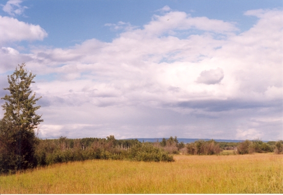
This is the Boreal Forest Region of Canada’s north. Aspen poplar and white spruce forests predominate with local stands of white (paper) birch and balsam fir. Jack pine prevails on sand and gravel soils, whereas black spruce and tamarack are dominant in the muskeg areas.
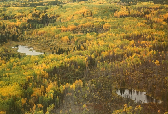
Extensive aspen parklands once covered much of the area. The grasslands were given the names, John D'or Prairie, Prairie Point, Buffalo Head Prairie, Wilson Prairie, and Savage Prairie. Willows and alders, saskatoons, chokecherries, roses, and other fruiting shrubs can form dense undergrowth beneath which many herbaceous, moss and lichen species thrive.
The Boreal Forest of this County is one of the largest to be found in Canada. Representative and unique landscapes within the region have been designated for research, education, recreation, and/or wildlife habitat preservation. These “Ecospaces” include the Ducks Unlimited Gull Lake Wetland, the Wadlin Lake Pelican Colony, candidate and designated Natural Areas of Watt Mountain, the Ponton River, Child Lake Meadows, Caribou River, and Harper Creek. The Hay Zama and Caribou Mountain Wildlands are more extensive protected places.
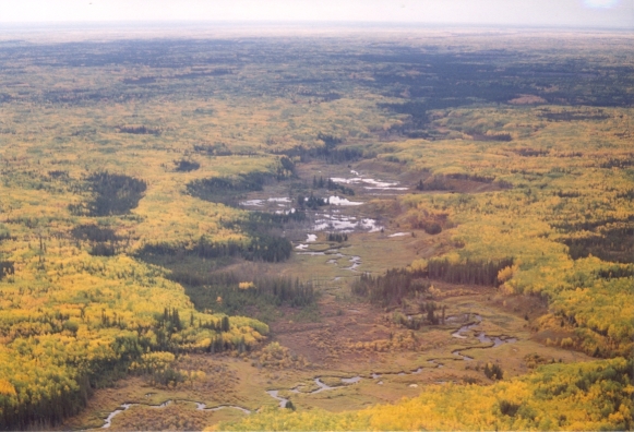
Still needing formal designation are the fragile and threatened “Hungry Bend Sandhills”. This island of wilderness is central to seven settlements (Fort Vermilion, Boyer River, Rocky Lane, Eleske High Level, Paddle Prairie, La Crete). The Sandhills are distinctive nationally, from ecological, geological, historical and archaeological perspectives and for interesting paleontology.
It is the wisdom and actions of decision makers that will dictate the future of such remaining “landscapes of the heart”. Much of the Mackenzie County has been “earmarked” for farming, logging and other industrial purposes. Intensive recreational pursuits follow as new lands are being opened.
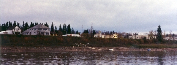
Fort Vermilion is Mackenzie Country’s oldest and most scenic settlement. For travellers on the Peace River, the Fort is the eastern gateway to Wood Buffalo National Park.
For years, people have come to Fort Vermilion and connected with nature. A quick click on the following “ecospaces” will start your journey too!! For those interested in birds, Click on Birds under 'Attractions'.
The Peace River/Vermilion Rapids and Chutes
Child Lake Meadows Natural Area
Hay - Zama Lakes Wildland Park
(A RAMSAR Site)
Caribou Mountains Wildland Park
(A UNESCO World Heritage Site)
Photos by Marilee Cranna Toews, Fort Vermilion
Acknowledgements: Summer Career Placement Program staff, Keith Klassen (2004/2005) & Jordan Lambert (2006) and