|
|


|

|
Mackenzie CountyCIAM RadioFort Vermilion School DivisionCanadian Heritage Information NetworkSpirit of the Peace MuseumsMighty Peace Tourist AssociationTravel Alberta |


|
|
|
|
|
|
Sister fur-trade posts, Fort Chipewyan (1788) and Fort Vermilion
(Boyers Post - 1788) are the earliest settlements in the Province of
Alberta (1905). Thriving settlement of the Peace River country as far
north as Fort Vermilion was a strong factor in deciding to strike the
new province's northern boundary along the 60th parallel. Were it not,
this resource rich area would not have been part of Alberta.
Aurora Borealis
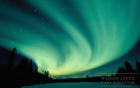
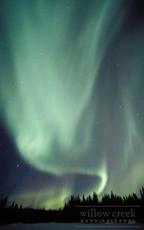
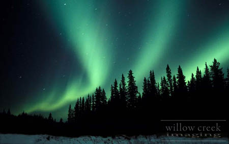
Willow creek imaging specializes in aurora photography.
Contact [email protected] for order details
Web site www.willowcreekphoto.com
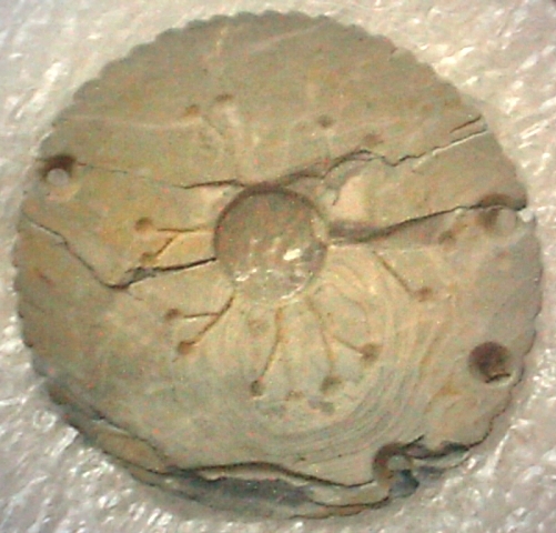
Unique Shell Pendant
Uncovered by archeological digs, artifacts such as the shell pendant seen here suggest that the Fort Vermilion area has been inhabited for over 3000 years!
Photo by Jordan Ronald Lambert, Fort Vermilion
The Peace - It's Rapids and Chutes
The Peace River, from its headwaters in the Rocky Mountains flows 700 miles (1167 kilometres) northeast joining the Slave and Mackenzie River systems on route to the Arctic Ocean. Only the Vermilion Rapids and Chutes interrupt navigation on the Peace.
'The Rapids' are 78 kilometres (49 miles) downstream form Fort Vermilion. They're not visible from afar, but canoeists should hear their distant roar. They are about a mile wide and the roughest part is only 1/2 mile in length.
Running parallel to the south bank, is a trail that is about 8 kilometres (5 miles) long. You can disembark at the Upper Landing where an old storage shed reveals names of travellers who portaged in days gone-by.
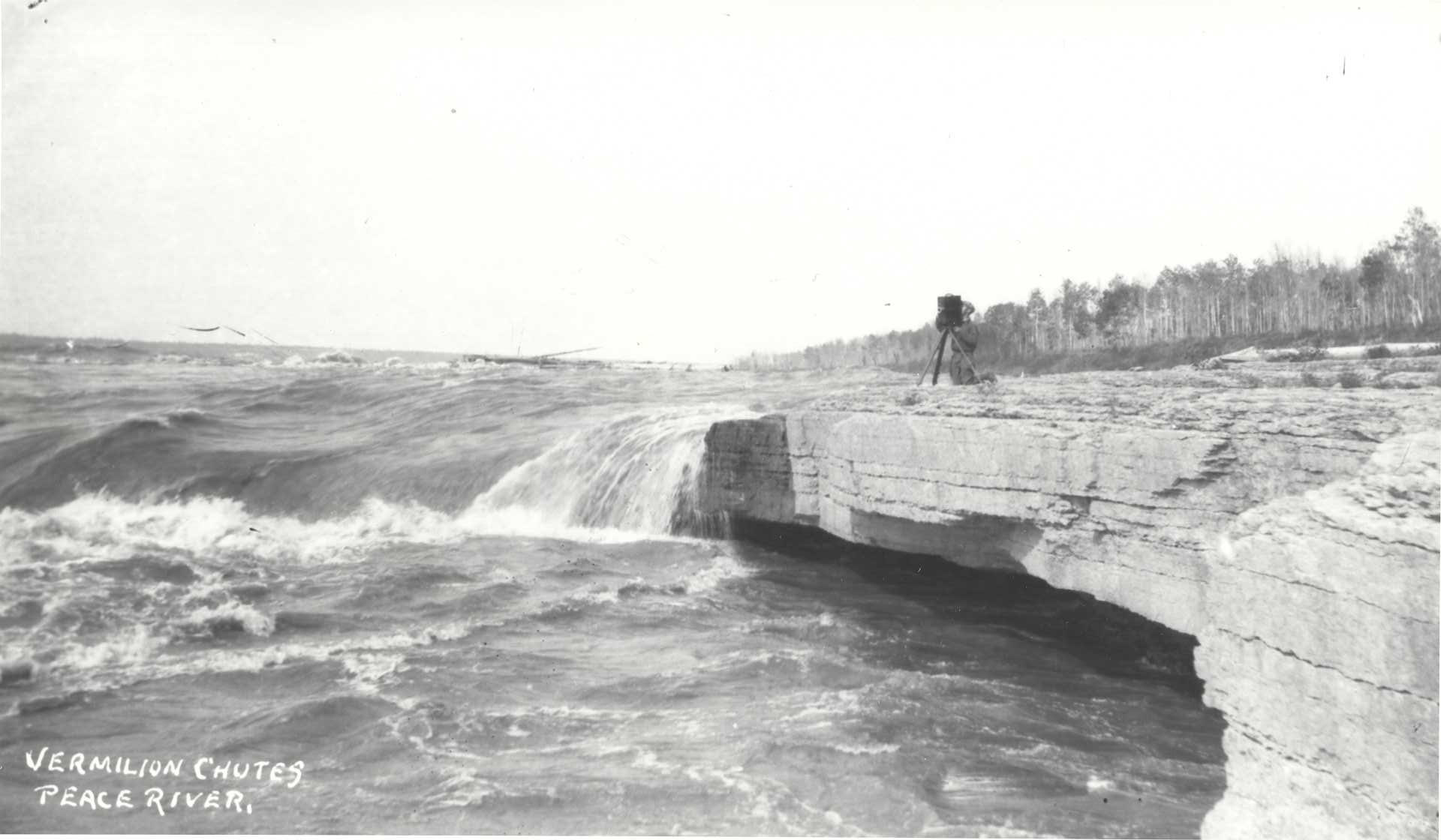
Provincial Archives of Alberta E. Brown Collection B 3015 Accession No. 990.4.74.50CP
'The Chutes' look like a series of "fan-shaped, stone steps" made of limestone rock and shale. They are approximately 4 kilometres (2.4 miles) below 'The Rapids'. 'The Chutes' range from 15 to 25 feet in height. In low water they are dangerous and could cause a shake up if you try to go over them. In high water, with proper experience, they are navigable.
Little Red River Post
The old Hudson's Bay Post at Little Red River is approximately 6 kilometres (3.75 miles) downstream on the south side. After 'The Chutes', the nearest settlement is Fox Lake, about 21 kilometres (12.6 miles) downstream on your right.
Birds
Birders will enjoy looking for 33 waterfowl, 17 waders, 3 grouse species, 8 aerialists, 22 predators, 12 non-perching, and 98 perching birds as well as 8 winter only residents. Occasionally Irregular visitors and migrants are added to the roster. For a complete bird listing click here for page 1 and here for page 2 or Contact Us
Wood bison (Bison athabasca) and woodland caribou (Rangifer tarandus caribou) are considered to be endangered mammal species. The northern leopard frog (Rana pipiens) is also considered to be threatened or of special concern.
The peregrine falcon (Falco peregrinus anatum), trumpeter swan (Cygnus buccinator), whooping crane (Grus americana) and perhaps the short-eared owl are the bird species at risk in the region.
Oldest Building!
Mission House
In 1876, Reverend A.C. Garrioch arrived at Fort Vermilion. He built this mission house downstream from the location of St. Luke's Cemetery. It had 3 ground level and 2 upstairs rooms.
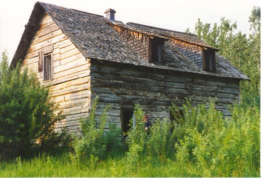
Photo by Marilee Cranna Toews, Fort Vermilion
Around 1943 the house was taken apart, the logs numbered and moved by horse and wagon to Lambert Point. In 1944, the house was rebuilt as the home (1944-1962) of Mr. and Mrs. A.R. Campbell. The shed dormers were added during reconstruction. The house is located on the Bittman farm and is the oldest dove-tailed log structure in the Mackenzie County.
Weather
On January 11, 1911 the temperature drops to -78° Fahrenheit or -61.1° Celsius, in Fort Vermilion. This is the second coldest day in Canada's recorded history.
WHY?
Why do we live in this frozen land?
Where the frost comes to bite
Your nose and your hand…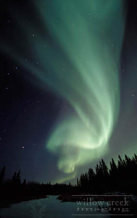
Where the day’s just begun,
And it’s suddenly night,
But you can’t go to sleep
The sky’s all alight
It’s dancing and twisting
And turning with glee,
Then reverses itself
Like a shawl on a spree…
"Aurora", they say,
And it comes in the night
With green, reds and purple
That fringes the white
Then on comes the brightness
Of day if you please,
And there are stanchions of grandeur
Where once there were trees.
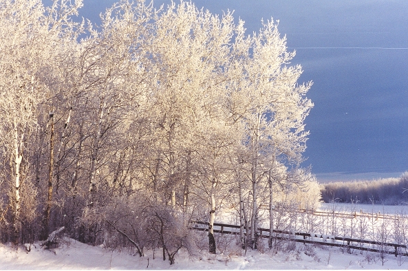
Photo by Marilee Cranna Toews, Fort Vermilion
They’re covered with diamonds
Of hoarfrost and snow,
They transform the landscape
Wherever you go.
But your car won’t start,
So you have to stay home
And play with your kids
Give neighbours a phone.
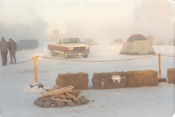
Photo by Marilee Cranna Toews, Fort Vermilion
You just step outside
And the air takes your breath,
But once you’re back in
You’re all filled with zest.
Winter’s a time
To look in and look out
The earth disappears
There are tracks all about.
On Earth, in the sky
Peace and quiet are here,
Along with the grouse
The rabbit, the deer.
If people could come
From the rush and the fray
They would see for themselves,
Why we stay and we stay.
By Eugene Dextrase
Click here to return to home page