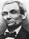
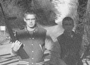
1860 photo taken 4 days after Mr.
Lincoln visited Lincoln, Illinois, for the last time. Info at 3 below.
This President
grew;
His town does too.
Link to Lincoln:
Lincoln & Logan County Development Partnership
Site
Map
Testimonials
Abraham Lincoln Bicentennial Commission of Lincoln, IL

|
Internet Explorer is the only browser that shows this page the way it was designed.
Your computer settings may alter the display.
April 24, 2004: Awarded "Best Web Site of the Year" by the Illinois State Historical
Society
|
|
|

|
Marquee Lights of the Lincoln Theater, est. 1923, Lincoln, Illinois |
|
|
|
12.
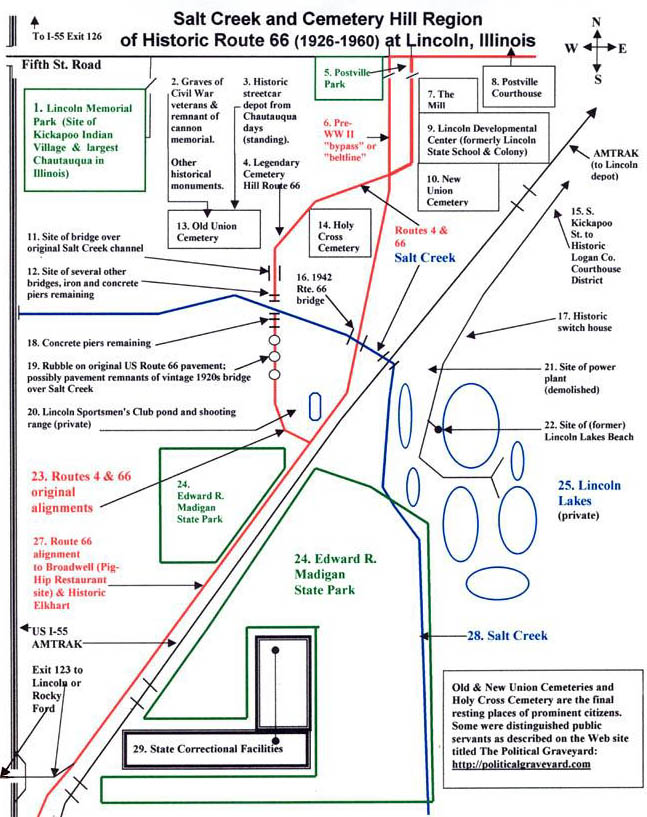
Route 66 Map & Photos Showing Salt Creek & Cemetery Hill,
Also see, 11. Route 66 Map & Photos Showing New and Old Union Cemeteries (William Maxwell family stones) and Lincoln Memorial Park (site of Kickapoo Indian Village and of Illinois's Largest Chautauqua Village) |
|
_____________________ Salt Creek, called the Onaquispasippi -- no wonder the term did not stick -- by the Indians (Stringer, p. 12), greatly affected the history of Lincoln, Illinois. Salt Creek is a tributary of the Sangamon River, which flows across central Illinois past Springfield and then to New Salem, where Abraham Lincoln taught himself law and became a state legislator. Salt Creek, the largest stream in Logan County, borders the southern edge of Lincoln, Illinois, as it flows to its confluence with the Sangamon. Abraham Lincoln crossed Salt Creek countless times as he surveyed the town site of Albany on Salt Creek at Rocky Ford, rode the Eighth Circuit across the prairie for many years, and conducted legal and personal business in the town he named. Upper Salt Creek was the setting for two of Abraham Lincoln's legal cases in Logan County: "In 1840 Abraham Lincoln tried a law suit, under a white oak tree on a farm which later belonged to Joseph Ream, north of Mt. Pulaski. It concerned the old Dement mill stand, with its dam, which was the first on Salt Creek and had rights that were encroached upon by a dam built a few miles below. Later, in another mill case, Mr. Lincoln proposed that the parties, with their attorneys, should meet on the premises on Salt Creek and make an effort at settlement. The attorneys on the opposite side failed to come but Mr. Lincoln was present. The whole thing was talked over by the parties, before Mr. Lincoln; arbitration was agreed upon, and Mr. Lincoln was chosen arbitrator. He heard both sides and then rendered a decision that tradition declares was satisfactory to all concerned" ("Life of Emancipator Played Integral Part in the Story of Early County Existence," Lincoln Evening Courier, centennial edition, section one, August 26, 1953, p. 1).
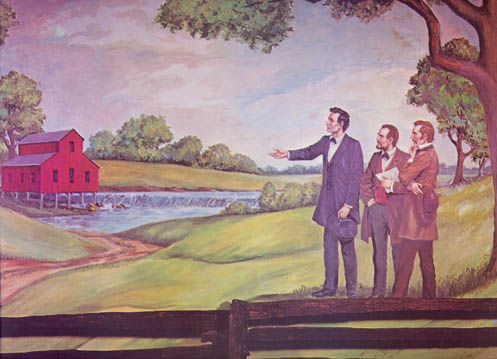
12.1: Lloyd Ostendorf Painting Titled Lincoln at the Dement Mill Trial (Click on thumbnail for larger version.) This image is from a laminated placemat most likely used at the Rustic Inn at Lincoln, Illinois, when this business was a restaurant operated by Jackie Sheridan in the 1970s. This placemat and others in a collection were lent to me for use in this Web site by Judy Henson, who found them at a yard sale in Lincoln. The original art work is in the possession of the State Bank of Lincoln, located at 111 N. Sangamon Street in Lincoln, Illinois. * * * * * In the mid 1850s, Preachers John England and Walter P. Bowles held "a great meeting" on Salt Creek four miles south of Lincoln. Other religious meetings with common participants were also held in the vicinity of Lincoln. These believers formed the Lincoln Christian Church ("Beginning of Lincoln Christian Church Traced to Salt Creek Banks." Lincoln Evening Courier, centennial edition, section 2, August 26, 1953, p. 2). William Maxwell's paternal grandparents, the Robert Creighton Maxwells, were members of the Lincoln Christian Church. The John England referred to above was the brother of Author William Maxwell's "great-great-grandfather, David England, and the son of the pioneer preacher, Stephen England. . . ." (Maxwell, Ancestors, p. 139). William Maxwell's maternal grandfather, Robert Creighton Maxwell, had married Margaret Turley, and her family belonged to the Christian Church. Mr. Turley gave his daughter and son-in-law a farm just three miles from Lincoln. In Ancestors, William Maxwell describes both sets of grandparents, including their religious views, which differed considerably.
The Christian Church placed great emphasis on baptism by immersion.
This importance is reflected in William Maxwell's description of his
paternal grandmother: "My grandmother [Maxwell], having no mind to
speak of, bypassed all questions of doctrine and went right to the heart of
the religion. She never stopped talking about immersion, or
thinking about it. She kept track of who was and who wasn't. She
had the makings of an evangelist" (Ancestors, p. 144).
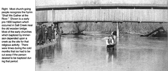
12.2: Proper Baptism in White Shirt and Vest at Salt Creek, Logan County, Illinois (undated) (From Paul E. Gleason and Paul J. Beaver, Logan County Pictorial History, p. 161) The photo above is included in a section of Logan County Pictorial History that portrays Mt. Pulaski, Illinois, several miles east of Lincoln, Illinois (I didn't even know the creek was wide enough for a bridge in those parts). Most likely the bridge over Salt Creek immediately south of Lincoln also provided access to the creek for baptism by immersion for such denominations as the Christian Church, which very strongly advocated that immersion was the only valid version of this ritual. * * * * * Various bridges over Salt Creek were required for the railroads and highways between Lincoln, Illinois, and the state capital of Springfield. Later, on this page, I describe how the bridges over Salt Creek were unsupervised playgrounds for local guys, including William Maxwell and, a generation later, my own contemporaries. On such a highway bridge, Maxwell learned he could not trust himself. When landmark roads and bridges survive as ruins, some folks view them with nostalgic fascination. Exploring unfamiliar ruins, however, requires guidance. An indication of the practical need for the map below, plus descriptions and photos, is the following journal account of a visiting adventurer to Lincoln, Illinois, who posted this account on the Web: "With me, I had taken as much literature about the old road [Route 66] as I could gather. In the evenings, I would often get all my materials spread out on the bed in the motel and check over them to see that I hadn't missed anything. Driving and navigating at the same time can be a little tricky. This morning, based on what I'd read the previous evening, I went gadding about trying to find the Ghost Bridge over Salt Creek. This took me through a cemetery and down a strange road. I'm not sure I ever found what I was supposed to find, but the trip was interesting just the same" (April 7, 2001). This following map and related information are intended to make such exploration easier and more successful.
12.3: Diagrammatic Map of Salt Creek and
Cemetery Hill |
|
|
|
4.
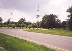
Legendary Cemetery Hill of Routes 4 and 66.
Access this area by approaching from the north or south on Business I-55 (66).
Turn (west) onto original Routes 4 and 66 pavement where that road
diagonally crosses present Business I-55. |
|
|
This crossing occurs near the location where the campus of Lincoln Developmental Center (LDC) is adjacent to New Union Cemetery (the crossing is about a quarter mile north of the Salt Creek bridge). Photo 12.4 was taken from near the Lincoln Developmental Center and New Union Cemetery. This view looks across Business I-55 at Routes 4 and 66 pavement. Photo 12.4 looks south toward the turnoff (between utility poles) onto original pavement of Routes 4 and 6. |
|
|
12.5: Brick
Pavement (Leigh Henson photo, 6-02) |
12.6: Brick Pavement of
(Leigh Henson photo, 6-02) |
|
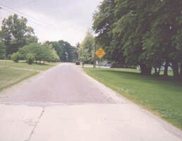
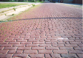
Directions to the North-Shore Piers of Lincoln's Route 66 "Ghost Bridge" Just after the turnoff from Business I-55 is a section of original red brick pavement, now named Cobblestone Avenue. Lincoln, Illinois, has many red brick streets of original pavement. Straight ahead down the
road shown in photo 12.5 is a barricade near the crest of Cemetery Hill.
As you look at photo 12.5, beyond the
trees to the left is Holy Cross Cemetery; beyond the yellow sign to the
right is the entrance to Old Union Cemetery. Straight down this road is
Cemetery Hill. The barricade prevents driving down the old road, but
it is possible and pleasant to walk it. The "ghost bridge" piers near
Salt Creek are only about a half mile down this road. |
|
|
12.7: Routes 4
& 66 Pavement,
(Leigh Henson photo, 6-02) |
|
|
12.8:
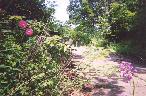
Spring Wildflowers (or spreading cemetery flora?) Line Routes 4 and 66 (Leigh Henson photo, 6-02) |
|
|
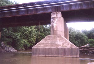
12. Site of Several Bridges over Salt Creek The site of several bridges over Salt Creek is a quarter mile or so south of the original channel (bottom of Cemetery Hill). Here, the land was low and tended to flood, explaining the need for other bridges. This area south of the original creek channel became the site of the main creek channel when the stream was straightened and deepened in order to increase water flow and decrease flooding.
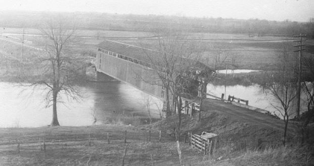
12.9: 19th-Century Covered Bridge over Salt Creek Below Cemetery Hill (This photo was discovered in family albums of Eleanor Gibson, LCHS Class of 1937, and provided to Leigh Henson by his cousin Jerry, Eleanor's son.) This view looks south. On the far side of the bridge, the road continued on a levee. A small stream bed, visible in the background, later became the main channel when the stream was straightened and channelized in the early 20th century.
12.10: A Reverse of the Preceding Photo According to the source of photo 12.10 (Paul Beaver, History of Logan County 1982 [p. 30]), this photo shows the covered bridge in approximately 1925. It was replaced by a bridge similar in design and construction to that shown in photo 12.11 below. "The flooding of Logan County streams in 1913 caused heavy damage, especially to bridges. This Salt Creek flood has been noted as the greatest high water since 1844. The flood threatened the interurban, Alton Railroad, and the old covered bridge and the covered bridge north of Middletown. . . . The flooding of Salt Creek brought about the formation of the Lower Salt Creek Drainage district in the 1920s and work of dredging and straightening the creek channel from near Middletown east to the Alton railroad bridge south of Lincoln was begun. The limestone rock on the bed of the creek at Rocky Ford was blasted for the channel and the breaking of the rock barrier caused a drop of the water table upstream and in the area of Lincoln Lakes more than a foot. Kickapoo Creek was also dredged from Salt Creek to the Fifth Street road" (Larry Shroyer, "Natural Disasters and Otherwise," in Paul Beaver, History of Logan County 1982, pp. 11-12). Civil Engineer John Werschey of the Illinois
Department of Transportation responded to my email inquiry about bridges
over Salt Creek with verification that more than one bridge was located over
Salt Creek near Cemetery Hill: |
|
"I do know a that an SA
road (County) existed in this area prior to1922 and that the northernmost
bridge was in place (was raised 2.1 feet) and was utilized as part of the SBI 4 [State Bond Issue
that created Illinois Route 4] along with two additional bridges to the
south built specifically for this project either as overflow or main channel
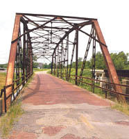
structures. All three were truss bridges of varying styles, including one
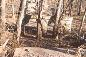
Pratt Truss. The original channel of Salt Creek lay at the foot of Cemetery Hill. Here were located a covered bridge and a steel truss bridge that replaced it. The steel truss bridge has been demolished. The location can be identified by the dip in the dirt road, where fill does not quite reach the grade. Photo 12.11 shows a steel truss bridge that was very similar to the one at the foot of Cemetery Hill. The bridge in the photo is on Route 66 near Sapula, Oklahoma. About a quarter mile
south beyond the bottom of Cemetery Hill are the concrete piers of the Route
4 bridge after channelization. On the north shore of the creek, between two of these concrete piers,
is a pair of twisted iron piers from a Logan County bridge that predated the
concrete bridge. |
12.11:
Steel Truss Bridge on Route 66
12.12: Routes 4 and 66 Bridge Sentries Bridge girders are at right, Cemetery Hill in background. Photo from the 1958 Lincolnite. |
|
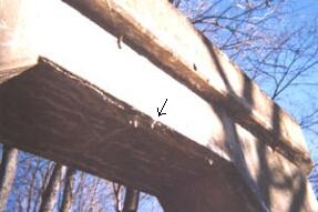
The photo above shows two of the many fine Lincoln young men who guarded the old Routes 4 and 66 Salt Creek bridge. In the photo are Dick George (left) and Mike Hudkins, both LCHS Class of 1960, as they secure the bridge from rats and snakes. Bob Goebel, also LCHS Class of '60, sometimes targeted wayward squirrels. I recall the time when Mike Hamilton shot his elephant gun "30 ought 6" at the bridge to see if the bullet would pierce the steel girder. I do not recall the results because I was long gone to avoid the ricochet. My father tells me that in the 1920s my Great, Great Uncle Boone Hoblit (brother of Great Grandfather John Hoblit and great uncle of Cousin Jerry Gibson) lived in a shack at the bottom of Cemetery Hill, and that shack would have been located less than a hundred yards or so at the left of the scene shown in the above photo. Willie Aughton also remembers Boone. As a kid, my dad used to go fishing in Salt Creek and in the nearby marshy creek bottoms called Devil's Hole and so would occasionally cross Boone's path. Dad says he was much afraid of Boone. One of Boone's eyes was disfigured; he drank a lot; and he threatened passersby who came too close. I suppose since that was the time of Prohibition, I can understand why Boone did not want anyone snooping around his place. North Shore Piers of the Routes 4 and 66 1920s Bridge Over Salt Creek at Lincoln
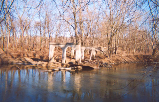
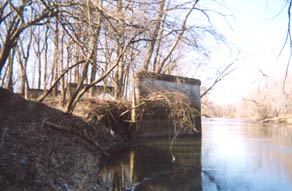
12.13: 1920s "Ghost Bridge" Piers at Salt Creek after Channelization
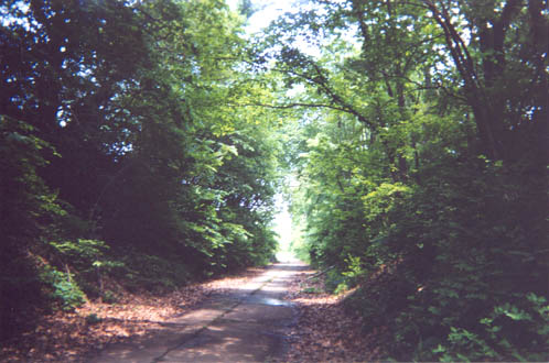
(Leigh Henson photo, 6-02) From the foot of Cemetery
Hill, first there is a brief stretch of dirt road where the steel bridge was
removed and the area filled in. Then, for about a quarter mile, the
original concrete pavement continues on a levy, leading to the site of the
concrete piers of the 1920s-era bridge. The present channel of Salt Creek
is also located here. This new channel was
formed in the late 1920s, when Salt Creek was straightened (channelized) to
expedite flow and reduce flooding. In the above photo, Salt Creek is
murky from heavy spring rains. |
|
|
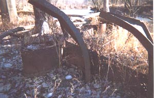
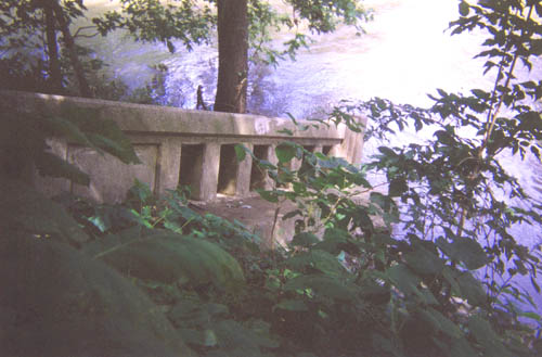
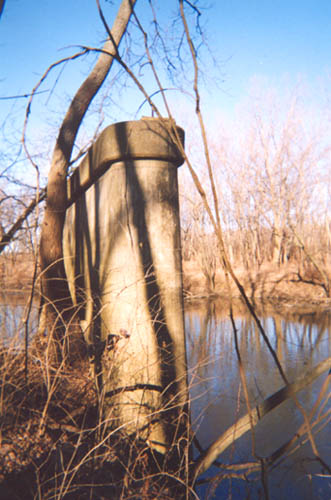
At the end of the pavement, it is possible and pleasant to walk down the slope of either side to see the piers up close. The iron and concrete bridge piers seen in photo 12.14 are the piers nearest Salt Creek. Photos 12.15 and 12.16 below show the unusual features of the concrete piers, which invite a close look at the coloration and small stalactites. Presently I have been unable to find exact dates for the construction of the iron and concrete bridges. Another set of photos and
directions to this "ghost bridge" are found at a Web site by Steve
Look, whose address is
under Sources Cited (below). |
|
|
The photo of 12.14 clearly shows the remnants of an iron bridge across Salt Creek that preceded the concrete bridge, yet I find no information about the iron structure. I recall the twisted iron beams of 12.14 from my earliest visits to this area -- before 1950 -- with my father and Grandfather Harrison Franklin Wilson, who used to take me fishing for carp with cane poles, bobbers, and night crawlers to the creek in this area. During the late 19th Century
and early 20th Century, iron bridges were commonly used to span the creeks
of central Illinois. For more information about these iron bridges,
including photos of iron bridges over other Logan County creeks, please
visit the Web site of Mr. Douglas Coulter of Morton, Illinois (Web
site address below in Sources Cited). One of his "passionate causes"
has been the study of these magnificent structures. Doug Coulter's great photos are
guaranteed to help transport you back 50 to a 100 or more years! Why not
visit his site and send a
quick email to let him know you appreciate his work. |
|
|
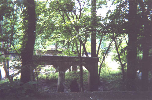
12.15: Multiple Arches of Concrete Bridge Piers on North Side of Salt Creek Looking South (Leigh Henson photo, 12-01) |
12.16: Stalactites on
Bottom of
(Leigh Henson photo, 12-01) |
|
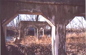
12.17: North Shore Piers of Routes 4 and 66 1920s Bridge Over Salt Creek (Photo by Leigh Henson, 12-01) This December view is from the south shore looking north. Just beyond the trees in the background toward the right are Cemetery Hill, Old Union Cemetery, and Holy Cross Cemetery. The white concrete piers shine in the winter sun like bleached skeletons. Salt Creek
in winter months is at normal pool and free from the silt that muddies
prairie streams in other seasons. With a thin layer of ice in places, the
still, cold stream reflects the brilliant winter sky. |
|
|
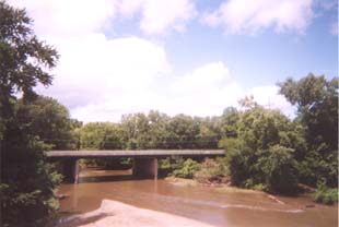
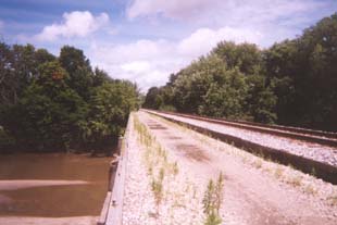
16. 1942 Route 66 Bridge over Salt Creek and Nearby Railroad Bridges. Also, railroad bridge immediately to the east.
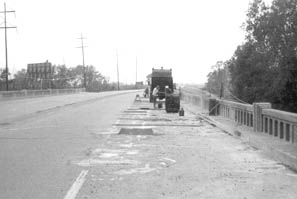
12.18: Looking South on Route 66 at Repair to the Floor of the 1942 Salt Creek Bridge Before Replacement of Original Concrete Balustrade Railings in the 1960s
(Illinois Department of Transportation photo) |
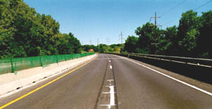
12.19: IDOT Photo Showing the Contemporary Scene on 1942 Route 66 Salt
Creek Bridge in East Lane Looking North Toward Lincoln, Illinois |
|
12.20: Balustrade
Railing from 1942 Route 66 Bridge
Mysteriously Relocated to a (Leigh Henson photo, 7-02) Sometimes the past appears in unexpected and delightful ways. In late July 2002, I discovered this section of the balustrade railing of the 1942 Route 66 bridge over Salt Creek while roaming the Edward R. Madigan State Park along the south shore of Salt Creek near the railroad bridge. Photo 12.17 shows balustrade railing in its original place on the bridge. Civil Engineer Nelson Teichmann, LCHS Class of 1960, mentioned in an email that Bob Ware and he, working for the Illinois Department of Transportation in the summer of 1962, were on a crew that removed this balustrade railing in preparation for its replacement. Nelson describes Bob's enthusiasm for the tricky challenge: "he was quite a dare devil, in my opinion in that he would hang over the outside of the bridge, I want to say without even a strap or maybe a crude one and jack hammer from that position" (email to Leigh Henson of 1-22-02). Respond to Nelson at [email protected]. The location of this large bridge remnant is unusual for a couple of reasons. First, no other traces of the railing are noticeable in this area. Also, this heavy railing had to be moved at least a hundred fifty yards upstream to its present location, and that would take some doing. Was it deliberately located there -- upright, intact, perpendicular to the stream, and on the bank -- as a breakwater to retard creek bank erosion? On a related matter, I note that the 1920s Routes 4 and 66 concrete bridge (photos 12.14 and 12.15 above) also most likely had a balustrade railing. In fact, Willie Aughton, 87, in conversation with me in June of 2002 confirmed that it did. I also suggest that the floor and railing of that bridge compose the concrete chunks that I have always remembered seeing on the old highway pavement (see photo 12.29 below). I further speculate that with such a balustrade (low) railing the 1920s Routes 4 and 66 bridge might have been the setting for a scene in William Maxwell's story titled "With Reference to an Incident at a Bridge" (1984). Maxwell recalls his days as a senior Boy Scout when some other Scouts and he were mentors to a group of Cub Scouts. One night Maxwell and friends "walked the little boys clear out of town in the moonlight and halted when we came to a bridge. . . with low sides that came up about to the little boys' belly buttons." The Cub Scouts were blindfolded with their backs against one side of the bridge. On command the Cub Scouts "charged bravely across the bridge and into the opposite railing and knocked the wind out of themselves." Maxwell rationalizes that the "incident" taught the boys that "cruelty could never again take them totally by surprise." He concludes "I learned that I was not to be trusted" ("Incident," p. 169). He also says he did not ask God's forgiveness because he knew he would not get it. Memoir of the Old Iron Bridge at the Foot of Cemetery Hill One afternoon in the fall of 1959 or following winter of 1960, while some of my friends went "plinking and plunking" with their 22s at the old bridge shown in photo 12.11, they devised a practical joke. One guy was placed in the trunk of a car and heavily smeared with catsup. Then, a couple of the guys drove into town and to the parking lot at the back of Leonard's Cafe. These guys went inside where they knew they would find the girlfriend of the guy in the trunk. Feigning shock and confusion, they summoned her outside, muttering something about a terrible accident. They rushed her to the parking lot and opened the trunk to ask her what they should do about the bloody body of the shooting accident victim. She is a member of the 170 LCHS alums' email list. From this (im)practical joke, did she learn not to trust any of us? |
|
|
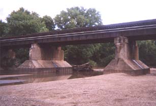
12.21: View of 1942 Route 66 Salt Creek Bridge from the GM&O Railroad Bridge (Photos 12.21- 12.24 by Leigh Henson) Millions of people crossing this bridge going north into Lincoln (left to
right in photo) have looked to their right and noticed the GM&O railroad
bridge. So, for fun, I thought I would show the Route 66 bridge from the top
of the railroad bridge. |
12.22: GM&O Railroad Bridge Looking Toward Lincoln (north) One of the two original tracks has been removed. Darold Henson remembers when there were two tracks for the GM&O and one for the Interurban (separate bridge) to accommodate the dozen passenger trains through Lincoln daily. The Interurban bridge was to the right, upstream, about 1/8th mile. |
|
12.23: GM&O
Railroad Bridge
The discovery of this gravel deposit early in the 20th Century
led to the formation of the Lincoln Sand & Gravel Company and Lincoln Lakes.
For more about Lincoln Sand & Gravel, see
28. Mining Coal, Limestone, & Sand & Gravel; Lincoln Lakes; &
Utilities . |
12.24: Center Bridge Pier
I find no date for the construction of this bridge. It was
certainly built to withstand floods and support two trains. The skirt
of the base pier appears to be steel, perhaps walls of a coffer dam filled
with concrete. The yellowish red vertical line to the left of the pier is a rope
suspended from under the bridge so that today's youth can climb onto the
pier, swing out, and cannon ball into the creek when depth allows. |
|
18. South Shore Concrete Piers of Salt Creek Bridge. To get to these piers, drive south toward Springfield on Business I-55 (old Route 66) over the 1942 Salt Creek bridge, and turn on the first right (about a quarter mile south of the Salt Creek bridge). Then drive about a quarter mile, around a curve to the right, until reaching the barricade. You can park nearby. If you choose to
walk forward toward the bridge piers, be careful. The old
roadbed is filled with concrete debris, which may be the remnants of the old
bridge floor. As you walk toward the bridge piers, take care to
walk to the left of the road because of an adjacent shooting range at right. |
|
|
|
|
|
|
|
|
12.29: Main Pier of 1920s Routes 4 and 66 Bridge Over Salt Creek on Its South Shore Here the scrub trees encircle the main pier of the
1920s Route 66 bridge over Salt Creek. These arms of nature seem to
embrace this structure as if it were a coveted, towering boulder-monument, holding it
dear to protect it from the threat of man's "progress." |
|
|
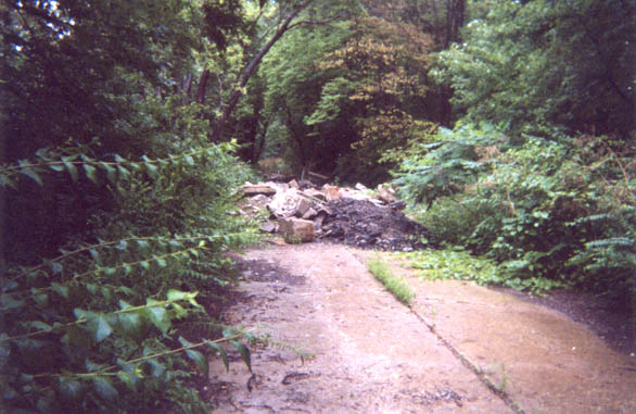
19. Rubble on Original Routes 4 & 66 Pavement The photo below shows the beginning of debris that extends about 100 yards up the old roadbed toward Salt Creek. Some of the debris visible in the photo may be from recent dumping by the Highway Department, as suggested by the black asphalt chunks in the foreground. Yet, I remember seeing chunks of concrete piled on this roadbed when I was a kid. My memory of this area extends back about 55 years to the times I was with my dad and Grandfather Wilson when they fished Salt Creek and the nearby gravel pit. In the last couple of years, I have examined this rubble, and I am convinced that the concrete chunks that I recall from childhood -- the ones closer to the creek -- are indeed the remnants of the Routes 4 and 66 bridge floor whose concrete piers remain and are pictured above.
12.30: Remnants of a Lost World: Chunks of Routes 4 and 66 Bridge Floor and Pavement (Leigh Henson photo, 7-02)
Caution:
tourists may be tempted to remove debris as souvenirs of the historic
highways, but this material belongs to the people of Illinois and is under
the jurisdiction of the Illinois Department of Transportation. |
|
24. Edward R. Madigan State Park and 28 Salt Creek |
|
|
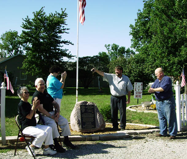
"Situated on the southern edge of Lincoln, Edward R. Madigan State Park is an ideal destination for those looking for a quiet place to enjoy nature. The park offers picnic areas and trails, plus canoe access to Salt Creek that borders its east side. The park allegedly is home to the state's largest sycamore tree and also features oaks, walnuts, ashes, hackberries, and hickories. Its resident wildlife species include deer, raccoons, rabbits, pheasants, quail, and hawks. Surrounding Lincoln Correctional Center and Logan Correctional Center, the 750-acre park was known as Railsplitter State Park with its inception in 1971. In 1995, it was renamed to honor a Lincoln native with a distinguished career in public service. Edward R. Madigan (1936-1994) served as state representative, U.S. congressman and, under President Bush, agriculture secretary" (brochure titled Edward R. Madigan State Park). Herb Altman, Lincoln Community High School Class of 1956, provides additional information about the origin of this park: "It is great to be reminded of the local congressman, Ed Madigan, at the park. But I would like to remind everyone that the park was built by the efforts of my father, Fred E. Altman. At the time he was a union official for the Operating Engineers, and he pushed for the park to be transferred to the Department of Conservation from the Department of Mental Health, and he had the vision of the park, and obtained volunteer labor from the organized labor group. That is the reason for the Flag at the entrance, and the memorial plaque at the base of the flag. His efforts through Governor Ogilvie, a personal friend, is the reason the park exists." Respond to Herb at
[email protected]. |
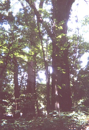
12.31: Giant Cottonwoods Near the Banks of Salt Creek in the Edward R. Madigan State Park (Leigh Henson photo, 7-02)
I have not looked for the state-record sycamore tree located in this
park and would welcome a photo of it and a description of its location in
the park. |
|
Visitors to the park enjoy picnicking, fishing (channel catfish, bass, and panfish), canoeing, hiking, and hunting. "The park offers a scenic 7-mile hiking/biking trail, which meanders through grasses, trees, and creek bottoms. There is also a 3/4-mile jogging trail" (brochure). More information is
available by contacting the site superintendent at 1366 1010th Ave.,
Lincoln, IL 62656 or 217-735-2424. |
|
|
A Youthful
Misadventure on Salt Creek: Or, How I, Too, Learned Not to Trust Myself
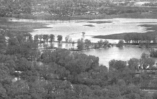
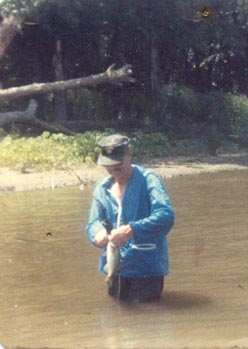
(with apologies to William Maxwell) I learned a lot about fishing by going with Dad to this area. I recall his meeting his friend, Dr. Chester Davis, there one evening just above the dam when Dr. Davis was fishing with a new-fangled spinning reel. Dr. Davis patiently showed Dad how the gear worked, and soon after that Dad acquired his own spinning reel outfit. In the late summer Dad liked to fish for channel catfish just above the dam on Salt Creek. At those times, he assigned me the task of venturing into the tall weeds of vacant lots near home in the afternoon in order to catch large yellow grasshoppers for bait. On a hot summer afternoon, that proved to be sweaty work. When I caught one, I placed it in a pint or quart mayonnaise jar. The lid had holes punched with hammer and nail to allow the hoppers to breathe. Catching them required moving slowly through the tall weeds to avoid scattering them in flight. As hoppers spotted me, they tried to hide behind stalk, branch, or leaf. The trick was to reach forward slowly and quickly grab the hopper. Hoppers would shift position on the weed stalk as a shield against my hand. Once caught, the hopper would spit its "tobacco juice" on my fingers as I slipped it into the jar among the blades of grass I put there for its last meal. I was always concerned about having enough hoppers but usually did have. Hoppers had other uses than bait. My sister reminds me that sometimes I arranged for the hoppers' "tobacco juice" to get on her. Another "hopper prank" I pulled only once. My Aunt Mariann and Uncle Loren Wood lived next door. One afternoon I crept up to their living room window by the driveway, pried open the window screen, and released a few hoppers inside. First, there was commotion; later that evening there was justice. It may have been the following year when the Woods moved to the arrowhead country of Minnesota. When Dad got home from work, he would eat a quick sandwich before we were off to the dam and creek. There, he fished with a fly rod, using just a split shot weight with baited hook. The hook was inserted into the grasshopper under its chin and threaded through the body with the hook protruding. Dad waded out into the stream far enough to cast into the middle, letting the bait drift into the eddies behind wooden pilings, where the catfish would strike hard and fight vigorously. The water rushing over the Salt Creek dam was a powerful force that I learned to respect even before I reached the teen years. Yet, when I was about 17 and a bit too rambunctious for my own good, I got into a dangerous situation there. It happened in the late winter of 1958 or 1959. Salt Creek was so swollen with runoff from melting snow and ice that it was out of its banks and flooding the whole region, even the crop land between the Lakes and Frorer Avenue. Mike Hamilton and I decided to "borrow" my dad's canoe and explore the flooded back lakes. On our way to launch the canoe, we managed to drive past the power plant, down to the next underpass. It was flooded so we launched there and headed out.
12.32: Salt Creek Spring
Flooding of Farm Fields
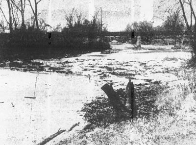
(This 1970s photo is from Flood Plain Information: Salt Creek, Kickapoo Creek, Brainard [sic] Branch, and Salt Spring Branch, by the U.S. Army Corps of Engineers for the Logan County Regional Planning Commission, p. 24. The background shows houses at the southeast edge of Lincoln.) After canoeing through the hot water ponds, back lakes, and the regular Lincoln Lakes, we paddled over the flooded fields seen above in 12.31. From there, we made our way south to Salt Creek above the dam and decided the water was high enough that we could "shoot the rapids." We saw that the water was near the bottom of the first railroad bridge (interurban) with only a couple of feet of clearance, but we planned to paddle to the side before reaching the bridge. The current was so swift that it carried us toward the bridge, and we nearly had to flatten ourselves in the canoe bottom, barely clearing the bridge. The image below is crude, but it shows the dam and the Interurban bridge not far beyond it.
12.33: Looking Downstream Over the Salt Creek Dam Toward the Interurban Bridge Photo is from the Lincoln Evening Courier, January 14, 1954, p. 10. The image quality is poor because it is a scan from a microfilm printout, but better than nothing. The Courier photo caption reads, "Looking westward down Salt Creek not far from Lincoln Lakes one can see the bare rocks below the dam and sandbars that ordinarily are not visible at this time of the year. Instead of the water flowing over the whole dam, liquid barely trickles through a single area, which in the photo is just above the left arm of the Y-shaped stump." It was getting dark, so we paddled through the backwater lake, close to the Rubicon, and into the ditch near the parked car. We had to paddle a ways into the ditch and go hard against the current. We got to the place where the car was parked; and as we were trying to turn the canoe toward land, it got sideways against the current, which overturned the canoe, throwing us both into the near-freezing water. I went under but managed to touch bottom and spring upward, grabbing the canoe. My varsity jacket was soaked and seemed to weigh 50 pounds, so it was fortunate that I did not have to swim out. Mike was closer to the shore, so didn't go under, but both of us had our breath taken by the shock of the cold water.
When I got home, Dad was not there. He had gone looking for us, and he
was not happy when I later explained why I was soaked. This
incident should have taught me I could not always trust my judgment, but I
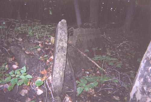
confess I'm not sure it did. 12.34: Ruins of Old Dam Over Salt Creek Robert Frost wrote that "the woods are lovely dark and deep," and they are here, so dark that a flash was needed in mid afternoon. Finding these ruins was almost like an Indiana Jones adventure and certainly reminded me of my "float trip" over the dam with Mike Hamilton. I find very little information about this dam. Darold Henson asked two men who had worked at the old power plant, a son and his father, if they knew anything about the origin of the dam, but neither did. At first glance the dam appeared to be a jumble of broken concrete chunks dumped there, but a closer look indicated at least the front of the dam had been carefully designed. It had concrete slabs standing on edge end to end, forming a shallow wall across the channel. This first row was abutted by other concrete slabs, lying flat in the stream bed, whose ends were perpendicular to the front row to brace it. Dad said the dam at one time had a wooden chute in the middle to allow fish to swim through, further evidence of the dam's deliberate design and construction. Most likely the dam was constructed to raise the water level above Salt Creek when Lincoln's first wells were located in this area. That suggests the dam was constructed late in the 19th Century and was thus truly an historic landmark.
The dam was demolished as a result of a controversial redirection of Salt
Creek, which was deliberately re-routed by a private landowner to circumvent
the dam. I know of at least one other case like this (on the Mackinaw
River) where the landowner was taken to court and ordered to return the
stream to its original channel, but that did not happen here. My
observation is that the old dam was bulldozed to the edge of the new channel
to provide a barrier against bank erosion. As Alexander Pope wrote, "Whatever is, is right." |
|
|
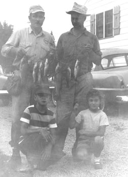
12.35: Salt Creek Fisherpersons (Jane Henson photo) |
12.36: Darold Henson with Bass Caught in Salt Creek in the 1980s (Judy Henson photo) |
|
In photo 12.35, from left to right front are Leigh and Linda Henson; at back left to right are Uncle Loren Wood and Darold Henson. Loren and Dad often fished together, using a canoe they jointly owned and refinished in Dad's basement one winter around 1950. They stripped the bottom from an old wooden canoe and applied fiberglass, sending unpleasant chemical odors throughout the house. Loren and his wife, Mariann Wilson Wood, now live outside Cook, Minnesota, near Lake Vermilion. Note in 12.34 that Loren
wears a service station uniform (Shell logo on shirt) as this photo is from
the time he operated the Shell Service Station at Fifth and Washington Streets. |
|
|
Lee Walker Recalls Salt Creek, the Old Dam, and Old Union Cemetery
From: Lee Walker
[mailto:[email protected]] Mon.,
7/24/06 |
|
|
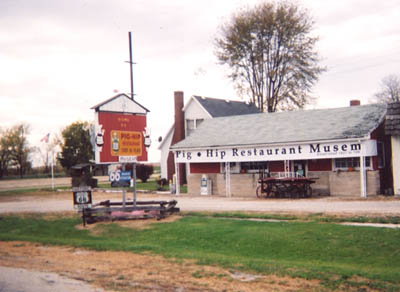
27. Route 66 to Broadwell (Site of World-Famous Pig-Hip Restaurant) and Elkhart Just seven miles south of Lincoln on Route 66 is Broadwell, Illinois, hometown of the esteemed Benners and the world-famous former Pig-Hip Restaurant, now a most pleasurable Route 66 museum:
12.37: Pig-Hip Restaurant Museum at Broadwell on Route 66 (Leigh Henson photo, 10-03)
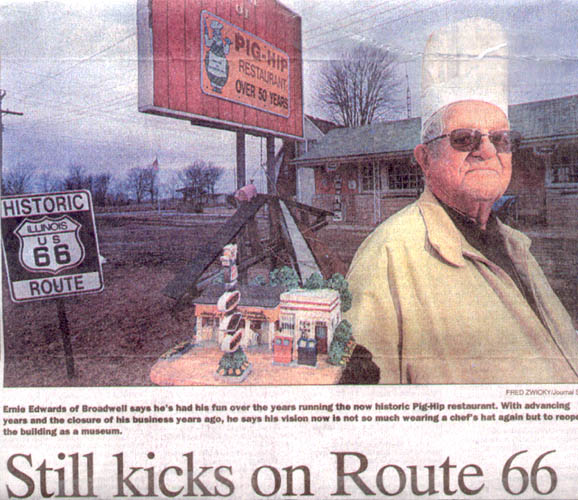
12.38: Photo from the Peoria Journal Star, March 3, 2003 Phil Luciano of the Peoria Journal Star provides a full account of how Mr. Edwards' "local color personality" and "labor of love" have created the Pig-Hip Restaurant Museum: "The Pig-Hip Restaurant Became a Standard Stop on 'The Mother Road'" Ernie Edwards loves tall tales. Ask him how he named his restaurant, a world-renowned Route 66 legend called The Pig-Hip in Broadwell. He won't blink before explaining that the hip in question refers to the swine's left leg, which produces a better cut of pork: 'The hog raises its right leg to scratch, and that makes it tough.' Or, question him about the old wagon in front of his eatery -- one he'd gladly sell you, for a price. 'They made that wagon special to take Abe Lincoln's casket off the funeral train,' he says, not ashamed of himself at all. No, a pig doesn't have a favorite scratching hoof. And the wagon wasn't built until long after Lincoln went to his final resting place. But Ernie is serious about one thing: Getting his kicks on Route 66. He made a living and raised a family off the old historic road, enjoying himself all the while. 'I've had a lot of fun,' he likes to say, like a mantra. But even in his 88th year, he's not done having fun. Ernie is turning that old, shuttered Pig-Hip into a new museum -- not to make a buck, but to leave a legacy. 'I'm not going to be around long,' he says off-handedly, without self-pity. But the notion seems ludicrous. It's almost unthinkable that Broadwell (pop. 200) and Route 66 could exist without Ernie and wife, Frances, 81, who seemingly have catered to the motoring set since forever. In 1937, nine years after the laying of the Chicago-to-Santa Monica highway, Ernie and Frances opened a small, three-table cafe they named (for reasons long forgotten) the Harbor Inn. An aged menu in Ernie's den lists those initial prices, including a 10-cent hamburger and 5-cent iced tea. You won't find any ham sandwiches, because he didn't sell any at first. Purely by chance, the next year Ernie found his destiny. A hungry farmer bustled into the joint and asked for a sandwich. When Edwards asked him to name his pleasure, the farmer impatiently looked around, pointed to a steaming pork roast and blurted, 'Just give me one off that pig hip.' Ernie, as always wearing his sky-high white chef's hat, paused. He'd never heard that reference, but he liked the sound of it. He had his gimmick, and soon changed the name of the place to The Pig-Hip. The newfound pig-hip sandwich, served with a secret sauce Ernie concocted, became an instant hit. Enthusiasts of Route 66 -- which John Steinbeck dubbed The Mother Road of westward migration -- began making The Pig-Hip a standard stop, and business boomed. A few visitors arrived with more than a rumbling tummy. One afternoon, a then-unknown Harlan Sanders sauntered in and offered a franchise to Ernie -- who turned the tables and invited the chicken huckster to buy a Pig-Hip franchise. Another time, Steak 'n Shake founder Gus Belt came in to complain that Ernie had stolen Belt's black-and-white color scheme; Ernie politely told him to get lost. Meanwhile, next door to the eatery, brother Joe Edwards put in a filling station. On the other side, sister Bonnie Jean Welch and her hubby erected a motel, making Broadwell a full-service stop. Now 80 and 75, Joe and Bonnie Jean live in nearby Lincoln. The secret behind the siblings' longevity? 'It's all those pig-hips,' Ernie says, grinning. In the 1960s, interstates pulled traffic from highways and byways, and Route 66 fell into disuse and disrepair. Eventually, the filling station and motel were sold, then closed. By the early 1980s, the handful of other businesses in Broadwell shut down, leaving Ernie, Frances, and The Pig-Hip as the sole commercial survivors. Their perseverance was rewarded in the mid '80s, when Route 66 aficionados succeeded in restoring much of the road, including the strip through Illinois. Suddenly, The Pig-Hip saw a resurgence in popularity -- so much so that the Edwardses (already past retirement age) got worn out. In 1990, unable to find a buyer, they shuttered the place -- for good, they thought -- and retired to their quaint A-frame next door. But curiosity seekers kept coming. Ernie has yet to turn down a request of a tour, and even throws in a yarn or two. 'Most of my visitors are foreigners,' says Ernie, who recently entertained a vagabond from Africa. 'They've heard so much about 66.' But rather than just regale listeners with stories and photos of The Pig-Hip, he's decided to revive a bit of history. He's busy turning the old ranch-house eatery into a museum. For funding, he's been selling made-in-China replicas of The Pig-Hip for $15. So far, he's sold 200, making a profit of $1,800. Plus, on March 15, the Route 66 Association of Illinois (Ernie sits on its board of directors) will bring a bevy of volunteers to continue to gut and rehab the place. Half of the place will feature a replica of the original three-table restaurant. Another will display Ernie's considerable collection of Route 66 memorabilia. But most of all, it's Ernie's gift of gab that makes his place a perfect regentrification [sic] project, says John Weiss, chairman of the association's preservation committee. 'Here's a chance for people to hear about Route 66 through the eyes of someone who lived it," Weiss says. "And that's pretty darn neat.' And though Ernie will gladly serve as curator, he won't be serving any pig-hip sandwiches. 'I might put on the white hat, but I'm not gonna work,' he says, laughing. A sign out front promises the museum will open in time for the association's yearly Chicago-to-St. Louis motorcade on June 7 to 9. Eventually, Ernie envisions volunteers manning the museum on weekends. But as much as Ernie is putting into the historical effort, don't expect him to reveal the recipe of his secret sauce. He plans to take it to the grave. 'I keep it up here,' he says, pointing to his white-haired head. He thinks a moment, cracks a sly grin and adds, 'If someone has a thousand dollars, I'd probably sell it to them.' ▪ Write Phil Luciano at 1 News Plaza, Peoria, IL 61643, or call 686-3155 or (800) 225-5757, Ext. 3155. E-mail him at [email protected]. ▪ Visit the Peoria Journal Star online at www.pjstar.com/. Request for permission to reprint article has been made to the Peoria Journal Star.
Next stop heading south on Route 66 is Elkhart,
site of the historic Elkhart Cemetery on the hill. Buried there are
three-time Illinois Governor Richard Oglesby, America's "Cattle King" John
Gillett, and World-Champion Skeet Shooter Adam Bogardus.
This cemetery is a beautiful wooded site with many distinctive tombstones, a
rustic stone chapel, and the Gillette Memorial Bridge over the Elkhart-Mt.
Pulaski Road. |
|
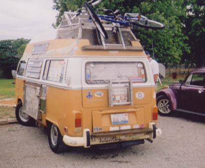
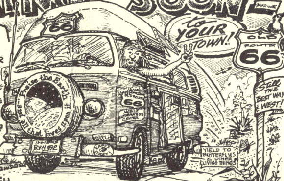
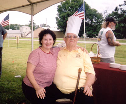
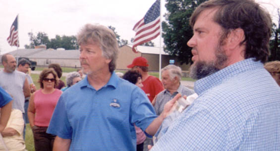
Ernie Edwards' 90th Birthday Party (June 10, 2007) On Sunday, June 10, 2007, I borrowed my wife's car--yes, entirely with her permission--and drove south on old Route 66 from my dad and stepmother's home (northeast corner of Seventh and Monroe Streets in Lincoln.--my childhood home--), heading to Broadwell--hometown of my esteemed high school classmate Jim Benner--to attend Ernie Edwards' 90th birthday celebration. (I'll never understand why my stepmother and wife Pat thought that going to yard sales in Lincoln would be more fun than Ernie's party in Broadwell. My dad at 88 was content to stay at home and dream about his next fishing trip.) The day was partly sunny, and I seemed to have the Mother Road mostly to myself--no one tailgating me just then and there. As I drove, I was surrounded by lush green foliage: the prairie unmowed "rehab" along old Route 66, the dense scrub trees along the former GM&O tracks, and the thick, knee-high corn (an endless green sea). The enchantment of this nostalgic six-mile drive kept my speed at 50 mph as I watched the parallel traffic on I-55--the countless fools going 85. When I got to Ernie's place, the parking lot was nearly full. Cars, RVs, and some motorcycles began to line the service road in front of the Pig-Hip Restaurant and Museum site. A small, circular flower garden memorialized the site of the Pig-Hip Restaurant, recently destroyed by fire. I noticed Bob Waldmire's famous Volkswagon van--I had previously seen it at the Cozy Dog Drive In in Springfield, IL-- parked near Ernie and Fran's house, and that was the first sign that this party would truly be a Route 66 historic happening!
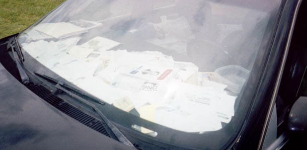
12.39: Bob Waldmire's Trademark Volkswagon Van As I looked at the center of the driver's side of Bob's van, I noticed a pocket with free copies of one of his artistic postcards ("free while they last"). The postcard has a self-portrait:
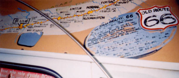
12.40: Cropped Section of Bob Waldmire's Self-Portrait Picture Postcard The van's roof on the driver's side has a map of old Route 66:
12.41: Bob Waldmire's Roof-Top Map of Old Route 66 Showing Central Illinois Towns
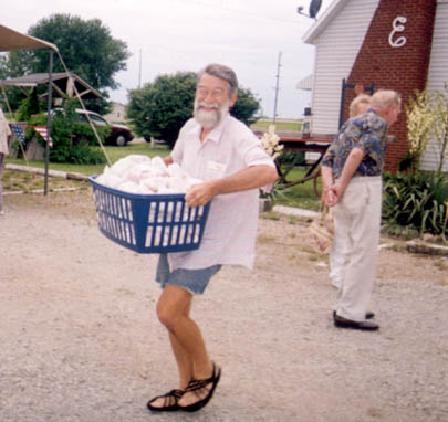
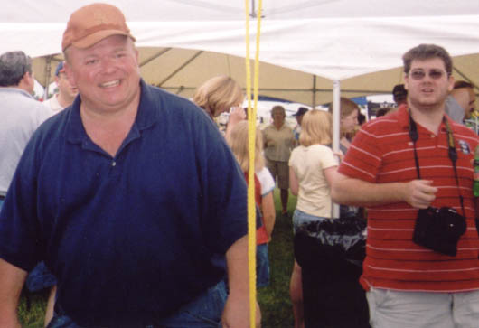
12.42: Bob Waldmire Happily Carries a Basket of 300 Pig-Hip Sandwiches to the Serving Table The car seen below belongs to Mr. Bobby Olson, a good friend of Ernie, and one of the key organizers of his birthday party.
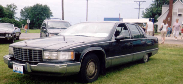
12.43: Mr. Bobby Olson's Black Cadillac Fleetwood with "Oly 2" License Plate Bobby later emailed me to say that his trusty Fleetwood came in handy during preparations for the celebration: "The hecticness of Sunday was compounded by two flying trips to Lincoln between 10 AM and 11 AM to get additional tomatoes and buns for additional Pig Hip Sandwiches."
12.44: Bobby Olson's Dashboard Is the Desk of His Mobile Route 66 Executive Office Mr. Olson has also been a good friend to me, providing information, gifts, and encouragement in the development of this community history Web site of Lincoln, Illinois. Last fall he generously sent me, as a gift, a copy of Ernie Edwards' biography titled Pig-Hips on Route 66 by William Kaszynski. Bobby explained that he sent me the copy after finding it in his car several months after putting it there. As I looked at the interior of his car, I saw a lot of things stored there, including a large box that took up the passenger's side of the front seat. So, when I saw the packed condition of this mobile office, I was glad my copy of Ernie's biography was not somewhere still in it. (Below this series of annotated photos is a link to my review of Ernie's biography.)
12.45: Bobby Olson (l) with His Characteristic Smile and One of Ernie's Unidentified Relatives
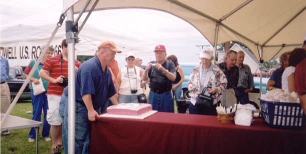
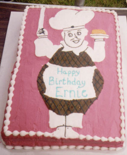
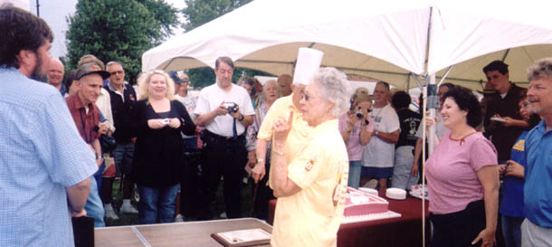
12.46: Bobby Olson Sets up the Serving Table
12.47: Ernie's 40-Pound-Plus 90th Birthday Cake Ernie told the story of how he was invited to Colonel Sanders' 90th birthday celebration several years ago. The Colonel had bragged that his cake would weigh 40 pounds, so Ernie requested his own 90th birthday cake be just as BIG. Patty Ambrose, executive director of the Illinois Route 66 Association, baked Ernie's cake and assured him that his cake weighed even more than 40 pounds.
12.48: Patty Ambrose, Ernie Edwards, and Unidentified Party Guest
12.49: Bob Olson (left) (former
IL state representative); Jonie Tibbs (Lincoln, IL, city alderwoman); Bruce Huskins is widely credited with the idea for the first Annual Logan-County-wide yard sales ("Route 66, 37 Miles of Smiles") and doing much of the hard work to organize this activity, which coincided with Broadwell's sesquicentennial celebration and Ernie's 90th birthday celebration.
12.50: Leigh Henson (l), Jonie Tibbs, and Harry Tibbs (photo courtesy of Geoff Ladd)
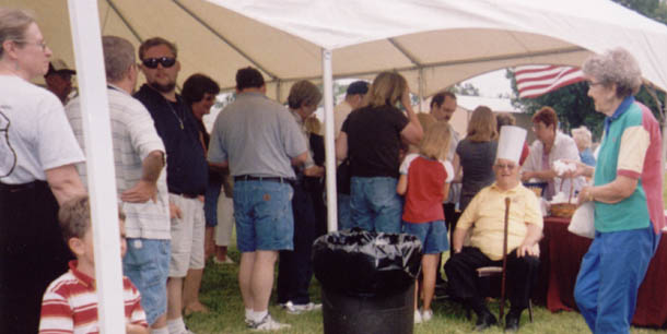
12.51: Ernie's Fans Line up to Shake His Hand and Get a Free Pig-Hip Sandwich
12.52: Logan County Tourism
Director Geoff Ladd (right) Presents the Broadwell Mayor Warren Bradley made sure that the village provided signage, funding for porta-potties, and some insurance for the event. How could anyone in attendance not be reminded by the US flags that events like these could happen in only this country?
12.53: Fran Edwards Makes an Emphatic Point About Being Ernie's Partner in the Pig-Hip Enterprise
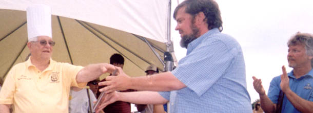
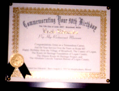
12.54: Geoff Ladd Presents Ernie with a Plaque Commemorating His 90th Birthday
12.55: Ernie's 90th Birthday Plaque For Peoria Journal Star reporter Phil Luciano's 2003 story on Ernie Edwards, scroll up this page. Leigh Henson's review of Ernie Edwards' biography, Pig-Hips on Route 66 by William Kaszynski. Scroll to the bottom of this page for links to information about more Route 66 icons. Link to mega-photo album of the first annual Logan County Route 66 garage sale and Ernie Edwards' 90th birthday party, courtesy of Geoff Ladd: http://www.route66garagesale.com/ For other Web pages about Route 66 in this site, see the site map. 12.56: Tourism Director Geoff Ladd Christens Pig-Hip Monument with Rte. 66 Root Beer (9-28-07) (Photo courtesy of Geoff Ladd)
Pictured L-R: Frances Edwards, Ernie Edwards,
Patty Ambrose of IL Route 66 Heritage Project, Geoff Ladd, and Bob
Olson (longtime friend of the Edwardses)
|
|
Sources Cited Altman, Herbert M. Email to LCHS Alums' Internet Community. May 3, 2002. Beaver, Paul. History of Logan County 1982. Published by the Logan County Heritage Foundation. Dallas, TX: Taylor Publishing Company, 1982. "Beginning of Lincoln Christian Church Traced to Salt Creek Banks." Lincoln Evening Courier centennial edition, section two, August 26, 1953, p. 2.
Coulter, Douglas. Web site with photos of iron bridges in Logan
County, Illinois. Edward R. Madigan State Park Web Site: http://dnr.state.il.us/lands/Landmgt/PARKS/R4/Edmad.htm Ghost Bridge--Lincoln by Steve Look: http://www.ilrt66.com/LincolnGhost.htm This Web site has numerous photos of Routes 4 and 66 pavement north as well as south of Lincoln. Illinois Department of Natural Resources. Edward R. Madigan State Park (brochure). Springfield, IL: no date. Luciano, Phil. "Still Kicks on Route 66." Peoria Journal Star, March 3, 2003. Maxwell, William. Ancestors: A Family History. NY: Vintage Books, Inc., 1971. ___________ . "With Reference to an Incident at a Bridge." All the Days and Nights: The Collected Stories. Vintage Books-Random House Inc., 1995. William Maxwell's works are available at www.amazon.com and www.barnesandnoble.com. Shroyer,
Larry.
"Natural Disasters and Otherwise," in Paul Beaver, History of Logan
County 1982. Steil, Tim, with photos by Jim Luning. Route 66. Osceola, WI: MBI Publishing Co., 2000. Stringer, Lawrence B. History of Logan County 1911. Reproduced, Evansville, IN: Unigraphic, Inc., 1978. Teichmann, Nelson, Civil Engineer, retired. Illinois Department of Transportation. Email to Leigh Henson, 1-22-02. Werschey, John, Civil Engineer. Illinois Department of Transportation. Email to Leigh Henson, 1-3-02.
|
| lincolncourier.com | lincolndailynews.com |
| Abraham Lincoln Tourism Bureau of Logan County |
Lincoln Daily News Tourism Page |
Lincoln-Logan County Chamber of Commerce |
|
|
|
"The Past Is But the Prelude" |
|
|
|
|
