 E-mail me at...
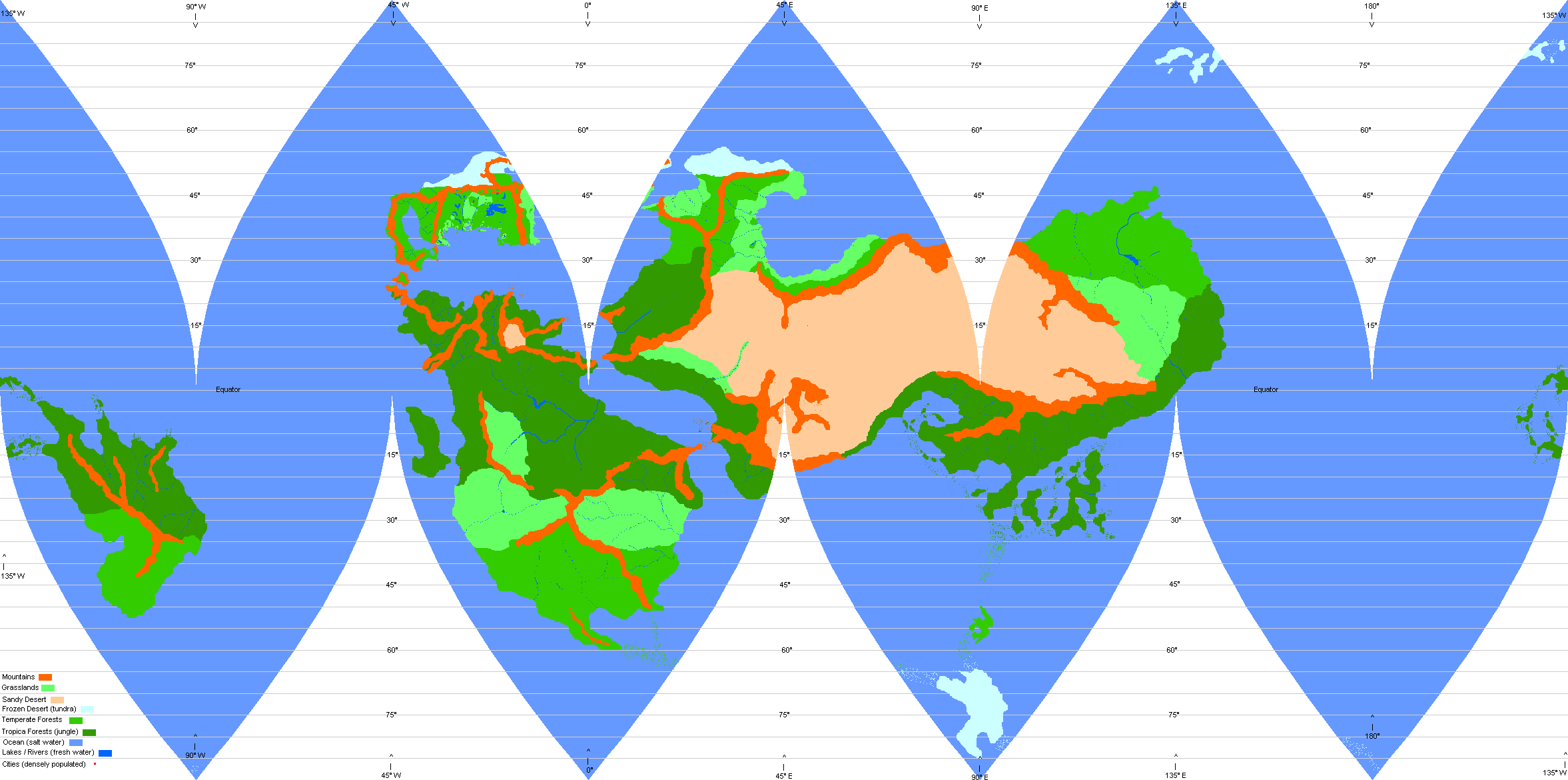
The World of Aernth is aproximately 7,493 miles in diameter. It has a circumfrence at the equator of 23,540 miles, and has a surface area of 176,384,873 square miles. It has a surface area just over 90% that of our own earth (thus is slightly smaller). Each pixel of the image equates to about 10 miles across (16.1 km, or 100 square miles, or 259 square kilometers). The rivers that are shown are not actually 10 miles across, but are meant to represent large navigable rivers.
You may notice that the "tundra" extends further from the "poles" in the north than it does in the south. Most of the intelligent inhabitants do not even realize this due to their lack of mapping technology. This is due to the water currents in the southern hemisphere travveling down from the equator along the coasts of the two southern continents, causing them to be warmer than expected. While the currents in the northern hemisphere above the 50th parallel keep most of the artic waters there, not allowing them to mix with warmer waters from the eqatoral regions very much, making them artifically cold further south. The depth of the ocean there, in conjunction with the salt content of the water, also keeps this water from freezing into a large ice cap, resulting in numerous but relatively small ice flows (ice bergs) above the 50th parallel.
The most detailed region at the present time is the small continent in the second portion of the northern hemisphere. But I hope to eventually have much of the surface detailed (although this is a huge project, much of it has already been done on paper and within my mind, so it is just a matter of converting it over to a digital format). However there are many sections that are not yet detailed in any way, other than appearing on the global map and as ideas.
 E-mail me at...