last updated 02.21.05
by webmaster
|| RENSSELAER SITE INFO
|| IMPORTANT NOTE ON TIME ZONES: The battle site is technically just over the dividing line between Indiana Time and Central Daylight Savings Time, But the town of Rensselaer (only 6 miles east) is in the Central DST zone. We are opting to keep things convenient for everyone and operate on Central time rather than Eastern... hey, if you come out of the Eastern zone, you gain an hour!
Site address for NFA purposes only is:
Haskell Farm
1921 E. Hwy 114
Rensselaer, IN 47978
Jasper County
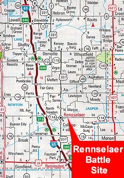
|| DRIVING DIRECTIONS:
FROM CHICAGO or INDIANAPOLIS: Off of I-65, take Exit 215 (SR 114) East to Rensselaer. Follow the signs to 114 East through town; proceed down SR 114, passing a large grain silo complex (3 miles out of Rensselaer). Keep going on 114, and at 6 miles from the eastern end of Rensselaer will be the Haskell farm; turn left at the "WW II" sign.
FROM THE EAST (FT.
WAYNE, IN): Take SR 24 West across to SR 421. Take 421 North
to SR 114; turn left (west). Keep going on SR.114, looking for the "WW
II" sign; turn right at the sign.
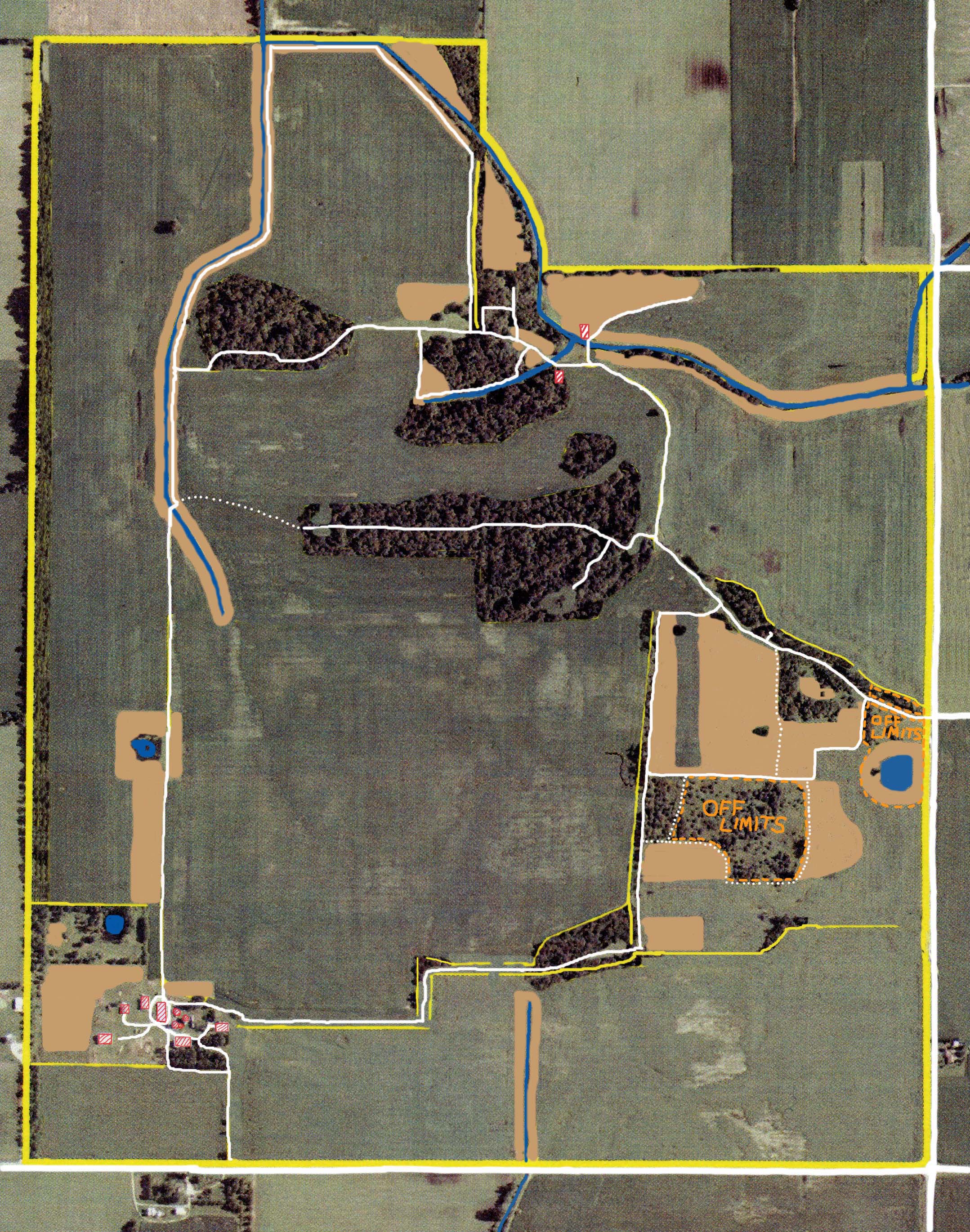
|| TACTICAL
MAPS || || THE TURRET || || BUNKER-RAMA ||