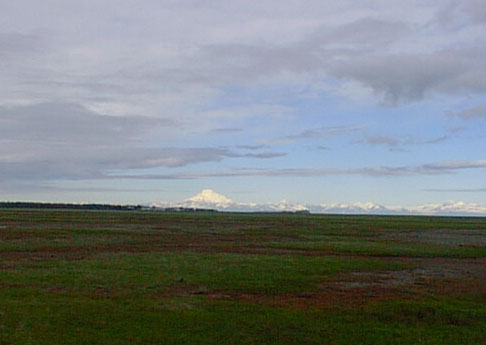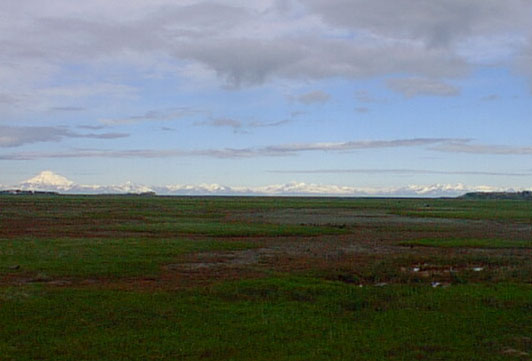
Today was partially overcast, but the mountains were so brilliant against the sky I wanted to try to get some photos for you. I wish you could see them as I do - the atmosphere makes them seem HUGE sometimes - or I wish my camera did a better job. Nevertheless, I give you some of our mountains.
Across Cook Inlet from Kenai . . . Mt. Redoubt (pronounced read-out with the emphasis on the second syllable) is one of several active volcanoes.
To the south of 10, 197 foot high Mt. Redoubt is Mt. Iliamna (which has not erupted since we have lived here) and Mt. Augustine which erupted in 1986. Several inches of volcanic ash covered Ninilchik to the south of Kenai during that eruptive phase. Iliamna can be seen from Kenai, but not today due to the cloud cover.
Moving northwards are several other peaks. One of them has recently been designated Mt. Florian at the request of area firefighters to honor those of their brothers lost Sept. 11, 2001. I believe that it is the very next peak visible to the right/north of Redoubt.
The green area in the foreground is a spring resting area for Snow Geese as they migrate to their nesting grounds. Also spotted in late April and May are Sandhill Cranes and Canadian Geese.
Between the green area and the "higher" ground seen here just below Mt. Redoubt (it is actually fish packing buildings) is the Kenai River.
Those buildings, by the way, were our first home in Alaska in 1978. We were winter caretakers - that is, boat babysitters, for our first winter. What a life - surrounded by water and mountains! This flatlander from Ohio was well pleased and smitten with her new home.
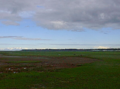
The higher land in the right part of the photo is "downtown" Kenai - the area fondly known as "the Bluff" or, in the book mentioned on the authors page (Dragline Kid) it was known as "Da Bank". The snow-capped peak you see at the far right of this photo is Mt. Spurr. This is also a volcano and had several eruptive phases in the early 1990s. The ash from these eruptions blew on the wind north of us and coated Anchorage. Here are some photos found on-line. They are not my images - some are credited, some are not: Mt. Redoubt with ice covered Cook Inlet.
Here is 10,013 foot Mt. Iliamna with some information on its eruptive phases.
Mt. Augustine is actually an island/volcano.
And, here is 11,066 ft. Mt. Spurr with a pretty neat satellite photo of the "ejecta" circling through the atmosphere.
Authors visit Kenai � Alaska Pics � Moose! � Windstorm
Back you go to the PurpleMoose
|