LANGENLONSHEIM
POTTONS TWIN TOWN
German version
The municipal district of Langenlonsheim lies in good agricultural land in the lower Nahe valley. Langenlonsheim Forest lies 300 meters above sea level and is a popular tourist spot. From the top you can see, to the north and east, the Taunus mountains and in the north and west the Hunsrück mountains. Because of its central location and good road and rail connections, Langenlonsheim can be reached easily from any direction. The A60 motorway takes you to the cities of Mainz, Wiesbaden and Frankfurt, and the A61 motorway to Cologne, Ludwigshafen/Mannheim and Speyer.
Langenlonsheim’s municipal history began in1800. In that year under the French government Langenlonsheim became a “Mairie" to which the communities of Bretzenheim, Laubenheim and Winzenheim belonged. This administrative district stayed together even after the withdrawal of the French and the transition to Preußen ( in the year 1815) of this area. It eventually became part of the district of Bad Kreuznach in 1816.
In 1939 the communities of Windesheim, Waldhilbersheim and Waldlaubersheim were added to the district of Langenlonsheim to make eight in all. On the 1st of October 1968 the communities were joined together to be called the “Verbandsgemeinde”. Since the agricultural reform ( 1970) Langenlonsheim consists of seven communities .The “Verbandsgemeinden” are only found the in Rhineland Palatinate.
The “Verbandsgemeinde Langenlonsheim” consists of Bretzenheim, Dorsheim, Guldental, Langenlonsheim, Laubenheim, Rummelsheim and Windesheim. The villages stayed independent, each having their own Mayor with a local council. TheVerbandsgemeinde is responsible for schools, fire prevention, and the building and maintenance of sport and leisure facilities, sewage disposal and the up keep of lakes and rivers. The administration is responsible for the administrative handling of all these tasks.
Langenlonsheim is a wine growing area known for it’s excellent wines. The suitable soil and warm climate were factors for the development of the area even in Roman times. Langenlonsheim was first documented in 769 as Longistisheim and changed hands many times in its’ history.
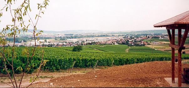
Langenlonsheim viewed from one of the grape terraces
Today Langenlonsheim is a thriving community with a large industrial estate. New development areas were opened and with many trade and business enterprises, Langenlonsheim has the fourth largest industrial estate in the Bad Kreuznach district. As well as the many businesses associated with the making of wine, there is a plastics factory, an electrical company and a farm machinery plant.
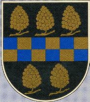
In 1991 a chronicle was published about the history of Langenlonsheim. In the town there is a sports and leisure centre (Kloningersmühle) with a track for light athletics, tennis club, football grounds and an outdoor swimming pool. There is a large community hall for cultural and sociable arrangements. There are two churches, the protestant church was built about 1588, and the catholic church is dated from the year 1907. The coat of arms of Langenlonsheim shows five grapes.
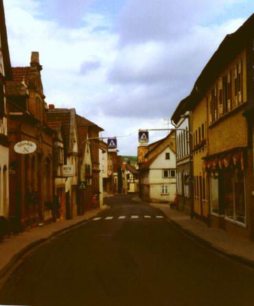
Langenlonsheim - Naheweinstrasse
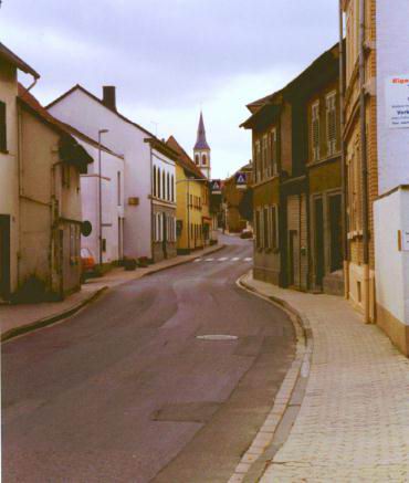
Naheweinstrasse looking towards the Protestant Church
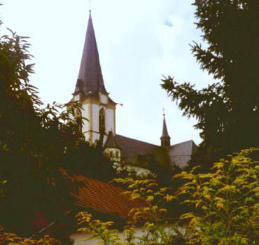
Langenlonsheim Catholic Church
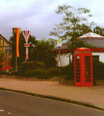
English Telephone Box outside the Town Hall (Rathaus)
Guldental
After the reform of the area in 1969 the villages of Waldhilbersheim and Heddesheim were joined together and called Guldental and this is the biggest wine growing area on the Nahe.
Heddesheim was first documented in 1163 and is the birthplace of Michael of Obentraut who won fame in the Thirty Years War. Gustav Pfarrius who was known as Singer of the Nahe was born there in the 18th century. He wrote many short stories of his birthplace and the first guide of the area for tourists. To cater for todays tourists there is a large camping area with 400 places.
Nearby are the tracks of the Hunsrück railway which used to carry passengers as well as goods. There is a new airport nearby called Hahn, planes from here fly into Stansted, England. The railway will be important again when this airport develops fully.
Thanks to: Ingeborg Duren for historical information
Andrew Inkersole for some of the photographs
These pages added 27 December 1999
To visit Potton Twinning Site, Click here
Back to Top