Whidbey Island, Washington Geo-Hikes
We will start off reviewing the findings from
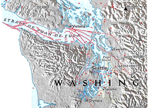
previous years, including the Ledgewood fault, Rocky Point floating
metasediments, slumping from cliff areas and water wells, movement on the
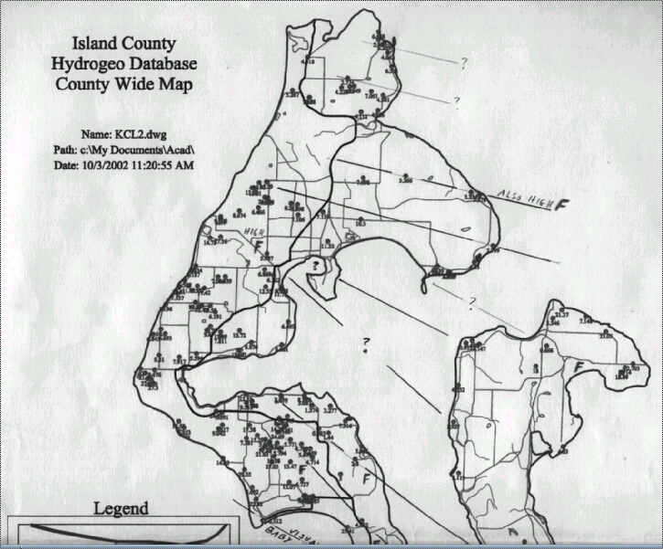
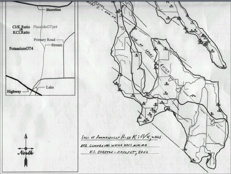
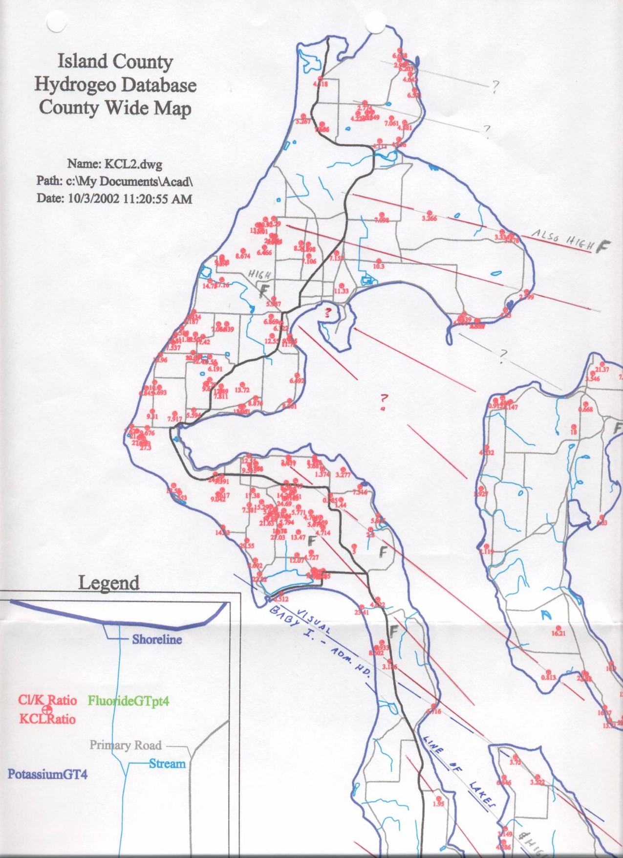
various fault systems, faulting as shown on LIDAR and fluoride in water
analyses, the occurrence of iron carbonates in seeps and well water, glacial
movements indications, Baby Island fault (Ledgewood) and small hogbacks, bays
created by faulting, and MORE! See pictures below.
Baby-Island ..|..
Baby-Island 2 ..|..
House ..|..
Ledgewood1 ..|..
Ledgewood2 ..|..
Strata ..|..
Wall-Fracture
Wall ..|..
Buckle, S. Hancock ..|..
Thrust, S. Hancock ..|..
Wedge, S. Hancock ..|..
Earthquake Indications, S. Hancock ..|..
Compression-S Lake Hancock ..|..
Pleistocene silts, S. Hancock
2004 Summary
Rocky Point pictures
Rocky Point N. Fracture...
Rocky Point N. Fracture
Harold L.
Overton:
2004 MISC. WHIDBEY ISLAND AREA INFORMATION