Cottonwood, Arizona Water & Geology Hikes
Harold has moved to St. George Utah, this data is for reference only.
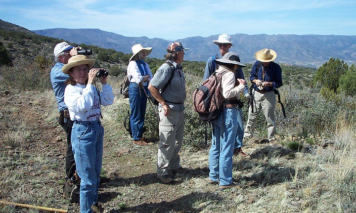
Trip Leader was Harold Overton
Our hiking group Petrologist is Dick Moore from Cottonwood.
Geology of the Cottonwood area by Harold Woods Canyon area
********************** Water Hikes, for geo-science people only.**********************
*************************** General Geology Hikes ***************************
Hike Announcements
Hikers: meet at the Wal-Mart parking lot in Cottonwood, at 8 am, Tue 13th for a
consolidation of autos, to hike into the Cherry Canyon. This hiking location is
near the road just south of the hiway 260 Justice Facility on the way to Camp Verde.
If anyone misses the meeting time, catch us at the paved turnoff, labeled Cherry,
just south of the Justice facility at 8:20. This is a paved road for a mile,
which changes into a graded gravel road. We will drive into the creek bed if
there is not running water. (We will drive west for about 5 miles before entering
the canyon with 4w vehicles, just before taking the numerous switchbacks toward the
town of Cherry). We will walk up the canyon reaching the faulting just before the
Precambrian rocks. There is exposed an excellent outcrop of the Laramide gravels
and Tbb, along with local grabens and Pm which has fallen into the gravels when
they were still soft (probably Oligocene time).
Hike Reviews
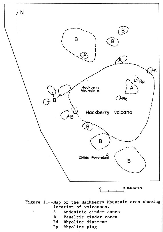
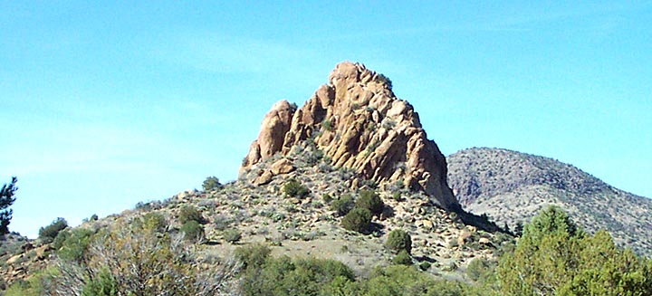
- March 24...Hike # eleven...for a hike into the Hackberry Volcanic center which straddles
the Fossil Creek road. Vent diagram ...Text
. Hike Review...Group pix
We had 8 hikers on this level 3 hike. The group tried to decide if a proposed
caldera was indeed a caldera. The results were about evenly split because of
the ambiguous nature of the proposed caldera boundries.
...Plug 1 Most of the volcanics on the hike
was Dacite, Rhyodacite & Basalt, more data and pictures are on the AFNM Area CD.
- March 18...Hike # ten...18th MARCH, for a hike into Lucky Canyon (near the salt mines) west of
the Verde River- to see deformed basalt flows near a branch of the verde fault. No review
- March 10...Hike # nine...Review
- Feb. 25...Hike # eight...No review.
- Feb. 18...Seventh hike...Repeat hike to Red Tank Canyon. The hike about
Red Tank-west revealed
some new facets to the analysis of the uplift of the Mogollon Rim,
and I will have to return to ferret out all of the information.
Here is an
analysis of Feb 18 geology, about Red Tank-west, on the
attachment.
- Feb. 11...Sixth hike...
Feb. 11----Red Tank Canyon- 18 my. dike cutting LARAMIDE gravels.
Hikers: gather at the Sedona Interchange of I-17 and hiway 179, at 9:30 am
for a hike into the TKg, where a basaltic dike cuts them, for an upper limit
age. Analysis of Feb. 11 hike geology
- JAN. 28...Fifth hike...
Hikers: meet at the intersection of hiway 179 and Beaverflat road, at 9 am,
Wednesday 28th, for a hike to Jack's canyon- Dr. Beus will show us how far
we can drive into a FS road, up this canyon. We can possibly drive in 1-2 miles,
in high clearance vehicles. Info
- JAN. 21...Fourth trip...
Hikers Meet at intersection of hiway 179 and Beaver Flat Road (north of the Beaver Ck.
Crossing, south of Village of Oak Creek- VOC ), at 9 am, Wed 21 Jan, for a hike into
Bias Canyon toward the Mogollon rim ;Duration= 4 hours, elevation change= 1000 feet,
Model ....Trip Results
- JAN. 14...Third trip...Results ... Trip info
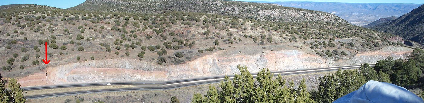
- JAN. 8...Second trip...We looked at faults south of the Verde graben (copper canyon) along I-17.
The Verde fault, which has a long history of up & down movement, is split
into a fault zone
at the location where I-17 winds down the side of the graben.
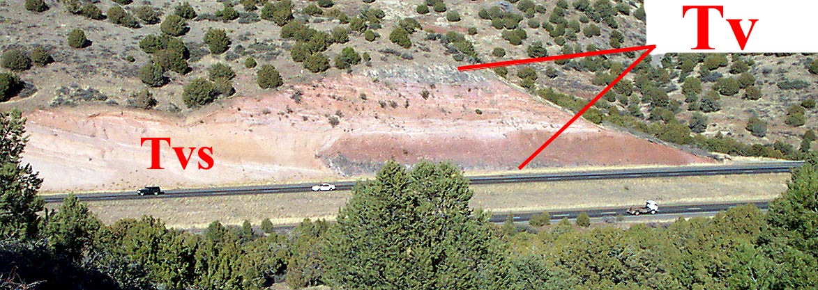
Start...Note the many tuff layers which came from
nearby volcanos. The lower darker basalt may have intruded
the tuff from below and caused what looks like burnt red soil above it.
Panoramic...Tv at top of the hill. The arrow points to
what looks like a lateral fault that strikes ~ 40deg.
Tuff...This rock shows an interesting and unusual outcrop of what
looks like layered basalt tuff and a more felsic tuff mixture.
- NOV. 13...
The first trips for the 2003 winter season will be a Volcanics trip to the;
1. Tuffs off hiway 169 east
2. Teepees, near Hackberry volcano, and a walk down the arroyo below the teepees
(viewing sedimentary igneous tuffs and basalts), taking 4-5 hours.