Emergency Evacuation Site Program
Northshore Forest
 |
|
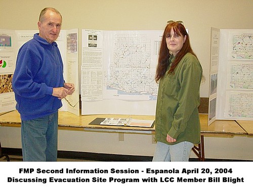
| In April 1997 the Sault Area Forestry Safety Committee (SAFSC) initiated a program where Emergency Evacuation Sites were established in the Sault Area. A critical injury which easily could have become a fatality inspired the members of this Committee to create the system. Emergency Evac Sites are points registered with the emergency response groups to assist forest workers in receiving medical attention as soon as possible. |
 |
In 2002, as part of this program, eight existing Evac Sites on the Sault Ste Marie District of the Northshore Forest were brought up to specs. North Shore Independent Forestry Association Inc (NSIFAI) established an Evacuation Site Sub-Committee, including representatives from Northshore Forest Inc (NFI). This Sub-Committee participates alongside the SAFSC. Also refer to the Protocol Flow Chart in PDF format. The proper procedure and maintenance of these sites is explained in Roles and Responsibilities.
Since 2003, Emergency Quick Reference Wallet Cards were prepared and distributed to forestry workers on an annual basis. Three additional sites were located in the Sault Ste. Marie District and maintenance was required by forestry companies who would soon be logging in these areas. Two of these were brought online in the Winter of 2003 and the other is scheduled for future use. |
| Plans are underway to establish Evac Sites within the Sudbury District of the Northshore Forest. Both NSIFAI and NFI are currently working together on this project. |
| Specs for Evacuation Sites |
- 150x150 feet diameter
- level
- tall trees around perimeter to be removed
- sandy sites to be seeded with grass. Note: evacuation sites should be seeded to minimize the amount of dust which is wearing on helicopter engines and may be uncomfortable for injured persons
- proximity to hydro lines and radio towers to be noted on maps
- where parking is a problem put up no parking signs (this can be enforced once LUPs are issued). Identify parking alternatives.
- where winter operations a taking place, evacuation sites that may be required should be kept plowed
- consider access to helicopter by vehicles transporting injured person
|
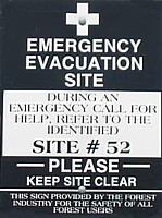
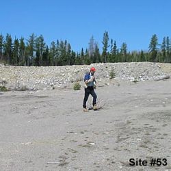
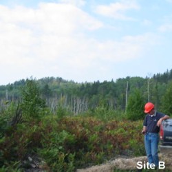
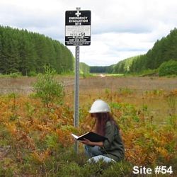
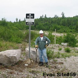
SITE LOCATIONS - MAPS - PICTURES
 
~ click buttons for Evac Site locations and information ~ |
 |
Inspections are carried out on an annual basis
Information is reviewed and confirmed at each site
Any maintenance that may be required is completed.
Trees that have grown up will be removed and any overgrown brush cleared in order to keep the landing areas clear
Signs may need to be straightened, ground re-levelled etc |
 |
| |
 |
NO PARKING
If you have received one of these on the windshield of your vehicle, this is a reminder that you are parking in a Registered Evacuation Site.
Please refrain from parking in that area in the future; we must keep these areas clear in the event of any emergencies. |
 |
Data and information is provided as a public service and for informational purposes only.
We endeavour to include accurate information, however we cannot warrant or assume any legal liability
or responsibility for the accuracy, completeness, or usefulness of any information provided. |
If you would like additional information on our Evacuation Site Program, please contact
North Shore Independent Forestry Association Inc.
P O Box 365
Spanish ON P0P 2A0

Email: nsifa@ontera.net |
|
|
|