Gairloch High School,
Geography Department
Abhainn Srath na
Sealga
a river study
This piece of work is aimed at 14-18
year old pupils or those interested in developing a knowledge and
understanding of the physical geography of rivers. This study is best
followed after an introduction to the subject. Access to Ordnance
Survey Landranger series sheet 19 would be helpful to further this
study and is needed for some of the tasks. Tasks are set at two
levels with those in B being more demanding.
The text
is available on one page
| Top
of page | Home
page |
|
Photograph 1
|
|
|
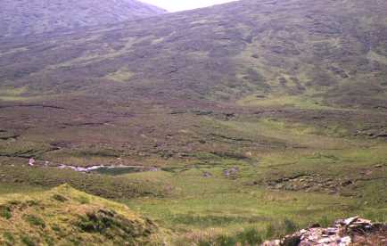
(092730, south)
This view was taken from next to the ruins named
'Feinasheen' on the map. There is little sign of running water in
this scene of heather covered peat and rushes. The watershed between
east and west flowing rivers is unclear in this deep U-shaped
valley.
Task A
1.1 What is the name for where a river
starts?
1.2 What is a watershed?
1.3 What evidence is there from the photograph
that this landscape has been glaciated? There is a clue in the text
.
Task B
1.4 This photograph was taken near to its source.
Describe three types of source that a river could have.
1.5 How could a watershed be easily
demonstrated?
| Top
of page | Home
page |
|
Photograph 2
|
|
|
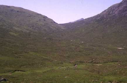
(085730, southwest)
This photograph, looking up Bealach na Croise, was
taken less than a kilometre from the previous one but shows clear
signs of running water. It could easily be argued that the principal
source of the river lies in Bealach na Croise.
Task A
2.1 Name any river features can be seen in this
photograph?
2.2 What evidence is there of erosion?
2.3 What evidence is there of
deposition?
Task B
2.4 By what means has the flow of the river become
greater between the source and here?
2.5 Use map evidence to support the statement in
the last sentence in the text.
| Top
of page | Home
page |
|
Photograph 3
|
|
|
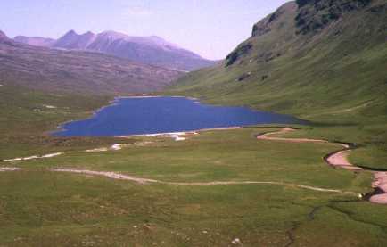
(081734, north)
The valley and loch in the photograph lie along
the line of a major fault. The glacier which moved down this valley
would have found this line of weakness easier to erode than the
surrounding undisturbed rock.
Task A
3.1 What is the loch an example of (albeit an
short one)?
3.2 Using the map to help, what term could be used
to describe the feature crossing the view in the
foreground.
3.3 Is there any evidence on the photograph that
the there has been a change to the foreground since the map was
drawn? (look at the left foreground)
| Top
of page | Home
page |
|
Photograph 4
|
|
|
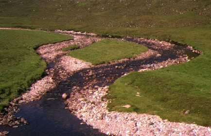
(087775, southwest)
Task A
4.1 Describe in detail what this photograph
shows.
| Next
page | Top
of page | Home
page |