Gairloch High School,
Geography Department
Abhainn Srath na
Sealga
photographs 5-8
| Top of page |
Home page |
|
Photograph 5
|
|
|
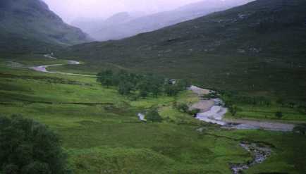
(090794, south)
This view looks up the river towards Loch an Nid,
seen in photograph three. The river here has changed its course; the
short stretch of water in the centre of the photograph shows where
the river used to flow. The river here is beginning to show signs of
a river in its middle course.
Task A
5.1 What is the term for the feature in the centre
of the photograph left when the river changed its course?
5.2 Under the headings of gradient (slope), width,
depth, valley floor,describe the difference between a river in its
upper and middle courses.
Task B
5.3 Using the map for extra information, label a
sketch of the photograph to show river features, names given on the
map and any other geographical features.
| Top
of page | Home
page |
|
Photograph 6
|
|
|
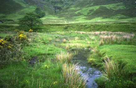
(089791, southwest)
This close-up of the feature shown in the previous
photograph shows it is some time since the river flowed along this
course. It is slowly filling and becoming a part of the river's
floodplain.
Task B
6.1 Describe the process of infilling that is
taking place.
| Top
of page | Home
page |
|
Photograph 7
|
|
|
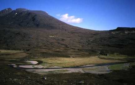
(075790, northeast)
The river here is meandering on a broad
floodplain. In middle right can be seen the semi-derelict house of
Achneigie.
| Top
of page | Home
page |
|
Photograph 8
|
|
|
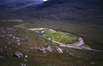
(073805, southeast)
This general view of Eilean a' Chip is included to
show the process of change that took place between 1994 and 1998. The
river in 1994 was taking the course shown on the map but was in the
process of cutting through the meander along the straight line. By
the time this photograph was taken, in 1997, the change was almost
complete. It would seem that this change in the river's course has
been a regular occurrence.
| Next
page | Top
of page | Home
page |