|
The Geography of |
![]() Click
here to connect to the Ministry of Education - Ontario Curriculum
for the Grade 9 Applied course
Click
here to connect to the Ministry of Education - Ontario Curriculum
for the Grade 9 Applied course
|
Date |
Lesson Topic |
Assignment / Homework / Text Reference |
|
|
Unit
1: Canadian Identity |
|
|
September 5 - 6 |
What is
Geography? Definition and brief note. Pattern |
Read Text Pg. 3
|
|
September 7 - 8 |
Canadian Symbols Canadian art, poems, music -Stompin' Tom -C-A-N-A-D-A
- |
Portfolio handouts Portfolio Cover:
|
|
September 11 - 13 |
ROC KING CAMP!!! |
HAVE FUN!!! |
|
September 14 - 17 |
The Human Connection Connections
between Similarities
among cultures. Pg. 299
Answer Qs 1 – 7 Definitions - Opinion, Fact Read pg. 300.
Do Q 1 – 3.
|
|
|
September 18 – 22 |
Latitude and
Longitude Atlas Exercise Read pg. 15 Do Q 21, 22
and 23 on pg. 16 Map
requirements – in text GeoSkills pg. 17 Q# 1 - 4 Thematic maps |
Remember: “Lat is Fat”, and “Long is Long”. ATLAS
EXERCISE HANDOUT.(/ 10 Communication, /15 Application) |
|
September 25 - 27 |
Time
Differences pg. 301, Q#4, 5, 6 Draw a
diagram to explain Q 4c) (see blackboard) Time Zones
pg. 302, Q# 7, 8 Read pg. 304
Different Times, Different Days. Do Qs 9 and
10 on pg. 304 |
GEOSKILLS Pg.
303. Read the 4
steps to calculating time differences. Copy the blue
box on pg. 304 into your notes. Do the “Practise It!” exercise Q 1 on pg. 304. |
|
September 28 |
Comparing
Economic Development Primary,
Secondary, Tertiary, Quaternary Sectors. Diversified,
Oil-Resource, Emerging Industrial, Agricultural Economies. Gross
Domestic Product (per capita) Do
Qs 16 and 17 on pg. 307 |
Read
pg. 305 – 306 Do
Qs. 11 – 14 on pg. 305 and 306. |
|
September 29 |
Rate Canada’s Quality of Life Opinion, bias, anthropocentric view Read Pg. 305 – 309
Comparing Human Development Do Qs 18 – 23 on pgs. 308
and 309 in your notebook. Use full-sentence answers
please! Case Study: pg. 311 - 312 |
What’s Your Opinion? Describe
your Quality of Life as a Canadian in a collage. |
|
October 2 |
Wrap it up. Do
Qs 1 – 4 on pg. 313 of text. |
Personal Ties Bingo Pg. 316 |
|
|
Unit
2: Natural Systems |
|
|
October 3 |
Introducing Regions (Handout Note & Questions) Activity: Map the regions of KCSS. |
A region is
any area that is different from the areas surrounding it! |
|
October 4 |
Characteristics of Natural Systems Landforms (pg. 23 –
27) What is a
landform region? Definition of a region note. Map the Regions
of
While watching the video,
make notes on the characteristics found within each of Canada’s landform
regions. |
1. Map Canada’s seven landform regions on the outline map using pg. 37 in your textbook as a guide. 2. Provide a legend for each
colour 3. Put a title on the map |
|
October 5
|
Quiz on Human and Cultural Regions (6 marks in Thinking) |
|
|
October 22 - 23 |
Plate Tectonic Theory note and diagrams Terms:
Ring of Fire, mantle, continental shelf, trench |
Constructing
a model to help explain sea-floor spreading
|
|
October 25 - 27 |
The
Canadian Shield (pg. 39 - 40) Building
Mountains (pg. 23) Plate
Tectonics Volcanoes Fold
Mountains GIS – Volcano
Investigator |
Do
Q #5 on pg. 39 Do
Q #1 on pg. 23 Do
Q #3 on pg. 23 Do
Qs 5 and 6 on pg. 25 Do
Qs 7 and 8 on pg. 25 The
Geologic History of Canada (4 maps to show Canada’s development) – Map 1: The
Precambrian Era |
|
October 30 |
Quiz on
Plate Tectonics How
to construct a Relief Profile Drawing
Profiles from contour maps: Handout Geoskills pg. 26 |
Hand
in Colin Island and Canadian Shield X-sections for 15 marks in the
Application category |
|
October 31 |
Forces
of Erosion and Uplift Forces
of Erosion diagram The
Formation of Limestone (sedimentary rock) diagram |
Do
Q #9 pg. 28 The
Geologic History of Canada (4 maps to show Canada’s development) – Map 2: The
Paleozoic Era Map 3: The
Mesozoic Era |
|
November 2 |
CANADA’S FOLD MOUNTAINSAppalachians
(pg. 43) How
the Appalachian mountains were formed The
Human Geography of the Appalachians The
Interior Plains (pg. 45) The
Western Cordillera (pg. 48) The
Formation of Coal and Natural Gas Diagrams. |
1.
Copy Figure 2.9 on pg. 43 into your notes. 2.
Do Q 14 on pg. 43 3.
Do Q 16 and 17 on pg. 44 4.
Do Q 19 on pg. 45 5.
Do Q 22 and 23 on pg. 49 |
|
November 3 |
|
Read
pg. 29. Do
Qs 11 and 12 on pg 29 (Use
pg. 13 of the Oxford 7th Edition atlas to answer Q 12.) |
|
November 6 - 10 |
The
formation of limestone diagrams. The
formation of fold mountains diagrams. The
formation of coal and gas. |
(Hand in for 6 marks in the thinking category). Interior
Plains pg. 45
Western
Cordillera pg. 48
|
|
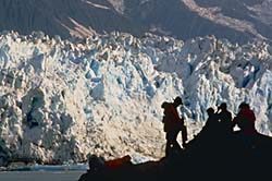
November 10 - 13 |
The Effects of Glaciation on the Canadian landscape: Erosion Deposition Meltwater The Formation of the Oak Ridges Inter-lobate Moraine
|
Glaciation pg. 29
|
|
November 14-18 |
The Formation of the
|
The Great Lakes / St.
Lawrence
|
|
November 21 |
Quiz on the Formation
of the
|
/5 marks in the
Communication category. |
|
November 22 |
|
Hand in for 20 marks in the
Knowledge category |
|
November 23 |
Cross-sectional
profiles of
|
The
Geologic History of Canada (4 maps to show |
|
November 24 |
|
|
|
|
Bioregions (pg. 54 –
65) BioRegions: Balanced Communities What
is a bioregion? Landforms + climate + water + soils + flora +
fauna + Humans Climate (pg. 33 –
36) How
to draw a climograph pg.
34 – 35 The Climate regions of |
Bioregions
pg. 54 – 65
Drawing Climographs Climate Region Jigsaw Create a model or graphic
representation of a bioregion. Summarize all information Present natural and human
characteristics, and how your bioregion fits
into the Global Biome |
|
|
Soil Soil
Composition (A
little bit of this, and a little bit of that) Typical
Soil Profile Eg. -
Grassland soils Biodiversity Soil
Map of |
Tundra soils - Do Qs 3 – 5
on pg. 56 Wetland soils - Do Qs 6 and
7 on pg. 57 Woodlot soils – Read pg. 57 |
|
|
Soil Quiz How
soil is related to climate and landforms |
|
|
|
Vegetation (pg. 60) Relationship
to landforms, soil and climate Deciduous
vs. Coniferous Which
strategy will win the “Energy Conservation Game”? |
Vegetation 1. Do Q 13 on pg. 61 |
|
|
Ecozones (pg. 70 – 81) What
is an ecozone? Transition
zones pg. 71. Human
Uses – Interaction in Ecozones. Natural
Corridors (pg. 67) |
Ecozones
Hint:
Remember when we looked at regions, there were two types: human and natural.
Why were boundary lines between human regions easier to see? Case Study: The Hudson
Plain Ecozone
|
|
|
Video study: Ecozone
examples
|
|
|
|
Wildlife Relationship
to vegetation, climate, and humans Threats
to Ecozones Fragmentation Article: Report urges protection for Algonquin wolves. The Article: Guess what's coming for dinner. The Globe and Mail.
Mon., Aug. 26, 2002 |
Culminating Activity: Presentation "Our Favourite Bioregion" (Communication evaluation) |
|
|
Unit 3a: Human
Systems: Population |
|
|
|
Demographics (pg.
88 – 102) Census Our class: Mini-census Census districts Video: CBC
News in Review: Mar. 2003 Census 2001: Diverse Cultures (pg. 103 –
108) |
Mini Census Questions
|
|
|
Population Density High, Medium, Low Calculating Population
Density Population Patterns in |
Population Density
|
|
|
Lesson and
Note on How to Construct Population
Pyramids Population Pyramid analysis
handout Factors in Population
Change |
Construct population
pyramids for 4 countries - |
|
|
Immigration YES/NO 3 Classes of
Immigrants (Family, Independent, Refugee) 4 Immigration Case
Studies. Video: Who
Gets In? Play the Immigration game. |
|
|
|
Communication
Quiz (Reasons
For and Against Changing |
|
|
|
Pull
Factors Push
Factors Chain
Migration |
Push and Pull Factors pg.
107
Case Study: Kensington
Market,
Hint:
Set up the chart for Kensington chain migration like
this Read
some more and see interesting old pictures of Kensington market here |
|
|
Regional Economics Core Periphery Migration trends –within - to other
countries (pg. 125 – 128) |
|
|
|
Unit 3b:
Human Systems:
|
|
|
|
First Nations Peoples in A History of
Frustration
Native Claims: Growing Frustrations
Kashechewan:
Toxic Water
A video about being caught between 2 worlds. |
“It makes you
so angry that you want to pick up a gun and start shooting up the place” After
watching the videos,
|
|
|
Connections
between First Nations Peoples and Ecozones. |
First Nations Peoples:
Specific Groups.
|
|
|
Transportation – no roads,
no rails Resources – hunters etc.
pipeline Social Services –
frustration |
Write a Legend. |
|
|
Unit 3c: Life in Cities Urban versus Rural
Characteristics (pg. 118 – 128, pg. 131 – 139) Urban Sprawl (pg. 129 –
130) |
Venn Diagrams: Urban,
Rural, Suburban, Wilderness Mapping Assignment pg. 149 |
|
|
Unit 4: Human
- Environment Interaction |
|
|
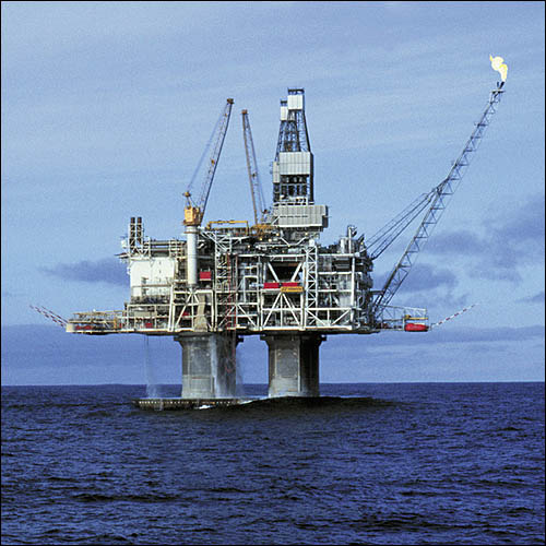
|
Energy (pg. 220 – 236) Location
of Energy
Mega Projects – Advantages and Disadvantages Athabaska Renewable
versus Non-Renewable Energy
Conservation GIS. |
|
|
|
Industry Types Primary (pg. 154 – 171) Secondary (pg. 172 – 186) Tertiary (pg. 187 – 200) Quaternary (pg. 201 – 215) |
Case study: Geographical
Requirements to determine the location of an industry. (Correlation) Pg. 158
– 159 |
|
|
How Human Activities Affect the
Environment (pg. 237 – 263) Pollution
– acid rain (cross-border) etc. |
|
|
|
Transportation Routes Advantages
and Disadvantages -for people -for the environment -affordability |
Map transportation networks
for best route for carpool, bike route, bus schedule from Point A to B. Snowmobile Route (pg. 82 –
85) |
|
|
Tourism (pg. 286 – 298) Canadian
Tourist Destinations Tourism
Importance to Canada Environment
versus Recreational Use Effects
on Environment Recreation Developments
in Sensitive Environments. |
Video:
White Water Rafting Video:
Extreme Sports Read Pg. 69 Do Qs. 1 – 4 on pg. 69 in
your notebook. |
|
|
Unit 5: Sustainable Development
|
|
|
|
|
|
|
|
Prediction of consequences
of human activities on natural systems Climate Change Garbage : Recycle,
Incinerate, Landfill Renewable energy – smart
cars, wind turbines etc. |
|
|
|
Ecological Footprint (pg. 265 – 279) |
Calculate your own EF. |
|
|
Promote environmental
awareness Video: Water
for tomorrow |
Conduct a survey of methods
to reduce energy and water use. Develop Questions Collect Data Organize Interpret – Select Relevant
Data Debrief |
|
|
Write a plan to address a
local environmental cocncern Eg. Summer Water Use Aquifer Groundwater contamination Pesticide Use Dump location. |
|
|
|
Unit 6:
Global Connections |
|
|
|
Global Connections (pg. 318 – 327) Economic Ties (pg. 318) |
Make a list of 10 relationships Canada has with other countries. Give an example for each. |
|
|
International Agreements NAFTA (pg. 319) |
|
|
|
Participation in Global
Warming Reductions (pg. 323) |
|
|
|
Portfolio Evaluation |
Cumulative Assessment is worth 10% of mark. |