![]()
![]()
![]()
![]()
![]()
![]()
|
|
|
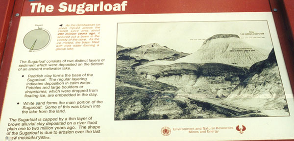
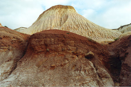
Visually this was the highlight of the walk, we were stunned by the form and colour of this geological formation. (If you have difficulty reading the information from the photograph of the sign I have retyped it below.)
Information next to the pie chart:As the Gondwana ice sheet moved across the Hallett Cove area about 200 million year ago, it scoured out a basin in the vicinity of the cove. As the ice melted, the basin filled with melt water forming a glacial lake.Information next to the sign's photograph:The sugarloaf consists of two distinct layers of sediment which were deposited on the bottom of an ancient melt water lake.
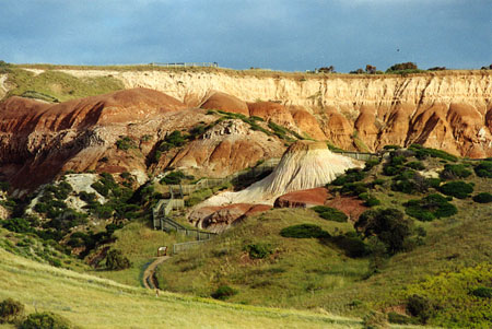
The sugarloaf is capped by a thin layer of brown alluvial clay deposited on a river flood plain one to two million years ago. The shape of the Sugarloaf is due to erosion over the last few thousand years.Distant view of the "sugarloaf" and the surrounding countryside, the variation in colourings of the whole area is what makes it so staggering to behold.
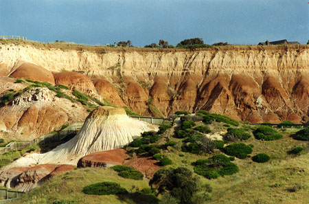
Here we are a little closer and as you can see the colourings of the whole area become even more intense.
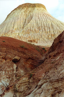
Here we are right underneath the sugarloaf, layers of colours caused by the different materials and erosion patterns clearly visible.
Another view, even closer ...... we were just stunned by this landform!
|