![]()
![]()
![]()
![]()
![]()
![]()
|
|
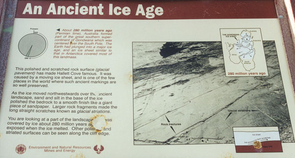
(If you have difficulty reading the information from the photograph of the sign I have retyped it below.)
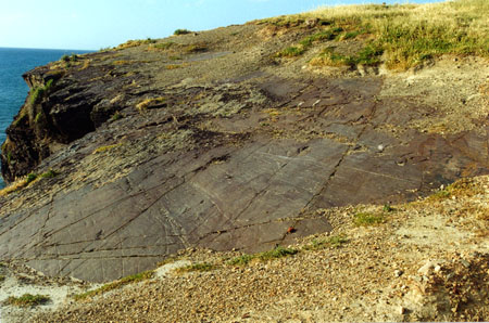
Information next to pie chart:About 280 million years ago (Permian time), Australia formed part of the great southern super-continent of Gondwana which was centered over the South Pole. The Earth had plunged into a major ice age, and an ice sheet similar to that in Antarctica covered most of his landmass.Information next to the sign's photograph:This polished and scratched rock surface (glacial pavement) has made Hallett Cove famous. It was caused by a moving ice sheet, and is one of the few places in the world where such ancient markings are so well preserved.As the ice moved north westwards over the ancient landscape, sand and silt in the base of the ice polished the bedrock to a smooth finish like a giant piece of sandpaper. Larger rock fragments made the long straight scratches known as glacial striations.You are looking at a part of the landscape which was covered by ice about 280 million years ago and was exposed when the ice melted. Other polished and striated surfaces can be seen along the cliff edge.The above information certainly made this site meaningful to us. You were just standing the other side of the fence from "scratches" that were made by a glacier over 280 million years ago! Staggering!
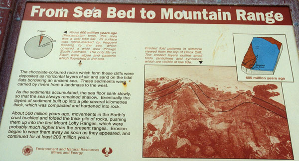
(If you have difficulty reading the information from the photograph of the sign I have retyped it below.)
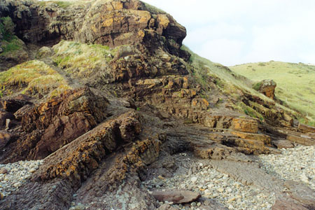
Information next to pie chart:About 600 million years ago (Precambrian time), this area was a vast tidal flat. Its surface was ripple-marked by frequent flooding by the sea, which covered a wide area through South Australia. The only life on Earth were algae and bacteria which flourished in the sea.Information next to the sign's photograph:The chocolate-coloured rocks which form these cliffs were deposited as horizontal layers of silt and sand on the tidal flats bordering an ancient sea. These sediments were carried by rivers from a landmass to the west.As the sediments accumulated, the sea floor sank slowly, so that the sea always remained shallow. Eventually the layers of sediment built up into a pile several kilometres thick, which was compacted and hardened into rock.About 500 million years ago, movements in the Earth's crust buckled and folded the thick pile of rocks, pushing them up into the first Mount Lofty Ranges, which were probably much higher than the present ranges. Erosion began to wear them away as soon as they appeared, and continued for at least 200 million years.We probably didn't capture everything we should have in this photograph, but you can certainly see that the rocks have been pushed up and folded.
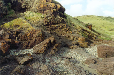
.....the folding and tilting is even more visible in the next photograph.
|