![]()
![]()
![]()
![]()
![]()
![]()
|
|
(If you have difficulty reading the information from the photograph of the sign I have retyped it below.)
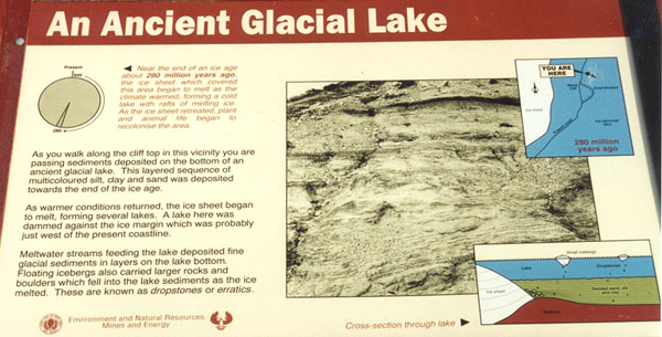
Information next to the pie chart:Near the end of an ice age about 280 million years ago, the sheet which covered the are began to melt as the climate warmed, forming a lake with rafts of melting ice. As the ice sheet retreated, plants and animals than began to recolonise the area.Information next to the sign's photograph:As you walk along the cliff top in this vicinity you are passing sediments deposited on the bottom of an ancient glacial lake. This layered sequence of multicoloured silt, clay and sand was deposited towards the end of the ice age.As warmer conditions returned, the ice sheet began to melt, forming several lakes. A lake here was dammed against the ice margin which was probably just west of the present coastline.Meltwater streams feeding the lake deposited fine glacial sediments in layers on the lake bottom. Floating icebergs also carried larger rocks and boulders which fell into the lake sediments as the ice melted. These are known as dropstones or erratics.As you can see the layers of silt, clay and sand are very obvious, we assume the red layer is silt, the brown layer is clay and the yellow layer is sand.
........more clay, silt and sand layers......
It is difficult to imagine ice carrying huge rocks, but the explanation below helps you to understand how rocks consisting of such different material to the cliffs were found in this area. (If you have difficulty reading the information from the photograph of the sign I have retyped it below.)
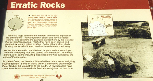
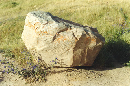
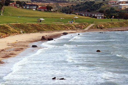
Information from the pie chart:Near the end of an ice age about 280 million years ago, the temperature rose, causing the ice sheet over Gondwana to melt and eventually disappear. The ice sheet over Antarctica did not reform until about 35 million years ago.Information next to the sign's photograph:These two large boulders are different to the rocks exposed in the cliffs below. They are paler in colour and have a coarser texture. The boulders are quartzite, carried here by the ice sheet that covered Gondwana. Rocks that have been carried and dropped by ice are called erratics. Softer silt and clay, which formerly surrounded these boulders, have been eroded away.As the ice sheet rode over the land, huge boulders were ripped from the underlying rock and carried vast distances. As the ice melted, rock debris including these boulders was dumped at the edge of the ice sheet.At Hallett Cove, the beach is littered with erratics, some weighing several tonnes. Some of these are of a distinctive granite from Victor Harbor, 50 kilometres to the south. A few boulders have come from Antarctica to which Australia was joined at that time.The boulders did not belong to this area, they were of a different colour and texture to the surrounding area, you knew that they had been carried here from somewhere else.
Yes, and as you can see the beach is strewn with huge boulders!
|