VARIOUS MAPS CREATED WITH DATA FROM RIO MINHO BASIN
1.
Topography and Hydrography of the Basin
(an ArcView map)
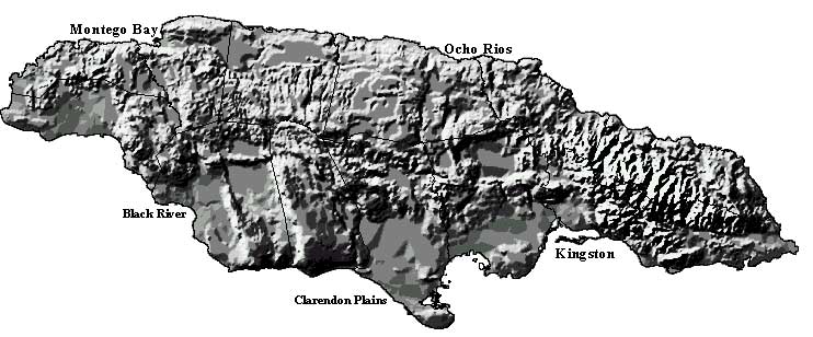
2.
Topography of Jamaica
(an ArcView hillshade projection)
3.
Rio Minho Basin: Relief, wells, springs
(an ArcView hillshade projection)
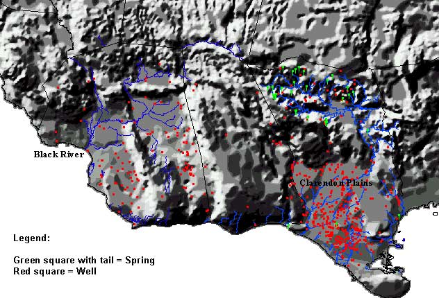
4.
Wells and Springs
(a GWW map)
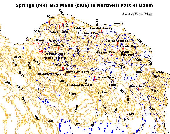
5.
Springs and Wells in Northern Part of Basin
(a GWW map)
6.
Abstraction Wells
in Clarendon Plain (a GWW map)
7.
Sites with Chemical Analyses
(a GWW map)
8.
Well Sites with Known Lithology
(a GWW map)
9.
Water Level Monitoring Network
(a GWW map)
10.
Well Sites with Repeated Ground Water Quality Monitoring
(a GWW map)
11.
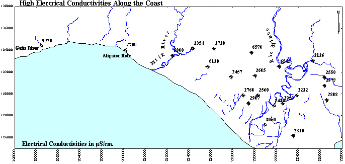
Electrical Conductivities
in Coastal Belt (a GWW map)
12.
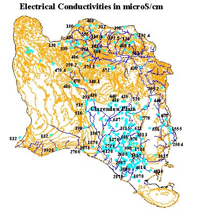
Electrical Conductivities
in Rio Minho (an ArcView map)
13.
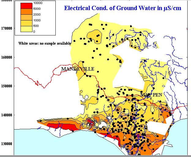
Electrical Conductivities
in Rio Minho (a GWW map)
14.
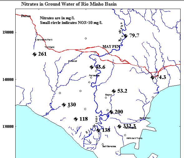
Nitrates in Ground Water
(a GWW map)
15.
Karstic Developments
in Rio Minho (a GWW map)
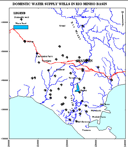
16.
Domestic Wells (N.W.C.)
in Rio Minho Basin (a GWW map)
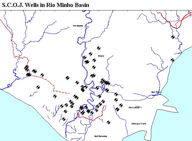
17.
S.C.O.J. Wells
in Rio Minho Basin (a GWW map)
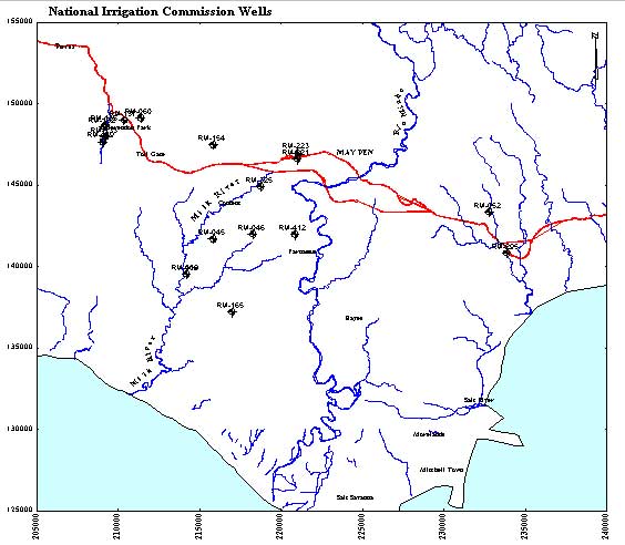
18.
National Irrigation Commission
Wells (a GWW map)
19.
Domestic Wells Near Rio Minho
(a GWW map)
20.
Wells near Rio Minho and Waste Pond with Time Series
of Water Quality Parameters (a GWW map)
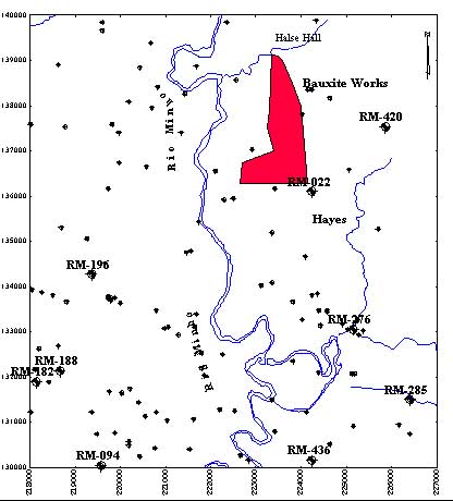
21.
Wells Near Industrial Waste Pond
(Halse Hall-Hayes) (a GWW map)
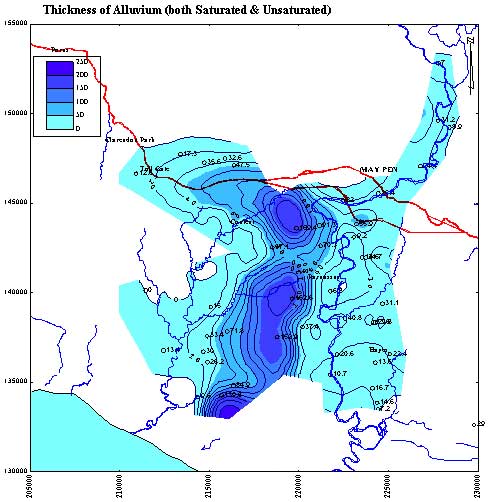
22.
Thickness of Alluvium
in Clarendon Plain (a GWW map)
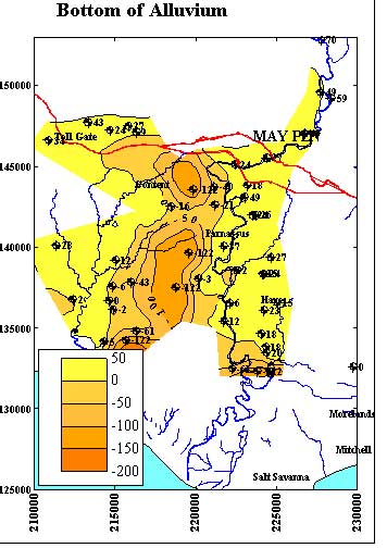
23.
Elevations of Bottom of Alluvium
in Clarendon Plain (a GWW map)
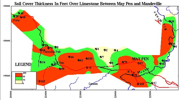
24.
Soil Thickness over Limestone Aquifer
between May Pen and Mandeville (a GWW map)