
![]() his is the map created with ArcView showing topography and hydrography of the Rio Minho Basin. Ground surface elevation contours are in feet. The lower part (below about 250 ft.) is known as the Clarendon Plain. Blue dots are wells, red dots with tail are springs.
his is the map created with ArcView showing topography and hydrography of the Rio Minho Basin. Ground surface elevation contours are in feet. The lower part (below about 250 ft.) is known as the Clarendon Plain. Blue dots are wells, red dots with tail are springs.
The Rio Minho Basin extends over an area of 1,750 sq.km. The Basin is subdivided into three sub-basins and three hydro-sytratigraphic units. Their respective catchment areas are as follows:
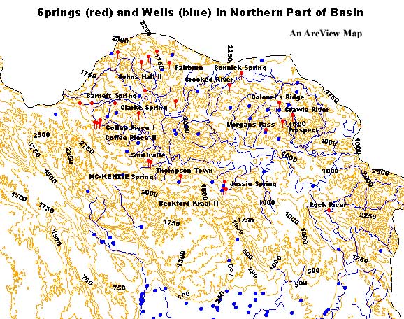
![]() he Upper Rio Minho basin corresponds to the impermeable catchment of the Basin. It is drained by the Rio Minho and its main tributary the Pindars River. The streams are oriented from west to east. There are many springs feeding surface streams. A larger-scale map of the northern part of the basin is also made a part of this presentation.
he Upper Rio Minho basin corresponds to the impermeable catchment of the Basin. It is drained by the Rio Minho and its main tributary the Pindars River. The streams are oriented from west to east. There are many springs feeding surface streams. A larger-scale map of the northern part of the basin is also made a part of this presentation.
![]() he Rio Minho enters the Clarendon Plains sub-basin NNE of May Pen at North Hall. The Rio Minho looses all of its dry season flow to the limestone aquifer between North Hill and Alley, an average of 20 MCM/Y (million cubic metres per year).
he Rio Minho enters the Clarendon Plains sub-basin NNE of May Pen at North Hall. The Rio Minho looses all of its dry season flow to the limestone aquifer between North Hill and Alley, an average of 20 MCM/Y (million cubic metres per year).
The other sub-basin unit is the ![]() ilk River sub-basin. It drains perched limestone aquifer storage in the north-west section of the sub-basin and the central and western areas of the alluvial Clarendon plains. The Milk River is seasonal above Rest.
ilk River sub-basin. It drains perched limestone aquifer storage in the north-west section of the sub-basin and the central and western areas of the alluvial Clarendon plains. The Milk River is seasonal above Rest.
There is no perennial or seasonal surface water stream within the Manchester Highlands sub-basin.
Ground water potential is associated with a limestone aquifer in the Manchester Highlands Sub-basin and with an alluvium and a limestone aquifer in the Clarendon Plains Sub-basin.
![]() larendon Plains Limestone Aquifer is ponded in the karstic Clarendon Plains limestone aquifer by clayey alluviums on the downfaulted southern block of the South Coastal Fault. Along its south-eastern boundary, alluvium and underlying coastal aquiclude act as a barrier to direct underflow to the sea. The aquifer is recharged mainly by rainfall but it also receives river recharge from the Rio Minho. Natural aquifer discharge occurs via the Cockpit and Bowers Springs along its south-eastern boundary.
larendon Plains Limestone Aquifer is ponded in the karstic Clarendon Plains limestone aquifer by clayey alluviums on the downfaulted southern block of the South Coastal Fault. Along its south-eastern boundary, alluvium and underlying coastal aquiclude act as a barrier to direct underflow to the sea. The aquifer is recharged mainly by rainfall but it also receives river recharge from the Rio Minho. Natural aquifer discharge occurs via the Cockpit and Bowers Springs along its south-eastern boundary.
Mean annual recharge to this aquifer was estimated at 280 MCM/Y, based on a recharge area of 505 sq.km., mean annual rainfall of 1,392 mm, and a recharge coefficient of 0.4.
Main limestone aquifer storage under the Clarendon Plains has a water quality which is adequate for all uses. It is protected from chemical and bacteriological contamination by the overlying alluvium. Localised areas of overpumping along the southern boundary of the aquifer have resulted in the contamination of well production by underlying saline ground water trapped at depth in the aquifer.
![]() larendon Plains Alluvium Aquifer occupies about 145 sq.km area approximating the southern half of the Clarendon Plain. Aquifer thickness averages 40 m. Aquifer recharge is mainly from rainfall, irrigation surplus and contributions from the Rio Minho above Alley. Aquifer discharge occurs via coastal swamps to the sea, drainage by the Rio Minho downstream of the Alley and well abstraction. There appears to be a restricted hydraulic continuity between the alluvium and the underlying limestone, each functioning as an independent aquifer system. A total safe yield for this aquifer was calculated and/or implied at about 88 MCM/Y.
larendon Plains Alluvium Aquifer occupies about 145 sq.km area approximating the southern half of the Clarendon Plain. Aquifer thickness averages 40 m. Aquifer recharge is mainly from rainfall, irrigation surplus and contributions from the Rio Minho above Alley. Aquifer discharge occurs via coastal swamps to the sea, drainage by the Rio Minho downstream of the Alley and well abstraction. There appears to be a restricted hydraulic continuity between the alluvium and the underlying limestone, each functioning as an independent aquifer system. A total safe yield for this aquifer was calculated and/or implied at about 88 MCM/Y.
Salinities in the alluvium are often too high for use as a source for domestic supplies and approaches the upper limit recommended for irrigation.
![]() anchester Highland Limestone Aquifer is partially ponded by coastal alluvium aquiclude. The aquifer is in direct hydraulic continuity with the sea, in places where the alluvium is absent. Aquifer discharge supports flow in four perennial streams. Mean annual rainfall of 1,550 mm over the limestone outcrop results in aquifer recharge of about 223 MCM/Y.
anchester Highland Limestone Aquifer is partially ponded by coastal alluvium aquiclude. The aquifer is in direct hydraulic continuity with the sea, in places where the alluvium is absent. Aquifer discharge supports flow in four perennial streams. Mean annual rainfall of 1,550 mm over the limestone outcrop results in aquifer recharge of about 223 MCM/Y.
Source: Water Resources Development Master Plan, Jamaica, Ministry of Agriculture, 1985.