Location Access History Topography Climate Home Page


TOPOGRAPHY

Lying in the southern part of Western Ghat, immediately south of Palghat gap, Parambikulam Wildlife Sanctuary, exhibits mountainous terrain.

The 
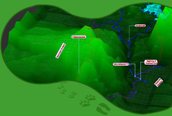
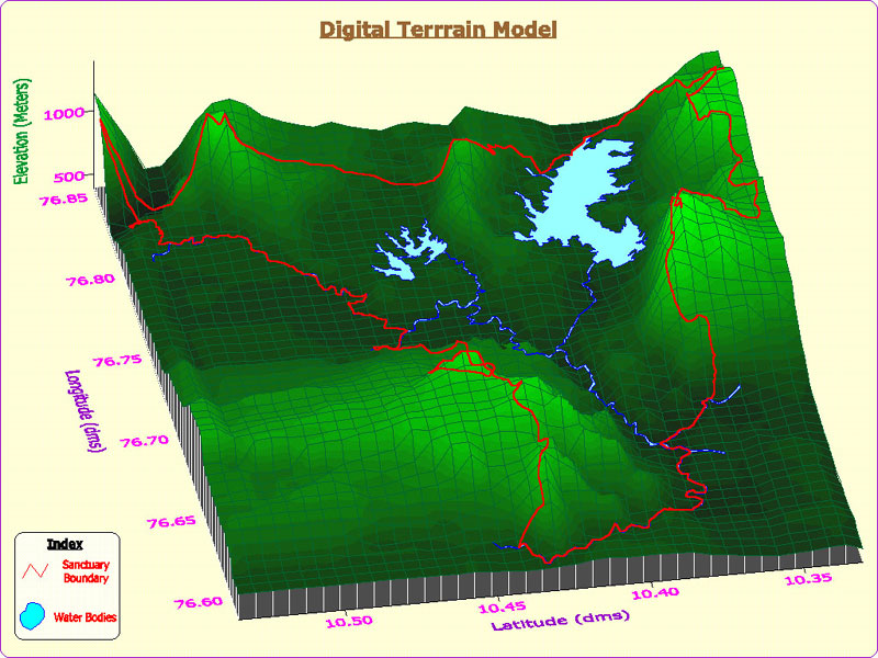
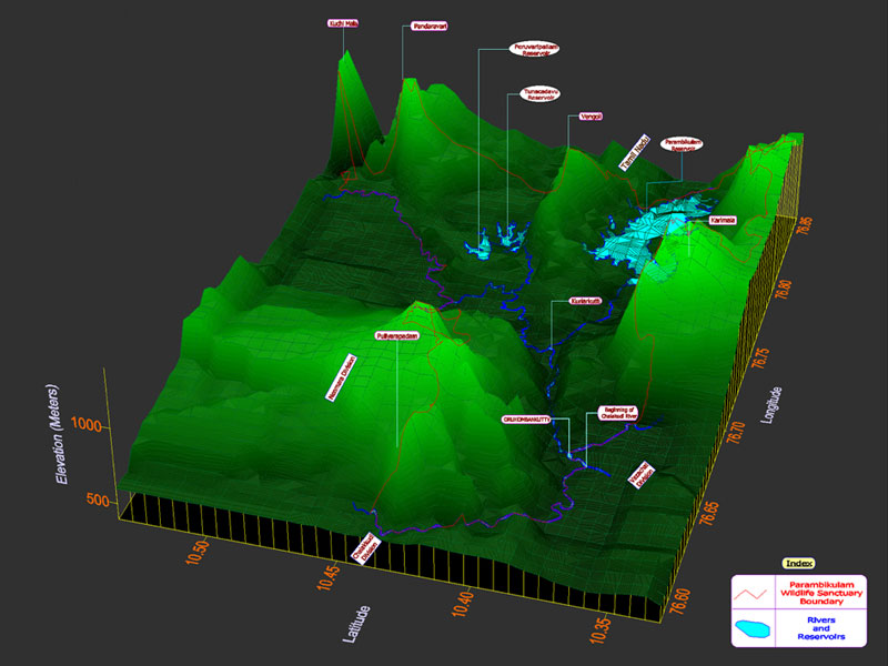
sanctuary lies in between the Anamalai hills and Nelliampathy hills. Altitude ranges between 300m and 1438m above MSL. There are 7 major valleys and 3 major river systems. Geologically the sanctuary has Hornblende biotite gnesis and charnockites. Major peaks in the sanctuary are Karimala (1438m), Pandaravarai (1290m) ,Kuchimudi, Vengoli (1120m) and Puliyarapadam (1010m). Apart from the natural rivers and streams, the sanctuary possesses 3 man-made reserviors namely Parambikulam, Thunacadavu and Peruvaripallam whose cumulative waterspread is 20.66 sq. km.

General Information
:
Location | Access | History | Topography | Climate
Biodiversity
:
Habitat| Plants | Animals
Native People
:
The People | Their Knowledge
Visitors Guide
:
Attractions | Eco-Tourism | Accommodation | Fees & Tariff | Season & Time
Contacts
:
Contact | Credit | Feedback
Others
:
Photo Gallery | Maps | Research | News Letters


Parambikulam Wildlife Sanctuary
Kerala Forest and Wildlife Department
Anappady, Thunacadavu, Parambikulam, Palakkad District, Kerala State, 678 661
Phone: 04253-277233

Email: [email protected],
Web: www.parambikulam.com

All Rights Reserved. Copyright © Kerala State Forest and Wildlife Department.
Website by: Iris Software Consultancy
for Vouge Systems, Chennai


Home
Hosted by www.Geocities.ws

1