The land
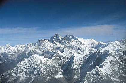
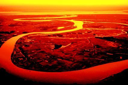
Rivers are the key to life in South Asian. From sources high in the himalaya, three major river systems the Indus, the Brahmaputra, and the Ganges, fan out across the northern part of the Indian subcontinent. All three rivers carry fertile soil from the mountain slopes onto their floodplains as the rivers swell with seasonal rains.The Indus River flows mainly through Pakistan, waterin orchards of peaches and apples before emptying into the Arabian Sea. It also serves as an important transportation route.The Brahmaputra River flows east through the Himalaysa and then west into India and Bangladesh. There it joins the Ganges, to form a delta before emptying into the Bay of Bengal.The Brahmaputra is a major inland waterway. Ships can navigate the river from the Bay of Bengal as far inlad as Dibrugarh in the Indian state of Assam , about 800 miles from the sea. The Brahmaputra provides Bangladesh with 50 percent of its power through hydroelectricity.The Ganges River flows east from the Himalaya.It is the mos important river of South Asia, drawing waters from a basin covering about 400,000 square miles. Fed by water from snow capped peaks, the Ganges retains its size throughout the year, even during the hot, dry season from April to June.
Standards
- Students show the connections, causal and otherwise, between particular historical events and larger social, economic, and political trends and developments.
- Students recognize the complexity of historical causes and effects, including the limitations on determining cause and effect.
- Students interpret past events and issues within the context in which an event unfolded rather than solely in terms of present-day norms and values.
- Students understand the meaning, implication, and impact of historical events and recognize that events could have taken other directions.
- Students analyze human modifications of landscapes and examine the resulting environmental policy issues.