Carinthia, Styria, & Burgenland
|
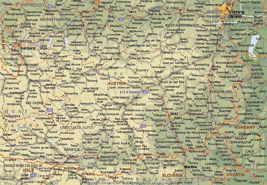
Page 4 |
Carinthia, Styria, & Burgenland
In the province of Carinthia (Kärnten), the principal rivers are the Drava and the Gail. The area known as Upper Carinthia, to the west of the confluence of the rivers, is in a mountainous section of the Alps and is the site of Grossglockner (12,457 ft), the highest peak in Austria. Mining of lead, zinc, iron, and lignite are important in the region, as are lumbering and the raising of cattle and sheep. The area east of the confluence of the Drava and the Gail is known as Lower Carinthia. This region is also mountainous, but it contains the fertile Drau Basin, in which wheat, rye, maize, and fruit are grown. Wörther See is a resort lake that attracts many tourists. The capital city of Klagenfurt and the town of Villach are the chief industrial centers, with plants for the manufacture of metals, chemicals, and textiles. Carinthia, at one time a Roman possession, was made an independent duchy in 976. The present province is sparsely populated. Slovenes make up a significant part of the population in the southern section.
The province of Styria (Steiermark), located in southeastern Austria, is noted for its scenic beauty. Its 6,327 square miles are covered by numerous small lakes and heavily forested mountain slopes. Despite the provinces mountainous terrain, Steiermark has large tracts of arable land, particularly in the valleys of the Enns, Mur, and Raab rivers. Agricultureparticularly the raising of livestock and the cultivation of maizeemploys a large proportion of the population. Mining is also an integral part of the economy. Minerals extracted in Steiermark include lignite, magnesium, graphite, and iron ore. Industry is concentrated around the Mura Valley and Graz, the provincial capital; these include ironworks, sawmills, and numerous heavy manufacturing plants. A Roman province in ancient times, the region has fallen under the dominion of numerous rulers. Over the centuries, the history of Styria has been intermingled with that of the Bavarians, the Franks, the Slavs, the Germans, and the Austrians.
The low-lying plains of the northern section of the province of Burgenland contain large tracts of pastureland and arable farmland. Elsewhere, the terrain of the province is hilly and thickly forested. About two-thirds of Neusiedler See lies within Burgenland. The main river is the Raab. Temperate climatic conditions prevail throughout most of the province. Livestock farmingespecially the raising of cattle, hogs, and poultryand lumbering are leading industries. The principal crops include grains, fruits, wine grapes, legumes, sugar beets, hemp, and flax. Deposits of bituminous coal, limestone, and sulfur are worked. Manufacturing consists largely of small-scale food processing. The population of Burgenland is mostly rural. Eisenstadt, the capital, is one of the larger communities in the province. After the 8th century AD, the region occupied by present-day Burgenland was settled by German, Slavic, and Magyar colonists.