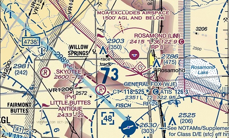
FAA Information Effective 03 JAN 2019 Of Rosamond Skypark
LOCATION
FAA Identifier: L00
| Lat/Long: |
34-52.230000N/118-12.325000W
34-52.230000N/118-12.325000W |
| Elevaton: |
2415 ft. / 736 m (estimated) |
| Variation: |
14E (1985) |
| From city: |
3 miles W of ROSAMOND, CA |
| Time zone: |
UTC -8 (UTC -7 during Daylight Saving Time) |
| Zip Code: |
93560 |
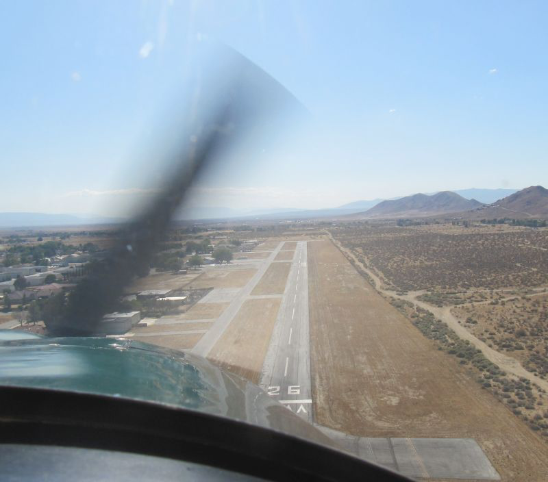
RUNWAY INFORMATION
| Dimensions: |
3600 x 50 ft. / 1097 x 15 m |
| Surface: |
Asphalt, in fair condition |
| Runway edge lights: |
Non-standard, RY 08/26 NSTD LIRL 25 FT |
|
RUNWAY 8 |
RUNWAY 26 |
| Latitude: |
34-52.230333N |
34-52.228167N |
| Longitude: |
118-12.685167W |
118-11.965000w |
| Gradient: |
0.9 |
0.9% |
| Traffic Pattern: |
Right |
Left |
| Displaced Threshold: |
300ft. |
300ft. |
| Markings: |
basic, in fair condition |
basic, in fair condition |
| Runway identifier lights: |
None |
None |
| Obstructions: |
None |
40 ft. trees, 625 ft. from runway, 10:1 slope to clear |