Listen to The Swanee River
See the lyrics
![]()
Listen
to The Swanee River
See
the lyrics
The Time
Machine | Regionally Speaking | The
Works in FL | Civics in the Sunshine
Lending a Hand | Book List | Field
Trips | Members | Time
Line
Bible Verses |
Games and Quizzes | Thanks
| Home
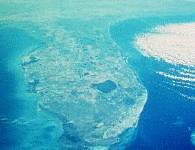
Lay 'O the Land - Native Plants | The Wild Life - Native Animals | Down by the Sea | Land Ho! | Weather Watch
|
|
|
|
|
|
-
Find and list all of the native plants that you can identify in your
neighborhood: Books about Native Plants of FloridaDressler,
R.L.; D.W. Hall, K.D. Perkins, N.H. Williams. 1987. Identification
Manual for Wetland Plant Species of Florida. University of
Florida, Gainesville. 297 pp. “This field guide was developed to
facilitate the identification of wetland indicator species in Florida.
Fine photographs and line drawings depict algae and mosses, ferns,
conifers, monotocyledons and dicotyledons. Descriptions of 285 species are
provided in common terms.” Hall,
D.W. 1978. The Grasses of
Florida. Dissertation, University of Florida, Gainesville.
498 pp. (Available from University Microfilms International, Ann Arbor,
MI) “A floristic treatment
of the grasses of Florida, including aquatic species. Includes 125 genera
and 504 species, common names, synonymy, habitats, and a review of the
morphology of grasses as an aid to their identification.” Hoyer,
M.V., D.E. Canfield, C.A. Horsburgh, K. Brown. 1996. Florida
Freshwater Plants - A Handbook of Common Aquatic Plants in Florida Lakes.
University of Florida, Gainesville. 280 pp. “Color photographs,
botanical descriptions, notes on biology and ecology, distribution in
Florida, water chemistry, and bibliographic references for more than 100
species.” Tarver,
D.P., J.A. Rodgers, M.J. Mahler, R.L. Lazor. 1988 (4th ed.). Aquatic
and Wetland Plants of Florida. Florida Department of Natural
Resources, Bureau of Aquatic Plant Management, Tallahassee. 127 pp.
“Color photographs, description, habitat, distribution and importance,
and wildlife utilization value for approximately 120 species, including
algae. Non-technical language.” Wunderlin,
R.P. 1982. Guide to the
Vascular Plants of Central Florida. Reprint 1992. A
University of South Florida Book, University Presses of Florida, Tampa.
472 pp. “Keys and descriptive flora. No illustration.” Zomlefer,
W.B. 1989. Flowering
Plants of Florida - A Guide to Common Families. Biological
Illustrations, Inc., Gainesville, FL. 207 pp. “A combination of
botanical illustrations and general summaries of the characteristics of 73
plant families, including an extensive, finely detailed illustrated
glossary. Not restricted to aquatics.” Tobe,
J.D., K.C. Burks, R.W. Cantrell, et al. 1998. Florida
Wetland Plants - An Identification Manual University of
Florida, Gainesville. 598 pp. "With more than 800 color photographs
and 1,000 entries, Florida Wetland Plants is a definitive work, covering a
majority of the plant species found in the Florida Wetland Delineation
Methodology, 1994." Plant
a butterfly garden with native Florida plants: http://www.nsis.org/butterfly/butterfly.html
Follow
the instructions on the website above to plan your garden. Make a list of
all of the plants that you have used.
Keep a journal of the type of butterflies that your garden has
attracted. Take photos of
your garden and the butterflies that it attracts.
Plant
a garden with native Florida plants: http://www.nsis.org/garden/garden-native.html
Follow
the instructions on the website above to plan your garden.
Make a list of all of the plants that you have used in your garden.
Take pictures of your garden, and keep a daily journal of your
activities and the results. Describe
the importance of mangroves to Florida’s ecology.
How many different types of mangroves are found in Florida?
Florida
Native Plant Trivia: For
answers to the trivia questions: email [email protected]
, with the subject line of FUSE Trivia Answer Request
|
|
|
|
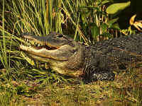
Alligator.net Manatees & Dugongs Florida Panther Loggerhead Sea Turtle Sea Turtles For Kids Birdwatching Basics Endangered Species of Florida Florida's Wildlife Refuges Habitat Protection Flora and Fauna Database Selected Birds of Florida Florida Animals |
|
Submit an article or a photo to Florida
Wildlife Magazine to be published. See the following description and visit
the website before beginning this project. If you are published, make sure
to let us know. We would like to announce your accomplishment on the
Florida Unit Studies for Everyone website.
http://floridawildlifemagazine.com/manuscri.html http://floridawildlifemagazine.com/photosub.html "Florida Wildlife is a not-for-profit, subscriber-supported,
bimonthly conservation magazine published by the Florida Fish and Wildlife
Conservation Commission to promote hunting, fishing, outdoor ethics and
conservation of Florida's natural resources. Florida Wildlife appeals to a
wide range of people, from school children to senior citizens. Subscribers
live in all 50 states, with many residing in urban areas. "Florida Wildlife prefers to use original transparencies (35mm color slides or larger color positive transparencies) but will consider high quality duplicate transparencies and 5 x 7 or 8 x 10-inch glossy color prints that are sharp, well-composed, and well-lighted with good color density. Only 35mm color slides or larger color transparencies will be considered for covers or larger images in the magazine. We cannot use color negatives or black and white negatives. At this time we do not accept digital images, but they may be sent via E-mail for review before submitting slides."
http://www.educationplanet.com/search/redirect?id=77114&mfcount=330&mfkw=Florida&startval=20
http://aquat1.ifas.ufl.edu/birds.html
http://floridabirdingtrail.com/birdid.htm
Wings Over Florida is a FREE awards program for Florida bird watchers. Its purpose is to encourage YOU to take your skills to the next level by identifying as many birds as you can within the state. As your skills increase and you identify more and more birds, you can apply for higher and higher levels of achievement. Full color certificates are awarded at five levels starting at a life list of 50 Florida species (Beginner) and ending at 350 species (Elite Florida Birder). Simply fill out a Wings Over Florida checklist and application sheet and send it to the Commission for review. Students will travel to a state or country park and will take pictures of Florida birds. Students will develop a Web page featuring the field trip. Students will produce a journal that includes the pictures taken during the trip. The students will write a short presentation on one of the birds. If a website is developed, please send the link to the Florida Unit Study group – so that we can post it on the FUSE website. - Plant a garden to attract Florida birds:Use the following websites to plan your garden. Research which animals that you would like to attract to your garden. Plan your garden with your parents permission. Take pictures of your garden and include your pictures and research in a gardening journal. Keep track of which Florida birds are attracted to your garden and try to take pictures of them enjoying the habitat that you built for them. http://www.nsis.org/garden/garden-native-birds.html http://www.nsis.org/garden/garden-native-wildlife.html http://www.nsis.org/bird/bird-sp.html http://www.nsis.org/bird/bird-spw.html - Florida Manatee http://www.educationplanet.com/search/redirect?id=58009&mfcount=330&mfkw=Florida&startval=20http://www.nationalgeographic.com/infocentral/fact/animman.html http://www.savethemanatee.org/info.htm http://www.cep.unep.org/kids/kids.html Create a captive setting that will meet all the manatee's needs. Materials:
Directions
Using the following websites and other sources, draw a map that
includes references to where the following snakes are found in Florida.
Make a list of the native snakes of Florida, and how common they are
found in your area. What precautions, if any, should be taken around the
snakes in your area?
http://www.educationplanet.com/search/redirect?id=77112&mfcount=330&mfkw=Florida&startval=0
http://www.educationplanet.com/search/redirect?id=77112&mfcount=330&mfkw=Florida&startval=0
http://www.educationplanet.com/search/redirect?id=77112&mfcount=330&mfkw=Florida&startval=0 Paul Moler authored A Checklist of Florida's Amphibians and
Reptiles, a pocket-sized, printed (hardcopy) booklet that is
available from the Florida Fish and Wildlife Conservation Commission,
Nongame Wildlife Program, 620 South Meridian Street, Tallahassee,
Florida 32399-1600, USA.
http://www.atlantic.net/~oldfla/panther/moreinfo.html
http://www.audubon.org/campaign/refuge/refuges/florida.htmlFlorida Animal Trivia:
For
answers to the trivia questions: email [email protected]
, with the subject line of FUSE Trivia Answer Request
|
|
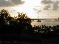 Photo by Ted Bowers |
The Florida Lighthouse Association Coral Reefs Corals and Coral Reefs Seagrass Beds Oceanography & Meteorology Servers The Aquatic Preserve Coloring Book Endangered Marine Life Marine Sanctuaries - Florida Keys Ocean Pollution Coral Reef Conservation |
|
Atlantic
Ocean, Gulf of Mexico, Lighthouses Name
the three bodies of water that surround Florida. Explain
how Florida’s location led to the description “Gateway to South
America”. Name
three reasons why Florida’s salt water resources are so important.
Read
about Ocean Currents, Tides and Waves: http://www.onr.navy.mil/focus/ocean/motion/currents1.htm
http://www.onr.navy.mil/focus/ocean/motion/currents2.htm
http://www.onr.navy.mil/focus/ocean/motion/tides1.htm
http://www.onr.navy.mil/focus/ocean/motion/waves1.htm
http://www.onr.navy.mil/focus/ocean/motion/waves2.htm Read
about Florida’s unique oceans, estuaries, bays, beaches, coral reefs and
the Gulf Stream at this website: http://www.gorp.com/gorp/location/fl/fishing/marine.htm What
is marine debris? Visit this
website for a description:
www.yoto98.noaa.gov/books/debris/debris2.htm Go
on a beach walk with a large garbage bag and wear gloves to collect as
much trash as your bag can hold. This
will help keep the garbage from washing and blowing into the ocean to
become marine debris that often entangles and kills sea life.
Read
The History of the Gulfstream at this site: Define
the following terms as they are related to waves:
Science
Experiment: Investigate
what happens to waves you make with a medicine dropper in a pan of water? You
will need: Background: What
to do: Next,
allow one drop of water to fall from the medicine dropper into the water
near a corner of the pan. Notice
what happens when the wave made by the drop of water hits the sides of the
pan in this case. Now
allow drops of water to fall from the medicine dropper into the center of
the pan at a regular rate. Make
a sketch of the pattern of waves that you see.
Then let drops of water fall at a regular rate into the water near
a corner of the pan. Make a
sketch of the pattern of waves that you see. What
happened when a circular wave that started in the center of the pan hit
the sides of the pan? Explain. What
happened when a circular wave that started near a corner of the pan hit
the sides of the pan? Explain. What
caused the pattern of waves that you saw when drops of water fell into the
center of the pan at a regular rate?
Explain. What
caused the patter of waves that you saw when drops of water fell near a
corner of the pan at a regular rate?
Explain. What
could be done to simulate the waves that you see at the beach?
Write down your investigation in detail, and demonstrate your
experiment to your friends and family. Locate
the lighthouses that are in your area.
Take a picture of the lighthouse and write a report on the history
of your local lighthouse. Find
out more about lighthouses at the following website: |
|
|
Florida
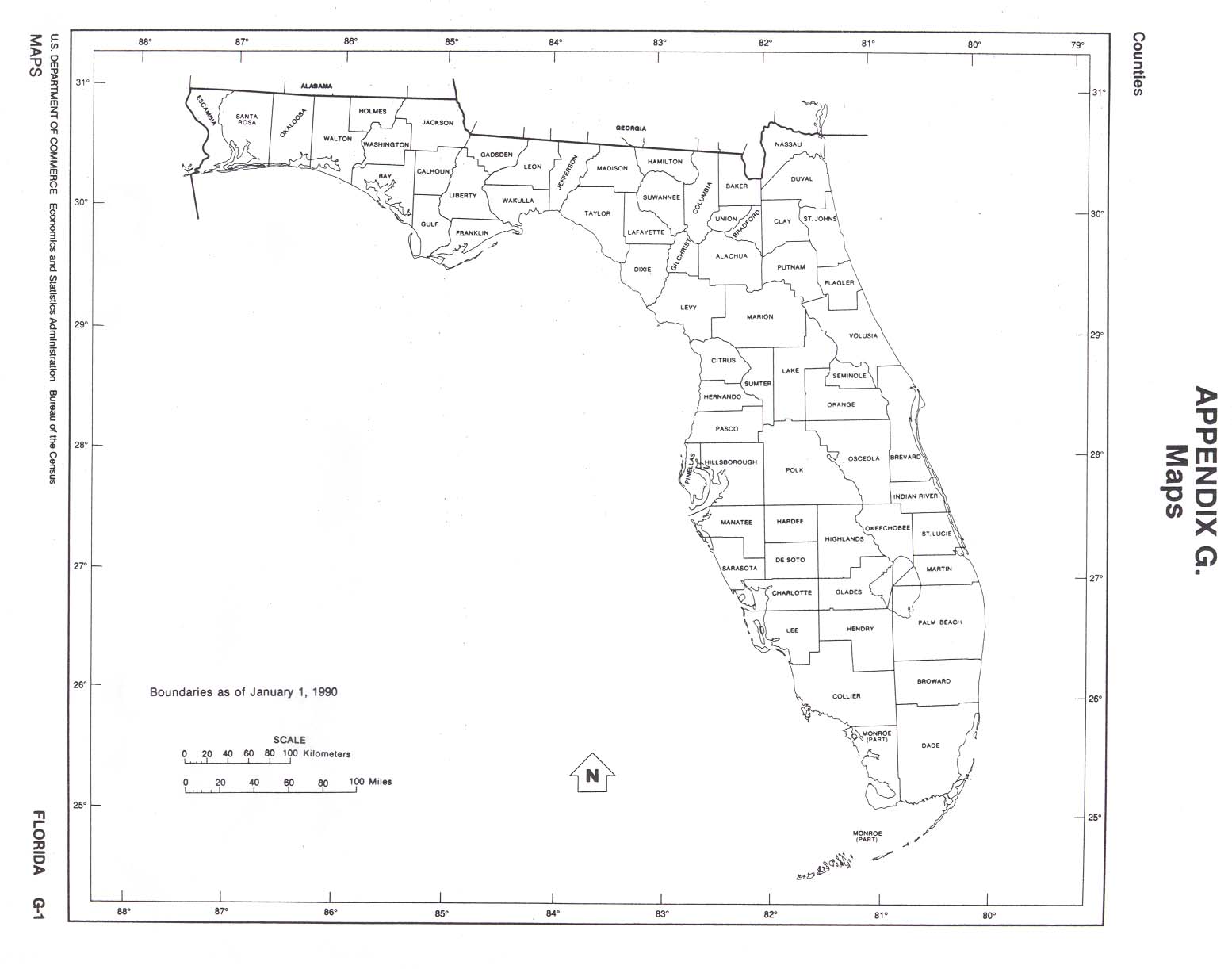
Counties County Name Origins Florida - county outline map Florida - county with names (outline map) Florida - outline map with cities Blank outline map Rocks and Minerals Educational Resources Index |
Land
Forms, Geographical Regions
Dr.
Robert Marcus and Dr. Edward Fernald divided Florida into four landform
regions, name them and describe where they are located and what makes them
different from the other regions in Florida.
Draw a map of Florida that shows where these landforms are located.
Name
the three sources of fresh water in Florida.
What is the major source of fresh water in Florida?
What is the second major source of fresh water in Florida?
Identify
five of Florida’s rivers. Name
Florida’s longest river. Describe
where it starts and ends in the state.
In what direction does this river flow?
What springs feed their waters into this river? How
many lakes are located in Florida? What
is Florida’s largest lake? What
is the size and average depth of the largest lake in Florida?
What is its size in relation to all the lakes in the United States?
What
is meant by the term aquifer? Why
is Florida’s aquifer so important? Describe
a first-magnitude spring. How
many are located in Florida? Draw
a map and show where the first-magnitude springs are located in Florida. The
Everglades are divided into five distinct regions.
Name and describe each region of the Everglades.
Where are the Everglades located in the state?
How many acres does the Everglades National Park occupy?
What is the biggest problem facing the Everglades today?
Taken
overall, including areas which are influenced by tidal action, what is the
total area of coastline in Florida? What
type of coastline is Florida considered to have? Define
the following terms:
What
purpose do the barrier islands of Florida serve?
Draw a diagram of the natural landform of a barrier island.
What is the danger of construction on these islands?
-
What
is a wetland? http://www.nationalgeographic.com/refuges/c065.html
For answers to the trivia questions: email [email protected] , with the subject line of FUSE Trivia Answer Request
|
|
|
Florida Climate Center Florida Forecasts and Warnings Oceanography & Meteorology Servers Average Annual Precipitation Hurricane Tracking Chart Another Hurricane Tracking Chart Hurricane Preparedness FEMA for Kids Tropical Prediction Center/National Hurricane Center Florida Weather Monitor Online |
|
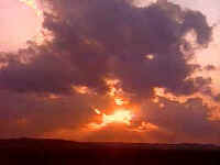
Hurricanes,
Thunderstorms, Drought, Flooding, and Sunshine Florida
Weather Trivia: For
answers to the trivia questions: email [email protected]
, with the subject line of FUSE Trivia Answer Request ·
The
state’s hottest day on record (as of 1995) was June 29, 1931, in
Monticello. How hot did it
get? ·
Key
West claims to be the only city in the continental United States to never
have experienced what? ·
What
weather event occurred in Miami on January 19, 1977, that people thought
would never happen? ·
Florida
has more of what weather phenomenon than any other place in the Northern
Hemisphere? ·
What
can account for as much as 30 percent of the September rainfall in parts
of North Florida? · What town was all but destroyed by the September 18, 1926, hurricane? Home MeteorologyMost of us have heard a television meteorologist talk about the dew point and the relative humidity, yet few of us know what those quantities are. Find out more...
List
the severe weather safety guidelines for the following:
Answers
found at: http://205.156.54.206/er/lwx/swep/Safety.htm
Hurricanes
– Research
a past hurricane, print out a tracking chart (or get one at your local
library), and plot the hurricane’s path.
Write a report about the damage that the hurricane caused, and any
other significant facts about the hurricane that you have chosen. Use
the tracking chart on this website to track current hurricanes or tropical
storms: http://www.fema.gov/kids/hurrtrac.htm
For
more information on hurricanes, go to the following websites: http://www.redcross.org/services/disaster/keepsafe/readyhurricane.html
http://www.discovery.com/stories/science/hurricanes/track.html
http://discovery.com/stories/science/hurricanes/hurricanes.html
Create
your own hurricane online: http://discovery.com/stories/science/hurricanes/create.html
Hurricane
Math - Complete
the following quiz: Write
a severe weather safety plan for your family.
Include a hurricane safety checklist.
Read about hurricanes at the following website: HURRICANE
TERMS: Terms: §
Tropical
disturbance §
Tropical
depression §
Tropical
storm §
Hurricane
§
Eye
§
Eye
wall §
Spiral
bands §
Storm
surge §
Advisory §
Best
Track §
Center §
Center/Vortex
Fix §
Cyclone §
Eastern
North Pacific Basin §
Eye §
Eye
Wall/Wall Cloud §
Explosive
Deepening §
Extratropical §
Fujiwhara
Effect §
Gale
Warning §
High
Wind Warning §
Hurricane/Typhoon §
Hurricane
Local Statement §
Hurricane
Season §
Hurricane
Warning §
Hurricane
Watch §
Post-Storm
Report §
Preliminary
Report §
Present
Movement §
Probability
of Tropical Cyclone Conditions §
Rapid
Deepening §
Relocated §
Storm
Surge §
Storm
Tide §
Storm
Warning §
Subtropical
Cyclone §
Subtropical
Depression §
Subtropical
Storm §
Synoptic
Track §
Tropical
Cyclone §
Tropical
Cyclone Plan of the Day §
Tropical
Depression §
Tropical
Disturbance §
Tropical
Storm §
Tropical
Storm Warning §
Tropical
Storm Watch §
Tropical
Wave
Meanings: a.
- Evolves from a tropical storm. Rotary circulation has become pronounced
and an eye is detectable. Constant wind speeds are 74 mph or greater. b.
- A moving area of thunderstorms in the Tropics that maintains its
identity for 24 hours or more. c.
- A wall of thunderstorms around the eye. d.
- A cluster of thunderstorms in the tropics that maintains its identity
and shows rotary circulation at the surface with constant wind speeds of
38 mph or less. e.
- The center of the hurricane where winds are light and skies are clear to
partly cloudy. The eye is rimmed by massive thunderstorms producing
torrential rains and extreme winds. f.
- Bands of thunderstorms that appear to spiral in toward the hurricane's
center. g.
- a dome of water often 50 miles wide that comes sweeping across the
coastline near the area where the eye of the hurricane makes landfall. h.
- Evolves from a tropical depression or may be a hurricane in its
dissipating stage. Rotary circulation is distinct and constant wind speeds
range from 39 to 73 mph. i.
- Official information issued by tropical cyclone warning centers
describing all tropical cyclone watches and warnings in effect along with
details concerning tropical cyclone locations, intensity and movement, and
precautions that should be taken. Advisories are also issued to describe:
(a) tropical cyclones prior to issuance of watches and warnings and (b)
subtropical cyclones. j.
- A subjectively smoothed path, versus a precise and very erratic
fix-to-fix path, used to represent tropical cyclone movement. It is based
on an assessment of all available data. k.
- A trough or cyclonic curvature maximum in the trade-wind easterlies. The
wave may reach maximum amplitude in the lower middle troposphere. l.
- A discrete tropical weather system of apparently organized
convection--generally 100 to 300 nmi in diameter---originating in the
tropics or subtropics, having a nonfrontal migratory character, and
maintaining its identity for 24 hours or more. It may or may not be
associated with a detectable perturbation of the wind field. m.
- A coordinated mission plan that tasks operational weather reconnaissance
requirements during the next 1100 to 1100 UTC day or as required,
describes reconnaissance flights committed to satisfy both operational and
research requirements, and identifies possible reconnaissance requirements
for the succeeding 24-hour period. n.
- A subtropical cyclone in which the maximum sustained surface wind speed
(using the U.S. 1-minute average) is 34 kt (39 mph or 63 km/hr) or more. o.
- Weather reconnaissance mission flown to provide vital meteorological
information in data sparse ocean areas as a supplement to existing
surface, radar, and satellite data. Synoptic flights better define the
upper atmosphere and aid in the prediction of tropical cyclone development
and movement. p.
- A low pressure system that develops over subtropical waters that
initially has a non-tropical circulation but in which some elements of
tropical cyclone cloud structure are present. Subtropical cyclones can
evolve into tropical cyclones. Subtropical cyclones are generally of two
types: (1)
An upper level cold low with circulation extending to the surface and
maximum sustained winds generally occurring at a radius of about 100 miles
or more from the pressure center. (2)
A mesoscale cyclone originating in or near a frontolyzing zone of
horizontal wind shear, with radius of maximum sustained winds generally
less than 30 miles. The entire circulation sometimes encompasses an area
initially no more than 100 miles in diameter. These generally short-lived,
marine cyclones may vary in structure from cold to warm core. q.
- The vertical axis or core of a tropical cyclone. It is usually
determined by cloud vorticity patterns, wind, and/or pressure
distributions. r.
- An announcement that a tropical storm poses or tropical storm conditions
pose a threat to coastal areas generally within 36 hours. A tropical storm
watch should normally not be issued if the system is forecast to attain
hurricane strength. s.
- A warning of 1-minute sustained surface winds of 48 kt (55 mph or 88
km/hr) or greater, either predicted or occurring, not directly associated
with tropical cyclones. t.
- A term used in an advisory to indicate that a vector drawn from the
preceding advisory position to the latest know position is not necessarily
a reasonable representation of the cyclone's movement. u.
- A warm-core, nonfrontal low pressure system of synoptic scale that
develops over tropical or subtropical waters and has a definite organized
surface circulation. v.
- An abnormal rise in sea level accompanying a hurricane or other intense
storm, and whose height is the difference between the observed level of
the sea surface and the level that would have occurred in the absence of
the cyclone. Storm surge is usually estimated by subtracting the normal or
astronomic high tide from the observed storm tide. w.
- A warning for tropical storm conditions including sustained winds within
the range of 34 to 63 kt (39 to 73 mph or 63 to 118 km/hr) that are
expected in a specified coastal area within 24 hours or less. x.
- A tropical cyclone in which the maximum sustained surface wind speed
(using the U.S. 1-minute average) is 33 kt (38 mph or 62 km/hr) or less. y.
- A tropical cyclone in which the maximum sustained surface wind speed
(using the U.S. 1-minute average) ranges from 34 kt (39 mph or 63 km/hr)
to 63 kt (73 mph or 118 km/hr). z.
- A report summarizing the life history and effects of an Atlantic or
eastern Pacific tropical cyclone. It contains a summary of the cyclone
life cycle and pertinent meteorological data, including the post-analysis
best track (six-hourly positions and intensities) and other meteorological
statistics. It also contains a description of damage and casualties the
system produced, as well as information on forecasts and warnings
associated with the cyclone. NHC writes a preliminary report on every
tropical cyclone in its area of responsibility. aa.
- A warning that sustained winds 64 kt (74 mph or 119 km/hr) or higher
associated with a hurricane are expected in a specified coastal area in 24
hours or less. A hurricane warning can remain in effect when dangerously
high water or a combination of dangerously high water and exceptionally
high waves continue, even though winds may be less than hurricane force. bb.
- A subtropical cyclone in which the maximum sustained surface wind speed
(using the U.S. 1-minute average) is 33 kt (38 mph or 62 km/hr) or less. cc.
- The probability, in percent, that the cyclone center will pass within 50
miles to the right or 75 miles to the left of the listed location within
the indicated time period when looking at the coast in the direction of
the cyclone's movement. dd.
- The actual level of sea water resulting from the astronomic tide
combined with the storm surge. ee.
- A report issued by a local National Weather Service office summarizing
the impact of a tropical cyclone on it's forecast area. These reports
include information on observed winds, pressures, storm surges, rainfall,
tornadoes, damage and casualties. ff.
- A decrease in the minimum sea-level pressure of a tropical cyclone of
1.75 mb/hr or 42 mb for 24 hours. gg.
- The best estimate of the movement of the center of a tropical cyclone at
a given time and given position. This estimate does not reflect the
short-period, small scale oscillations of the cyclone center. hh.
- The location of the center of a tropical or subtropical cyclone obtained
by reconnaissance aircraft penetration, satellite, radar, or synoptic
data. ii.
- The portion of the year having a relatively high incidence of
hurricanes. The hurricane season in the Atlantic, Caribbean, and Gulf of
Mexico runs from June 1 to November 30. The hurricane season in the
Eastern Pacific basin runs from May 15 to November 30. The hurricane
season in the Central Pacific basin runs from June 1 to November 30. jj.
- An atmospheric closed circulation rotating counter-clockwise in the
Northern Hemisphere and clockwise in the Southern Hemisphere. kk.
- An announcement of specific coastal areas that a hurricane or an
incipient hurricane condition poses a possible threat, generally within 36
hours. ll.
- A warm-core tropical cyclone in which the maximum sustained surface wind
(using the U.S. 1-minute average) is 64 kt (74 mph or 119 km/hr) or more.
The term hurricane is used for Northern Hemisphere cyclones east of the
International Dateline to the Greenwich Meridian. The term typhoon is used
for Pacific cyclones north of the Equator west of the International
Dateline. mm.
- 1-minute average surface winds of 35 kt (40 mph or 64 km/hr) or greater
lasting for 1 hour or longer, or winds gusting to 50 kt (58 mph or 93
km/hr) or greater regardless of duration that are either expected or
observed over land. nn.
- A public release prepared by local National Weather Service offices in
or near a threatened area giving specific details for its county/parish
warning area on (1) weather conditions, (2) evacuation decisions made by
local officials, and (3) other precautions necessary to protect life and
property. oo.
- A decrease in the minimum sea-level pressure of a tropical cyclone of
2.5 mb/hr for at least 12 hours or 5 mb/hr for at least six hours. pp.
- The region north of the Equator east of 140W. The National Hurricane
Center in Miami, FL is responsible for tracking tropical cyclones in this
region. qq.
- A term used in advisories and tropical summaries to indicate that a
cyclone has lost its "tropical" characteristics. The term
implies both poleward displacement of the cyclone and the conversion of
the cyclone's primary energy source from the release of latent heat of
condensation to baroclinic (the temperature contrast between warm and cold
air masses) processes. It is important to note that cyclones can become
extratropical and still retain winds of hurricane or tropical storm force. rr.
- A binary interaction where tropical cyclones within a certain distance
(300-750 nm depending on the sizes of the cyclones) of each other begin to
rotate about a common midpoint. ss.
- An organized band of cumuliform clouds immediately surrounding the
center of a tropical cyclone. Eye wall and wall cloud are used
synonymously. tt.
- A warning of 1-minute sustained surface winds in the range 34 kt (39 mph
or 63 km/hr) to 47 kt (54 mph or 87 km/hr) inclusive, either predicted or
occurring not directly associated with tropical cyclones. uu.
- The relatively calm center of the tropical cyclone that is more than one
half surrounded by wall cloud. Answers
found at: Thunderstorms – Although
Florida is known as the sunshine state, it is also the U.S. thunderstorm
capital. Heavy rain from summer storms gives Florida abundant rainfall
even though skies are sunny most of the time. Florida is usually dry
during winter - which gives tourists a sunny, warm respite from the winter
cold. List
the basic facts http://205.156.54.206/er/lwx/swep/Spotting.html To
find out about Lightning from NASA, go to: http://thunder.nsstc.nasa.gov/primer/ Write a report about what you found the most interesting about lightning and/or what you learned about lightning that you didn’t already know before reading. Cloud
in the Bottle Materials
Needed: -1
Clear plastic 2-liter soda bottle (remove label) Instructions: Step
2: Place your mouth over the opening and blow into it to ensure the bottle
is fully expanded. Immediately seal the bottle tightly. Step
3: Shake the bottle vigorously for one minute. This will distribute water
molecules in the air. Step
6: Lay the bottle on its side with the black paper behind it. Press hard
on the bottle for ten seconds. The bottle is strong, so don't be afraid to
really push hard. Release, observe, and repeat until a cloud forms. Scientific
Principle: By
following the steps, you have created the conditions necessary for cloud
formation: water vapor in the air, smoke particles for water to collect
on, and cooling of the air by lowering the air pressure within the bottle.
Voila! Instant cloud formation. Clouds form when condensation collects
dust particles, which you provided with the smoke from the match. To
learn more about the different types of clouds, go to the following
website: http://vortex.plymouth.edu/clouds.html
Match
the Terms with their meanings: THUNDERSTORM
TERMS:
Meanings: a.
- a cauliflower shaped cloud with a flat base and sharp edges. Tufts are
rising columns of air condensing. As the cloud and cloud droplets grow in
size, the base will begin to gray. b.
- a visible column of rain or hail falling from the base of the cloud. c.
- Low cloud fragments often seen in association with and behind
thunderstorm gust fronts. These clouds are ragged and wind torn and are
not usually attached to the thunderstorm. d.
- A radar pattern sometimes observed in the southwest (right, rear)
quadrant of a tornadic thunderstorm. The rain echo forms the hook pattern
as air rotates around the strong updraft. The updraft is the hollow
portion of the hook (looks like a backwards "J" or a 6) and is
where the tornado would most likely be found (if the storm were to produce
one). e.
- the towering cumulus cloud has continued to grow in height and width and
now lightning is occurring. The storm may extend 5 to 10 miles high into
the atmosphere and 5 to 25 miles across. Heavy rains and gusty winds often
accompany the storms. f.
- A small downburst effecting an area less than 2.5 Km in diameter. g.
- A line of cumulus clouds connected to and extending outward from the
most active portion of a parent cumulonimbus, usually found on the
southwest (right, rear) side of a storm. The cloud line has roughly a
stair step appearance with the taller clouds adjacent to the parent
cumulonimbus. It is most frequently associated with strong or severe
thunderstorms. h.
- a violently rotating column of air in contact with the ground and
extending to the thunderstorm base often seen extending from near the wall
cloud. It can be a few yards across to a mile wide. i.
- on rare occasions, a shelf cloud may turn into a roll cloud. The motions
of the warm air riding up and over the cool air moving down and under
creates a swirling of air or an eddy. The cloud takes on the shape of a
horizontal tube that appears to be rolling. It is detached from the
thunderstorm on its leading edge. j.
- A thunderstorm producing damaging winds or winds greater than 58 mph
and/or hail three-quarter of an inch or greater. k.
- the dark underside of a cloud (its base) that has no visible
precipitation falling from it. This marks the updraft of a thunderstorm. l.
- this cloud appears as an abrupt lowering of the cloud base from the
relatively flat rain-free base. It is attached to a thunderstorm and may
be rotating. This is the portion of the thunderstorm from which the
tornado often descends. m.
- a solid line or band of active thunderstorms. n.
- A sudden rush of cool air toward ground that can impact with speeds over
70 mph and produce damage similar to that of a tornado. It usually occurs
near the leading edge of the storm or may occur in heavy rain. o.
- the leading edge of the thunderstorm's downdraft of air as it spreads
out away from the storm. It is usually felt as a change to gusty cool
winds and often precedes the thunderstorm's rain by several minutes. p.
- A larger downburst effecting an area greater than 2.5 Km in diameter. q.
- these clouds appear to be hanging, rounded protuberances or pouches on
the underside of the cloud. With thunderstorms, it is usually seen under
the anvil and often accompany severe thunderstorms. r.
- a cumulus cloud that continues to grow so that its height is taller than
or equal to its width. It is first stage to growing into a thunderstorm.
It may be producing a shower. s.
- A column of cool air that sinks toward the ground. It is most often
accompanied by rain. t.
- a funnel-shaped cloud extending from a towering cumulus or thunderstorm.
It is associated with a rotating column of air that has condensed to form
a cloud. u.
- The spreading out (by strong winds) of the upper portion of the
thunderstorm. It usually has a fibrous or smooth appearance. With long
lasting thunderstorms, the anvil may spread 100 miles downwind. v.
- a low-level, wedge-shaped cloud attached to the thunderstorm. It forms
above the gust front as warm air ahead of the storm rides over the cool
outflow from the thunderstorm. w.
- Precipitation in the form of balls or clumps of ice. x.
- Warm, moist, rising air. As the air rises, it condenses into a visible
cumulus or cumulonimbus cloud. The updraft fuels the storm. In an ordinary
thunderstorm, air rises at 40 mph and in a severe thunderstorm speeds may
reach over 100 mph. Answers
found at: http://205.156.54.206/er/lwx/swep/Terms.htm
Drought
– Define
the following terms: 1.
Meteorological
drought 2.
Agricultural
drought 3.
Hydrological
drought 4.
Socioeconomic
drought http://enso.unl.edu/ndmc/enigma/def2.htm
List
the impacts of drought (economic, environmental, and social). http://enso.unl.edu/ndmc/enigma/impacts.htm
List
the current stresses on water resources around the globe. Although
we don't know how climate change will affect regional water resources, it
is clear that water resources are already stressed, independent of climate
change, and any additional stress from climate change or increased
variability, will only intensify the competition for water resources. http://enso.unl.edu/ndmc/enigma/cchange.htm
Flooding
- FLOOD
TERMS:
Meanings: a.
- a flood on large river such as the Potomac take a tremendous amount of
rain and usually develops over a period of one to two days. Rain water
first runs into the small streams which flow into the larger branches and
eventually end up in the main stem of the river. A flood crest from heavy
rains in West Virginia may take 2 days or more to reach Washington, D.C. b.
- pavement which causes rapid runoff (rain can't soak into the ground so
it runs downhill) and poor drainage can lead to flooded roadways and
underpasses and even become deadly. c.
- a flood that occurs suddenly during or shortly following heavy rains or
from a sudden release of water as in a dam break. Small streams and creeks
usually react the fastest to heavy rains and rise several feet in hours or
even minutes. d.
- the height of the river at which property damage begins to occur. Often
differs from bankfull. The river may overflow its banks into flood plain
without reaching flood stage. e.
- high tides, persistent onshore winds or a hurricane storm surge can
cause flooding along coastal areas. f.
- the highest height that the river reaches during a flood event. g.
- the maximum height of the river before it overflows its banks. Answers
found at: http://205.156.54.206/er/lwx/swep/Terms.htm
Sunshine
–
Explain
why Florida is known as the “Sunshine State”.
Florida
Sunshine Shake
1
cup Florida Orange Juice Combine
all ingredients in blender until smooth. Pour into glass, and serve
immediately. Makes
two 8-ounce servings. NUTRITION FACTS PER SERVING: 182 cal., 4 g pro., 40 g carbo., 1 g fat (0.1 g sat. fat), 0 mg cholesterol, 37 mg sodium, 2 g fiber, 91 mg vit. C.
|
|
©2001 FUSE. All rights reserved.
For problems or questions regarding this web contact Kathy
Last updated: October 01, 2001.