BC Home
If You Go...
BC Map
BC Photos
Day 1
Day 2
Day 3
Day 4
Day 5
Day 6
Day 7
Day 8
Day 9
Day 10
Day 11
Day 12
Day 13
Day 14
Day 15
| Date: | June 5, 2002 |
| Start: | Keremeos |
| Final Destination: | Just past Rock Creek |
| Start Time: | 8:30 am |
| Stop Time: | 7:30 pm |
| Total Biking Time: | 6:43:09 |
| Total Distance: | 112.57 km |
| Trip Distance: | 485.13 km |
| Average Speed: | 16.8 km/h |
| Maximum Speed: | 65.0 km/h |
| Weather: | Sunny, hot, and dry, then clouding over. A little bit of rain in the evening near Anarchist Mountain Summit |
| Road Shoulder Condition: | Crappy shoulders leaving Keremeos; improving on way to Osoyoos. Good shoulders to Anarchist Mountain Summit. Some bad, non-existent shoulders from Anarchist to Rock Creek. |
| Road Condition: | Cracked pavement out of Keremeos, but generally good beyond. |
| Route Description: | Starting flat and slightly downhill from Keremeos, then rolling hills getting bigger and bigger. Road turned east away from river and hills grew even bigger. Some good, long, steep climbs up to Richter Pass. A long and fast descent to Osoyoos. Very long and steep ascent to Anarchist Mountain. Rolling hills after that, then very steep descent into Rock Creek. |
| Traffic: | Light. |
| Significant Elevations: | Richter Pass 699 m Anarchist Summit 1233 m |
I stopped for a very inexpensive but good breakfast in Keremeos. Eggs, bacon, hash browns, toast, coffee, OJ, and lots of salt to replace all the salt I lost yesterday. Yum, Yum!
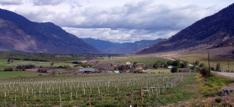
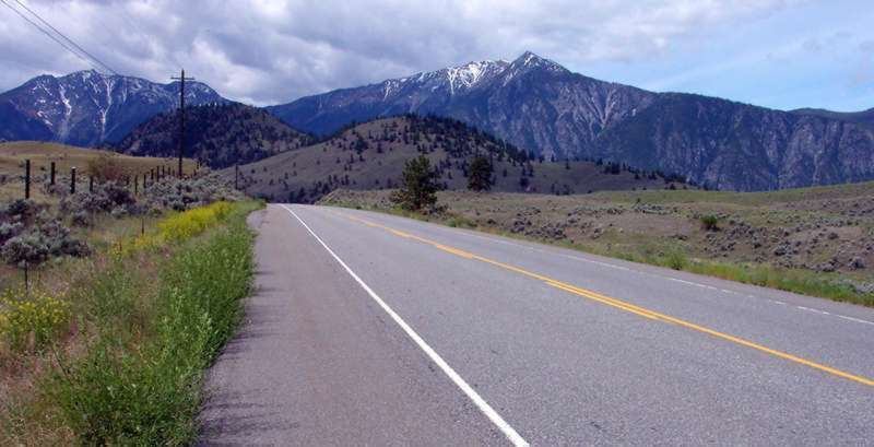
Route 3 continued to follow the Sililkameen River south. I passed by many more vineyards and orchards along the way. The flat road gave way to rolling hills, each hill larger than the previous one. The road was very close to the border at this point and I had some great views of mountains on the States' side.
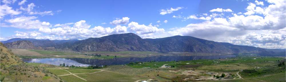
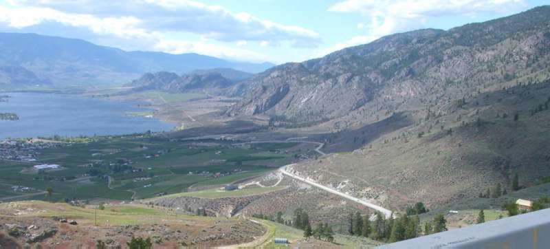
The road turned east away from the Silikameen and the hills grew even larger. I passed by a spotted lake, a mineral-laden body of water where evaporation has caused the minerals to crystallize, forming spots. The climbs continued up to Richter Pass (not on the map), crossed over to the next valley and turned south again, affording some excellent panoramic views of the town of Osoyoos. In the distance, I could see the road climbing the opposite side of the valley on its way to Anarchist Mountain.
Then I had one long, fast descent into town. The temperature climbed as I descended, and it must have been well into the 30's by the time I hit the town border.
My first stop was at the tourist info center, where I asked about a desert interpretive center and the difficulty of the Anarchist Mountain climb. The lady gave me directions to the desert park and told me, "You don't climb Anarchist Mountain in the afternoon." Like it was an undisputed fact or rule of law. "You see where the road disappears around the mountain? That's only about half-way." I wasn't interested in climbing this monster in the heat of the afternoon sun, but I didn't have much choice - I had to press on.
I promised the lady at the info center that I wouldn't attempt it until late afternoon. I biked over to a pizza shop/internet café for lunch/email, then I made a mad dash to the desert center in order to make it for the next scheduled tour (they go every hour). The tourist info people told me the road to the desert interpretive center was flat. Not quite! My all out sprint up the steep hill leading to the park seemed to amuse the staff. I made it with just a few minutes to spare.
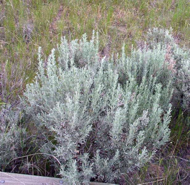
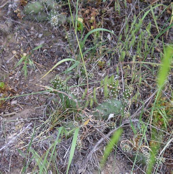
The guided tour was just under one hour long. The tour guide pointed out a large bull snake, a yellow-bellied racer snake, and a black widow spider. Apparently, the tour before us had seen a rattlesnake (western diamond-back, I think). The guide also identified most of the plants commonly found in this area - sagebrush, antelope bush, prickly pear cactus, and several types of flowers, thistles, and grasses.
After the tour, I made a quick stop at a grocery store to stock up on water for my afternoon's climb. I filled both water bottles, bought 1 liter of water, and drank half a liter of pop before leaving town. As I crossed to the other side of the valley and began to ascend, I passed by a hitchhiker dressed in black. Black shoes, black socks, black jeans, long sleeved black shirt, black hair, and a black skateboard. Black, black, black. It was at least 35 degrees out. "Not a good day to wear black", I remarked as I passed by. He responded with "The fun part is coming down the hill at night!" It didn't make sense to me at first, but then I realized, "This fool is going to ride down Anarchist Mountain at night on a skateboard, dressed all in black." As I've said before, you meet all kinds…
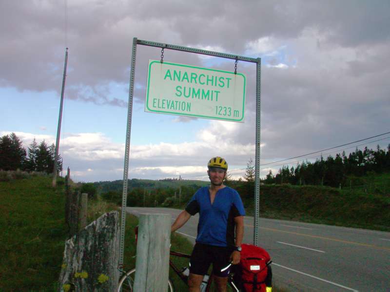
The climb up Anarchist was brutal; a good, steep grade with no breaks, 35 degree weather, the sun beaming down on me from above, and the heat radiating off the cliff beside me and the road below me. I stopped every 15 to 30 minutes or so to take in water and let my heart and lungs recover. It was difficult, but not quite as high a climb as Allison Pass. I went into Allison Pass unprepared and unaware of how far I had to go. This time, I was in better shape and I had some idea of how far I had to climb. However, I wasn't prepared enough; I ran out of water about halfway up.
I climbed a series of switchbacks with excellent views of the valley below. The road turned east, away from Osoyoos and the terrain and weather changed again. The cedar trees and grass were back, and the temperature dropped dramatically. Clouds appeared and it started to rain. I pulled into a rest area, thinking that it might have some drinking water, but no luck. No sign of Anarchist Summit, either. The road continued east over a series of rolling hills flanked by farms and fields of wheat and barley. A dramatic change from the desert-like towns of Keremeos and Osoyoos.
After a few more rolling hills, I reached the Summit. At mid-day, there might have been an excellent view from the top, but evening was approaching quickly and the clouds obscured the mountains in the distance.
I biked through more rolling farmland until I came to the Provincial campground that the tourist center had told me about. Yet another primitive campground. This one had hand-pump water that smelled and tasted heavily of sulfur, the campsites were hard-packed gravel, and a number of campers and RV's already there were running electric generators. A great spot if you have an RV, but no good if you are camping. I was not impressed. There was no way I was spending the night here, and with darkness fast approaching, I wasn't sure if I would find another campground in time. I left a nasty-gram in the suggestion box and got back on the road.
I crossed a very high bridge over a very deep ravine. There were more rolling hills and farmland, then a really fast and dark descent into Rock Creek. I stopped at the gas station to refuel on junk food and fill my water bottles. The attendant told me about an RV park about another 15km down the road. What choice did I have? Back on the bike….
The RV park was not bad, actually. It was only about 1/4 full. I picked a spot at the farthest corner from the entrance and away from the highway and hit the shower. After a super of chocolate bars, chips, and pop, I hit the sack for a well-deserved sleep.
Looking back (at mountains on U.S side, I think) from Richter Pass
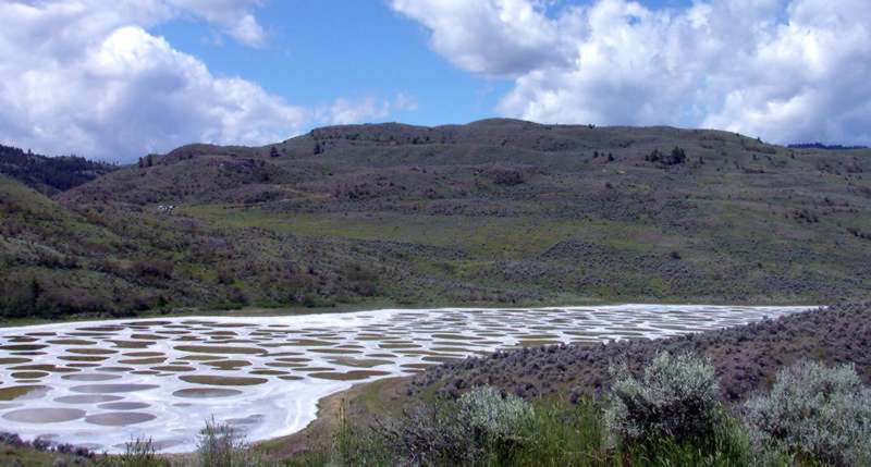
Spotted Lake in Richter Pass
![]()
Climbing Anarchist (a.k.a. "Anti-Christ") mountain
Copyright © 2003 Rideau Code Works Inc. All Rights Reserved
Questions? Comments? Suggestions? Email: [email protected]
Home | BC | Atlantic | Gear | Photos
![]()