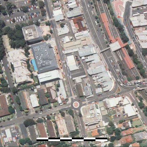
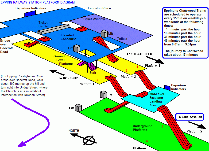
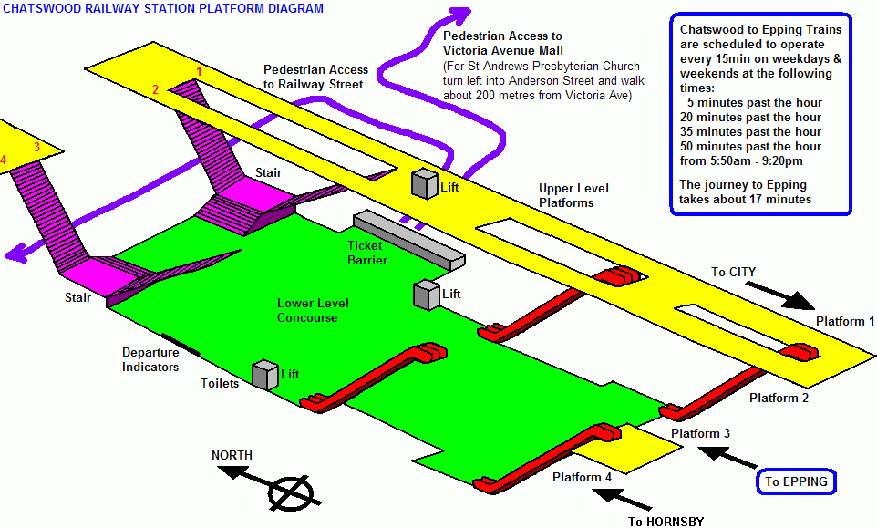
EPPING PRESBYTERIAN CHURCH - Corner of Bridge
Street & Rawson Street - EPPING - New South Wales - AUSTRALIA
![]()
![]()
![]()
![]()
![]()
![]()
![]()
![]()
| Church Location | |||
Simplified Street Map |
|||
Aerial Photograph over
Church
|
|||
 View Aerial Photograph over All
Properties in Epping View Aerial Photograph over All
Properties in Epping |
|||
 View Approximate Locations of More
Presbyterian Churches Around Sydney View Approximate Locations of More
Presbyterian Churches Around Sydney |
|||
 View External Church Photographs View External Church Photographs |
|||
 View
3 Dimensional Church Graphics View
3 Dimensional Church Graphics |
|||
 View Church Floor Plan View Church Floor Plan |
|||
 View Church Side Elevations View Church Side Elevations |
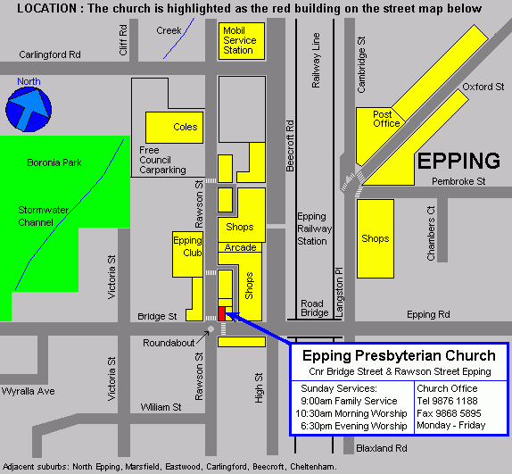 Epping is accessible by public transport (trains & buses) and a taxi stand is located on the
eastern side of the railway station. Free carparking is provided by Parramatta City Council near
Coles Supermarket (on the western side of Rawson Street). There is also considerable street
parking available near residential houses in the vicinity of the church.
Epping is accessible by public transport (trains & buses) and a taxi stand is located on the
eastern side of the railway station. Free carparking is provided by Parramatta City Council near
Coles Supermarket (on the western side of Rawson Street). There is also considerable street
parking available near residential houses in the vicinity of the church.